|
 Having trouble viewing this email? View it as a Web page. Having trouble viewing this email? View it as a Web page.
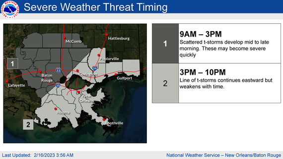
The National Weather Service is reporting this morning that the potential for severe weather remains for the area.
They are predicting that today all of SELA and southwest and coastal MS, along a Baton Rouge to Pascagoula line and northward has the greatest chance to see potentially multiple rounds of severe storms.
WHEN: Today and this evening
WHERE: The entire area but the greatest threat will be east of I-55 and north of I-12 in LA and I-10 in coastal MS.
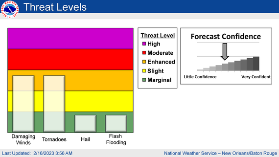
Impacts:
The main threats associated with any severe storms will be:
Damaging Winds:
• Wind gusts greater than 60 mph will be possible
• Trees and powerlines could be damaged and lead to isolated/scattered power outages
Large Hail:
• Large hail up to 2 inches in diameter will be possible
Tornadoes:
• Tornadoes will be possible, and a few could be strong
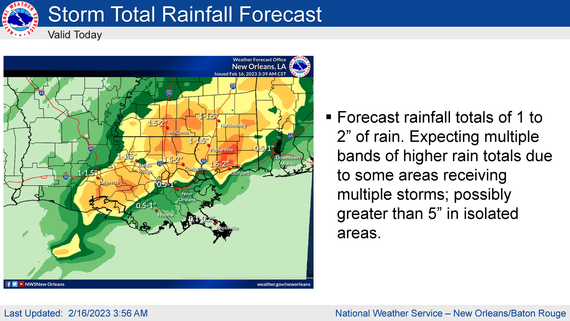
Rainfall
• In addition to the severe weather threat, rainfall of 1 to 2 inches is forecast with locally higher amounts expected.
• This rainfall could lead to ponding of water in low-lying areas and areas of poor drainage.
• Street flooding is likely from some storms, and flash flooding will be possible in the areas that receive the most rain.
The attached briefing highlights the threats associated with this system.
|
