|
|
 Having trouble viewing this email? View it as a Web page. Having trouble viewing this email? View it as a Web page.

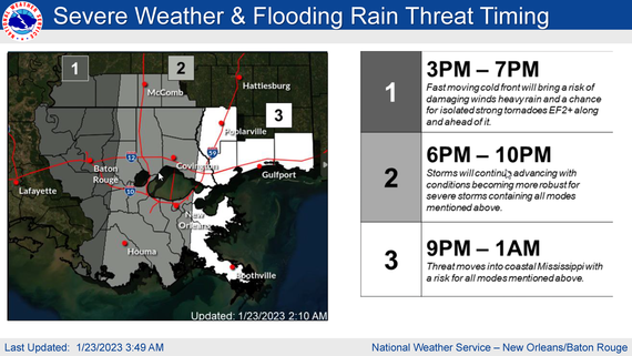
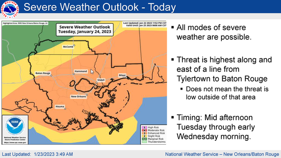
The National Weather Service is forecasting the potential for severe weather on Tuesday through Wednesday morning.
▪ There is a risk for severe weather Tuesday through Tuesday night across all of SE LA and southern MS.
▪ All modes of severe weather including strong tornadoes EF2+, straight-line
damaging winds and hail will be possible.
▪ Timing is primarily from mid afternoon Tuesday through early Wednesday
morning.
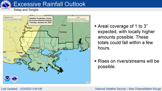
▪ Flash flooding will be possible, especially west of a line from McComb to Baton Rouge. Rainfall totals could be as high as 3 inches and this amount could fall within a few hours
Please stay weather aware and follow local news and LABAKER UPDATES for further information.


|
|
|
|