|
 Having trouble viewing this email? View it as a Web page. Having trouble viewing this email? View it as a Web page.

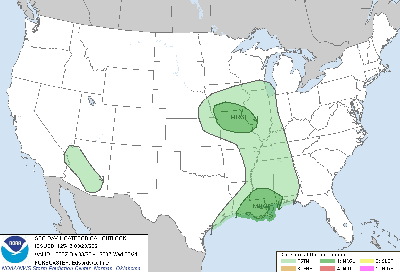
Weather Alert Update: 03/23/2021 - The National Weather Service has issued a Flash Flood Watch at 342 AM CDT Tue, Mar 23, 2021.
A slow-moving cold front will move into the region today and stall over southeast Louisiana and coastal Mississippi through Wednesday. It will lift north Thursday and a second cold front will finally push through late Thursday or Thursday evening. Multiple rounds of moderate to heavy rain are expected with widespread rainfall totals
of 4 to 8 inches.
Locally higher amounts will be possible.
PRECAUTIONARY/PREPAREDNESS ACTIONS:
Do not enter or cross flowing water or water of unknown depth.
Stay away or be swept away. River banks and culverts can become
unstable and unsafe.
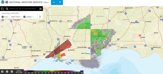
Please be aware that ongoing, southwest/northeast-aligned bands of convection over
southeast TX and southwestern LA are merging into the position of the eastern corridor, as the TX/western LA activity proceeds eastward along its own outflow. The eastern band has contained transient supercells and poses a marginal threat for a tornado or damaging gust the next few hours.
Tornado Safety Tips can be found here
Extended Forecast:
Today: Showers and possibly a thunderstorm. Some of the storms could produce heavy rainfall. High near 70. South wind around 10 mph. Chance of precipitation is 100%. New rainfall amounts between 1 and 2 inches possible.
Tonight: Showers likely and possibly a thunderstorm before 7pm, then a chance of showers and thunderstorms after 7pm. Some of the storms could produce heavy rainfall. Mostly cloudy, with a low around 63. Southeast wind 5 to 10 mph. Chance of precipitation is 60%. New rainfall amounts between a quarter and half of an inch possible.
Wednesday: A chance of showers and thunderstorms, then showers and possibly a thunderstorm after 1pm. Some of the storms could produce heavy rain. High near 76. Southeast wind 5 to 10 mph. Chance of precipitation is 80%. New rainfall amounts between a half and three quarters of an inch possible.
Wednesday Night: Showers and thunderstorms likely, mainly before 1am. Some of the storms could produce heavy rain. Cloudy, with a low around 67. South wind around 10 mph. Chance of precipitation is 70%.
Thursday: Showers and possibly a thunderstorm. Some of the storms could produce heavy rain. High near 79. Breezy, with a south wind 10 to 20 mph. Chance of precipitation is 80%.
Thursday Night: A 20 percent chance of showers and thunderstorms before 1am. Some of the storms could produce heavy rain. Mostly cloudy, with a low around 55. Southwest wind 5 to 15 mph becoming northwest after midnight.
Friday: Mostly sunny, with a high near 78. North wind around 5 mph becoming southeast in the afternoon.
Friday Night: A 20 percent chance of showers and thunderstorms after 1am. Mostly cloudy, with a low around 63. Southeast wind around 5 mph.
Saturday: A chance of showers and thunderstorms. Mostly cloudy, with a high near 82. South wind 5 to 10 mph.
Saturday Night: A chance of showers and thunderstorms, mainly after 1am. Mostly cloudy, with a low around 65. South wind 5 to 10 mph.
###
|
