|
 Having trouble viewing this email? View it as a Web page. Having trouble viewing this email? View it as a Web page.

The National Hurricane Center Reports as of 400 AM CDT Tue Oct 27 2020 Zeta is forecast to emerge off the northern coast of the Yucatan peninsula over the southern Gulf of Mexico shortly after 1200 UTC today. Although some slight additional weakening is possible while the center moves overland early this morning, environmental conditions consisting of low vertical wind shear and warm water over the southern Gulf of Mexico should allow for re-strengthening over the next 24 hour or so.
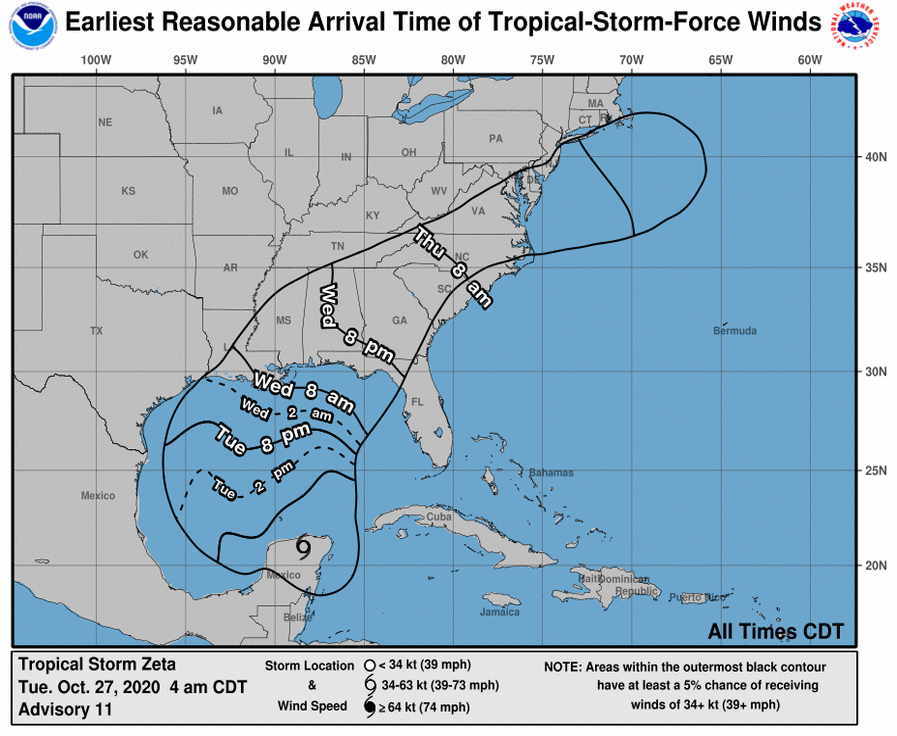
By the time Zeta moves over the northern Gulf, cooler waters and increasing shear are likely to cause the hurricane's intensity to level off or perhaps weaken slightly before landfall. Regardless, Zeta is expected to be at or near hurricane intensity at landfall. Given Zeta's acceleration before landfall, strong winds are likely to spread well inland along northern Gulf coast Wednesday night.
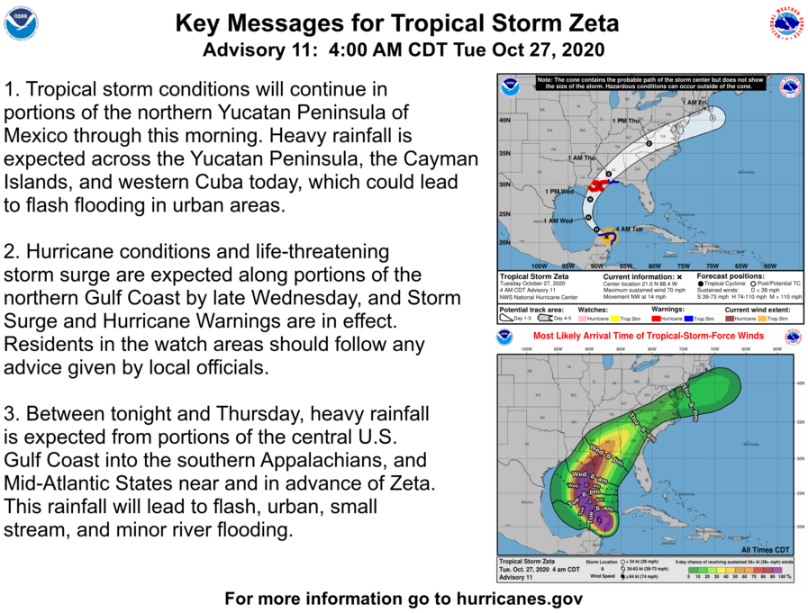
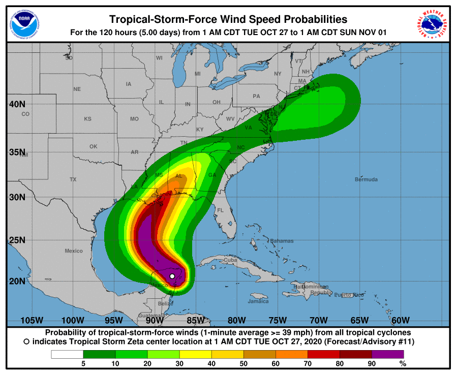
Hurricane conditions and life-threatening storm surge are expected along portions of the northern Gulf Coast by late Wednesday, and Storm Surge and Hurricane Warnings are in effect.
Between tonight and Thursday, heavy rainfall is expected from portions of the central U.S. Gulf Coast into the southern Appalachians, and Mid-Atlantic States near and in advance of Zeta. This rainfall will lead to flash, urban, small stream, and minor
river flooding.
Residents in the watch areas should follow any advice given by local officials.
Detailed Forecast from the National Weather Service:
Today: Showers likely and possibly a thunderstorm after 1pm. Some of the storms could produce heavy rain. Increasing clouds, with a high near 84. East wind 5 to 10 mph. Chance of precipitation is 70%. New rainfall amounts between a tenth and quarter of an inch, except higher amounts possible in thunderstorms.
Tonight: Showers likely and possibly a thunderstorm. Some of the storms could produce heavy rain. Cloudy, with a low around 72. East wind around 5 mph. Chance of precipitation is 70%. New rainfall amounts between a quarter and half of an inch possible.
Wednesday: Showers and possibly a thunderstorm. Some of the storms could produce heavy rain. High near 79. East wind around 10 mph. Chance of precipitation is 90%. New rainfall amounts between a quarter and half of an inch possible.
Wednesday Night: Showers likely and possibly a thunderstorm before 1am, then a chance of showers and thunderstorms after 1am. Some of the storms could produce heavy rain. Cloudy, with a low around 62. Northeast wind 10 to 15 mph becoming west after midnight. Chance of precipitation is 60%.
|
