|
 Having trouble viewing this email? View it as a Web page. Having trouble viewing this email? View it as a Web page.

Hurricane Delta Update
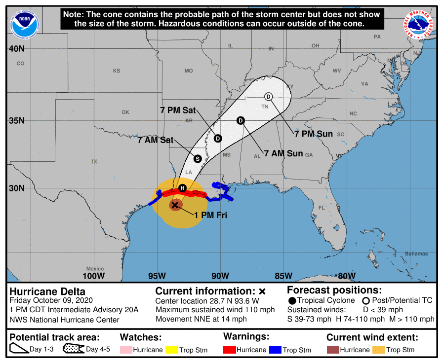
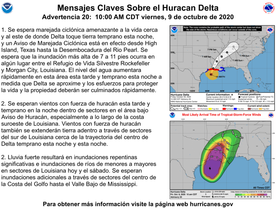
The National Hurricane Center has issued an update on Hurricane Delta. As of 1:00 PM CST: Delta is moving toward the northwest near 14 mph (22 km/h), and this motion with a reduction in forward speed is expected today and this motion should continue through Saturday morning. A turn toward the northeast is expected later on Saturday. On the forecast track, the center of Delta should make landfall along the coast of southwestern Louisiana during the next several hours, and then move across
central and northeastern Louisiana tonight and Saturday morning.
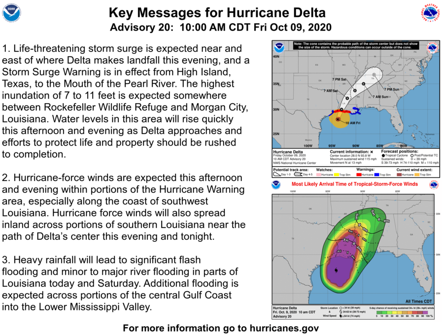
Maximum sustained winds are now near 110 mph (175 km/h) with higher gusts. Slow weakening is expected before landfall, with rapid weakening expected after the center moves inland.
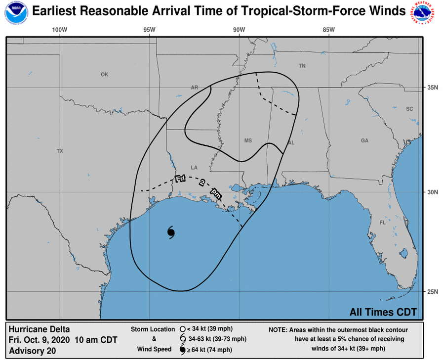
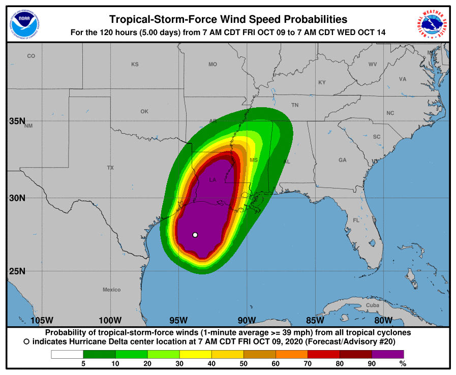
Hurricane-force winds extend outward up to 40 miles (65 km) from the center and tropical-storm-force winds extend outward up to 160 miles (260 km). The Texas Coastal Ocean Observation Network station at Texas Point recently reported sustained winds of 50 mph (80 km/h) and a wind gust of 57 mph (92 km/h). Lake Charles Regional Airport recently reported a wind gust of 60 mph (96 km/h).
HAZARDS AFFECTING LAND:
WIND: Hurricane conditions are expected within the hurricane warning area this afternoon, with tropical storm conditions already occurring. Tropical storm conditions will continue to spread onshore within portions of the tropical storm warning areas during the next several hours.
RAINFALL: Today through Saturday, Delta is expected to produce 5 to 10 inches of rain, with isolated maximum totals of 15 inches, from southwest into central Louisiana. These rainfall amounts will lead to significant flash, urban, small stream flooding, along with minor to major river flooding.
TORNADOES: A few tornadoes are possible today and tonight over southern portions of Louisiana and Mississippi.
For extreme east Texas into northern Louisiana, southern Arkansas, and western Mississippi, Delta is expected to produce 3 to 6 inches of rain, with isolated maximum totals of 10 inches. These rainfall amounts will lead to flash, urban, small stream, and isolated minor river flooding.
As with all tropical storms and hurricanes please be prepared for heavy rainfall, strong winds and strong wind gusts, and possible tornadoes.
Please ensure that you have your hurricane, storm and flood plans in place, be prepared and please stay up to date on weather forecasts.
The National Weather Service Forecast for Baker through Saturday:
Tropical Storm Warning until further notice
Flash Flood Watch until October 10, 01:00pm
Flood Warning until October 12, 01:09am
This Afternoon: Tropical storm conditions possible. Showers and possibly a thunderstorm. High near 80. Chance of precipitation is 90%. New rainfall amounts between a half and three quarters of an inch possible.
Tonight: Tropical storm conditions expected. Showers and possibly a thunderstorm. Low around 71. Chance of precipitation is 90%. New rainfall amounts between a half and three quarters of an inch possible.
Saturday: Showers likely and possibly a thunderstorm before 10am, then a chance of showers and thunderstorms between 10am and 1pm, then a chance of showers after 1pm. Mostly cloudy, with a high near 80. Southwest wind 10 to 15 mph. Chance of precipitation is 60%. New rainfall amounts between a tenth and quarter of an inch, except higher amounts possible in thunderstorms.
|
