|
July 2025
Igniting A Spark in Engineering

500 Presentations.
92 Presenters.
15,100+ Students Reached Statewide
The 2024-2025 school year was certainly a banner year for KEEN. The numbers from the past school year tell the story of how KEEN continues to grow -- leaving its mark on the classroom, and on the minds of so many students interested in learning more about STEM careers.
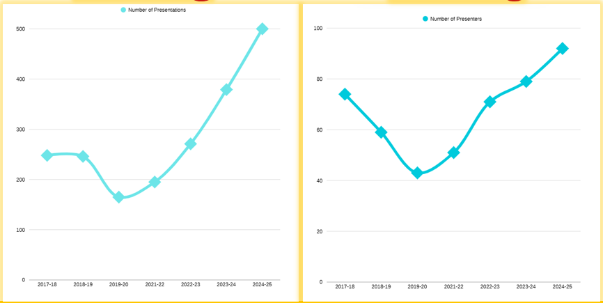 Since the 2019-2020 school year, KEEN has now seen a 203% increase in presentations and more than 114% increase in presenters. Year over year, KEEN provided 32% more presentations this school year when compared to the 2023-24 school year.
The number of presentations and presenters during the past school year have set new benchmarks for KEEN; however, the success of the program isn't only about numbers -- It's also about sparking interest in the career fields of science, technology, engineering and math (STEM). Our hope is to encourage students to think beyond the classroom, and to share what scholarship and career opportunities await!
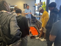
 Who says the fun has to just be for the students?
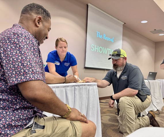
School is out, but our engineers are working hard this summer! On Wednesday, July 9, and Thursday July 10, more than 30 KEEN presenters traveled to Rough River Dam State Park in Grayson County, to hone in on their skills and participate in activities that have their aim at improving the overall KEEN experience.
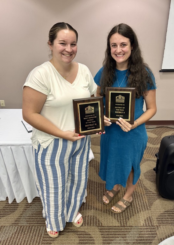
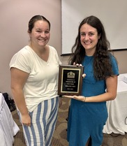
Pictured Above: KEEN Statewide Coordinator Elizabeth Gibson (left), and Mallory Frye (right) holding two awards
As part of the conference -- we like to recognize districts and individuals that are going above and beyond to help students. District 8 in southern Kentucky performed a 'clean sweep' of this year's KEEN awards!
|
...and deservingly so! During the 2023-24 school year, District 8 gave 35 presentations. This school year, engineers provided 189 presentations -- a 440% increase! District 8 won the 'most improved district' and the 'overall district of the year'.
As for the photo on the right -- don't worry. You aren't seeing double. District 8's Mallory Frye gave 78 presentations throughout the school year. We're looking forward to what the next school year brings for every district in our state!
|
|
 |
KEEN presenters volunteer their time knowing they're making a difference in the lives of thousands of students every year. Our interactive presentations and activities are the perfect supplement for classrooms of any age: grade school, middle school, high school and college students! These presentations come at no cost to the class/school. It's never too early to start scheduling presentations for your class!
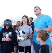
  Sun's out? Maps out.
Mapping is a great way to pinpoint fun destinations you explored during summer break! This activity integrates real-world geospatial data with geographic exploration using modern mapping technology -- making it fun and educational for everyone!
Teachers and students are welcome to use the ‘Talk to us!’ tool in the Web Map to send questions to KYTC’s GIS Help Desk. For more advanced/adventurous students, see the ‘Challenge’ section for an added fun test!
Objective:
Use KYTC's General Highway Interactive Map to identify favorite Kentucky summer memories. Find these locations by using aerial imagery and map 'search' elements.
Materials:
- A computer, tablet, or smartphone with internet access
- Click the links below to access the highway map and interactive video
For Challenge section:
- Access to a Microsoft Word document
Steps:
-
Pre-Activity Prep: Before beginning the activity, Watch the Interactive Web Maps Video by clicking the button above in the Materials section.
Key sections of the video for this exercise:
- Navigating in the map (0:09-1:09)
- Use the search function (search bar in top right) to locate your school
- Change the Basemap (2:37-3:15)
- Location tools: Dual Maps and Oblique Viewer (8:00-9:07)
- Zoom to Feature (9:08-10:02)
- Draw, Add Text and Print Map (11:28-14:30)
- Learn Web Map Functions (10 minutes)
- Open the General Highway Map
- Search and find your school using the map’s search function (search bar in the top right)
- Zoom in to the school
- Change the basemap to ‘KYTC - KY Most Recent Imagery’
- As a class, identify favorite places at school (playground, cafeteria, etc.)
- *Revisit the Activity Video whenever needed!
-
Discussion: How does using aerial imagery help you figure things out?
-
Discussion: What is the hardest part about using aerial imagery? (telling the difference between the science building and the math building etc.)
- Identify Fun Memories (5 minutes)
- Write down at least two places in Kentucky where you had the most fun this Summer.
- *Important* You must either know the address (e.g. Grandparents house), or it should be a ‘publicly known place’ (e.g. Land Between the Lakes, Local Pool/Park, Top Golf, Baseball/Soccer field, Red River Gorge)
- Map Your Summer! (20 minutes)
- Locate and zoom to the first ‘Summer Memory’ location.
- Use the Draw tool ‘Add Marker’ function to add points where students made their favorite memories.
- Use the Insert Text tool to label these point markers. Examples:
- The soccer field where I scored a goal
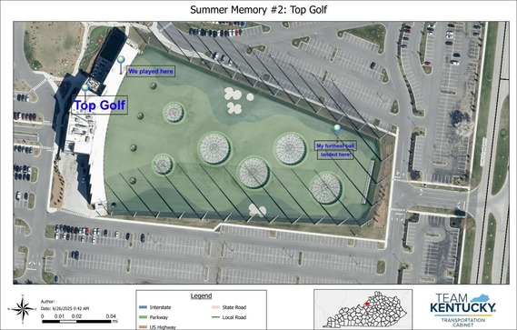
- Where I hit the furthest ball to at Top Golf
- The creek behind my grandparent’s house
- Now, make sure everything is visible on your screen
- Use the ‘Print tool’ widget to export the map to a PDF.
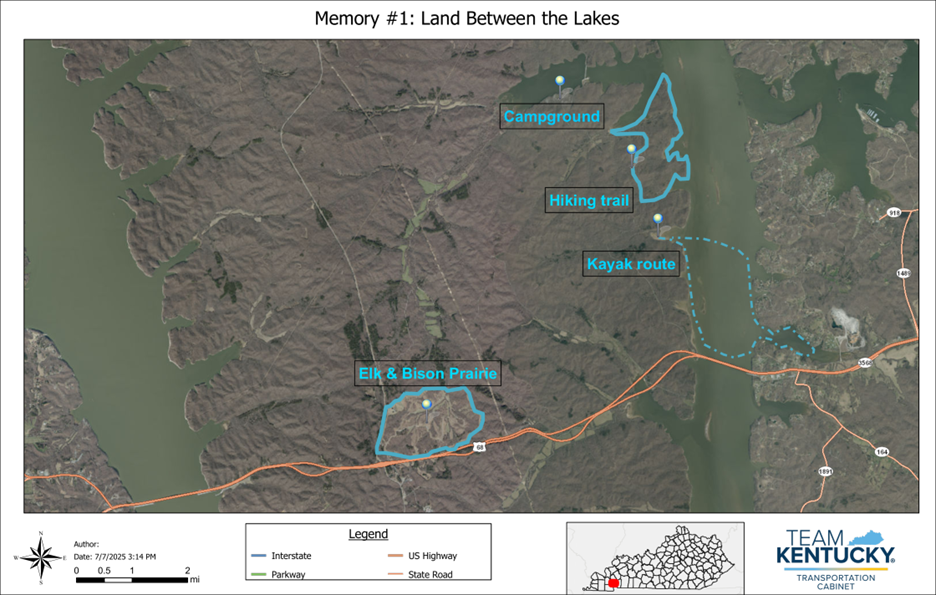
- Give your map a title, like ‘Memory #1: Land Between the Lakes’
- Click ‘Print’ and wait for the ‘Results’ tab to say ‘Results(1)’
- Now, click the ‘Results’ tab, open your map and save/download it.
- Now, create a map for your second summer memory!
Example Map 1:
 Example Map 2:
-
Challenge: Imagery Sleuth! (15 Minutes): *See the Web Map Video’s Challenge section for further details*
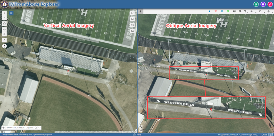
Discussion: Click the image below to open the KyFromAbove Explorer tool. What differences do you notice between the ‘Vertical Aerial Imagery’ and the ‘Oblique Aerial Imagery’ in each one?
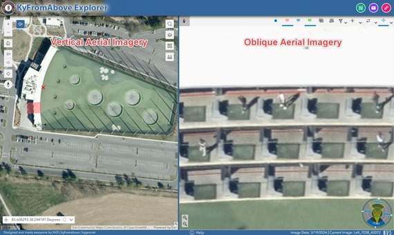 In this image, the Vertical Aerial Imagery view shows us Top Golf, but the Oblique Aerial Imagery view allows us to see golfers in action!
Now, it’s your turn!
- Open the Oblique Imagery tool (It’s in the Location Tools widget; revisit the Web Map Video if needed!)
- Find 5 areas using oblique imagery that otherwise can’t be seen using overhead aerial imagery.
- Use the ‘Link’ widget to create a URL for each area you find.
- Copy and paste the URLs in a word document to make a list of your 5 Imagery Sleuth locations.
- Describe each location in the word document (‘Golfers at Top Golf’)
- Your formatting should look like this:
- Western Hills Wolverines Banner
- Golfers at Top Golf
Submit the word document to your teacher so they can click on the URLs and see all the locations you find.
Wrap-up question:
Think about all the mapping tools you used for today’s exercise. How can you use these tools to plan some fun activities for winter break?
  The Kentucky Transportation Cabinet (KYTC) scholarship program has been a great experience. When I was first awarded the scholarship in 2018, I didn't really know what I was getting into. I just knew I had some help to pay for school and a summer job between semesters. During my time as a scholarship student, I had the chance to intern in Paducah (District 1), Bowling Green (District 3), and with the Department of Aviation.
 |
|
I was able to meet so many great people who work for KYTC and was afforded the opportunity to learn under many great engineers and other Cabinet employees. I learned everything from paving operations, to maintenance and construction of roadways. I even learned about the different layouts and designs of airports in our area. |
Once I graduated and started working full time for KYTC -- I found the work-life balance was the first thing I really enjoyed about the career. I can enjoy a fulfilling job, help citizens of the Commonwealth, and still be able to go home and spend valuable time with my family.
Even years later -- when I go to my job -- I don't feel as if it's work. We stay very busy, but I've always enjoyed what we do!
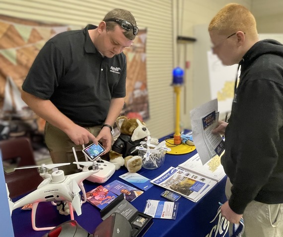
I am currently a Section Engineer with the Department of Aviation. In this role, I work mainly with Unmanned Aerial Systems. They're sometimes called UAS, but most folks know them as 'drones'. I assist citizens of the Commonwealth and other state agencies with drone related questions and training. I also use drones to fly the approach surfaces of airports to identify any obstructions to the approach surfaces of the runways. Once obstructions are identified we work with the local airports to get them removed. This critical position improves the safety at each of our state’s airports. |
|
 |
One of the most rewarding experiences I now have is the opportunity to attend career fairs at high schools and colleges. When attending these career fairs, I can speak with students related to the scholarship program, share my experience and encourage them to apply. Being able to assist, guide, and teach the next generation coming into KYTC is very rewarding as the Cabinet has been here before us and will be here after us if we do our part to keep it moving forward.
|