High Water Report for April 8, 2025 at 1:45 p.m.
Latest updates regarding weather related closures
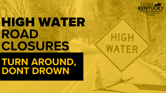
COVINGTON, Ky. (April 8, 2025) – High water is impacting numerous roads in KYTC District 6. These roads remain blocked due to flooding. New roads will be added to the closure list as updates are available.
High water remains possible even for roads not listed. Drivers are urged to check GoKY for traffic conditions before traveling. Never drive through a flooded roadway. Remember: Turn around. Don't drown.
KYTC will continue to provide updates as new closures are added and previous closures are cleared. Additional updates between press releases will be posted on the KYTC District 6 Facebook page.
List of roads in District 6 impacted by high water and/or mudslides:
Please note this list only includes state routes. Flooded roads added throughout the day will be listed as NEW. Roads in which water has receded are listed below as CLEARED and will then be removed from the list during the next update.
Boone County
- Riddles Run Road (KY 2852) between Beaver Road (KY 338) (0.0 mile point) and Hathaway Road (KY 536) (2.33 mile point)
Bracken County
- KY 19 near Chaney Road (4 to 5 mile point) is down to one lane with temporary traffic signals in place due to damaged pavement.
- Bradford Road (KY 1109) between Johnsonville Foster Road (KY 1951) and Mary Ingles Highway (KY 8) (3.81 to 5.84 mile points)
Campbell County
- E Main Street (KY 10) at the corner of Redstone Road. (3.4 to 3.65 mile points) One lane closed in the area due to damaged pavement.
- Mary Ingles Highway (KY 8) closed at Industrial Road (2.9 mile point)
- Washington Trace Road and Painter Road (KY 2921) closed between Oneonta Road (KY 1566) and Mary Ingles Highway (KY 8) (0.0 mile point to 2.21 mile point)
- Three Mile Road (KY 2238) between Johns Hill Road (KY 2345) and the nearby pump station. (2.44 to 2.19 mile points)
- Pond Creek Road (KY 1936) at the corner Visalia Road (6.8 mile point)
- River Road (KY 445) at 1.6 mile point. This is located between Delta Ave. and Mary Ingles Highway (KY 6635)
- Oneonta Road (KY 1566) between Stonehouse Road (KY 1997) and Mary Ingles Highway (KY 8) (mile points 0.0 to 1.8)
Carroll County
- KY 389 beginning near Green Bottoms Road to KY 55 (4.48 to 7.23 mile points)
- U.S. 42 from KY 55 (5.57 mile point) to the intersection of US 42/KY 36 (4.52 mile point)
- KY 36 from the intersection of KY 36/US 42 (8.12 mile point) to the Carroll/Trimble County line (0.0 mile point)
- KY 55 between the spilt to KY 389 and KY 549. (3.57 to 5.76 mile points)
- KY 36 from the railroad crossing to KY 47 (21.97 to 23.21 mile points)
- KY 467 between Harrison Street and Buffalo Creek Road (0.50 to 2.0 mile points)
- Goose Creek Road (KY 1204) between KY 227 and Kendall Road (0.0 to 0.45 mile points)
- KY 389 from the Carroll/Henry County line extending to near Camp Branch Road. (0.0 to 1.5 mile point) This portion of KY 389 is now completely covered with water.
- KY 2997 just north of Woodrow Wilson Road (2.51 mile point) to KY 389 (4.25 mile point)
Gallatin County
- Steeles Bottom Road (KY 1992) closure begins near Davis Road (2.0 mile point) extending to 3.9 mile point.
- Craigs Creek Road (KY 1130) between KY 35 and Winn Road (3.7 to 4.7 mile points)
- KY 467 between U.S. 127 in Glencoe and KY 35 in Sparta (2.2 to 7.6 mile points)
- KY 35 just south of Craigs Creek Road (KY 1130) (5.9 to 6.1 mile points)
- U.S. 42 West between Carvers Trail and Knox Lillard Road (4.6 to 5.2 mile points) is expected to close soon due to rising waters.
- No commercial vehicle traffic on KY 1039 extending over the Markland Locks and Dam (6.4 to 7.1) due to flooding in Switzerland County, Indiana.
Harrison County
- KY 3016 (0.0 to 1.9 mile points)
Kenton County
-
Decoursey Pike (KY 177) at Conley Road (7.4 mile point)
- Locust Pike (KY 1930) near Locust Pike Park (1.5 to 2.5 mile point)
- Locust Pike (KY 1930) between Wards Lane (5.94 mile point) and Red Row Lane (5.69 mile point)
- Decoursey Pike (KY 177) near Washboard Road between 3.8 and 4.7 mile points
- River Road (KY 8) between Amsterdam Road (KY 371) (0.01 mile point) and Lagoon Street (3.78 mile ponit)
- KY 14 (Rich Road) between Hempfling Road and Cruise Creek Road (6.4 to 6.8 mile points)
Owen County
- KY 355 from U.S. 127 in Monterey to KY 227 near Worthville (0.0 to 18.9 mile points)
- KY 3523 the loop through Monterey (0.0 to 1.0 mile points)
- KY 325 between KY 355 and KY 227 (0.0 to 5.6 mile points)
Pendleton County
- The KY 177 truss bridge over the Licking River between River Road (4.81 mile point) and Mill Street (5.01 mile point) reopened at 4 p.m., Monday, April 7. Motorists can access the City of Butler using U.S. 27 to KY 3149, and then right on KY 177. Per Pendleton County EMA: residents will be required to show proof of residency in the City of Butler to be allowed in.
- KY 177 between U.S. 27 and Duckers Woods Road (KY 3149) (4.01 to 4.46 mile points)
- KY 177 between KY 467 to Pendleton/Kenton County Line (9.15 to 9.59)
- KY 177 at the railroad tunnel near Butler (5.3 mile point)
-
CLEARED: KY 22 between KY 159 and Milford Road (11.7 to 13 mile point)
- KY 177 between U.S. 27 to KY 609 (2.3 to 4.0 mile points)
- KY 609 between Davis Road and Quail Run Road (1.91 to 4.0 mile points)
Robertson County
- CLEARED: Piqua Kentontown Road (KY 617) from south of Waterworks Road (4.0 mile point) to KY 165 (5.3 mile point)
###
|