|
LOUISVILLE, Ky. (March 10, 2026) – As work continues to advance on the $130 million widening and improvement project of Interstate 264 (Watterson Expressway) and U.S. 42 (Brownsboro Road) in Louisville, the Kentucky Transportation Cabinet (KYTC) advises motorists of upcoming weekend ramp closures for bridge demolition work.
To safely carry out the demolition of the I-71 South ramp bridge over the Watterson Expressway interchange ramps, the following traffic restrictions will be in place beginning Friday, March 13, at 8 p.m., continuing through Monday, March 16, at 5 a.m.:
- The I-264 East ramp to I-71 South will be closed (Exit 23B) – motorists should take I-71 North to I-265 North to reach I-71 South.
- The I-71 South ramp to I-264 West will be closed (Exit 5) – motorists should continue on I-71 South to Zorn Avenue at Exit 2 to I-71 North to reach I-264 West.
- I-71 North will be closed at mile point 4.9 – motorists will be able to continue to I-264 West at Exit 5 and should detour to either U.S. 42 (Brownsboro Road) at Exit 22 or KY 1447 (Westport Road) at Exit 21 to connect with I-264 East to proceed on to I-71 North.
The I-71 North ramp to I-264 West will remain open at Exit 5. The I-264 East ramp to I-71 North will also remain open (Exit 23A).
The interstate project is expected to be completed by the Fall of 2027. The work is being carried out by Cleary Construction Inc. of Monroe County, Kentucky. More details, including project timelines and traffic impacts, will be shared online as work progresses. Motorists are encouraged to sign up for email and text alerts regarding weekly traffic impacts pertaining to the project.
The date and duration of this work may be adjusted if inclement weather or other unforeseen delays occur. For the latest traffic and travel updates across the Commonwealth of Kentucky, visit goky.ky.gov. Information specific to District 5 counties is also available on Facebook and X.
 The Jefferson County PVA will mail property assessments on April 24, 2026. The 2026 reassessment covers MLS Areas 8 & 9, including areas in and around Prospect, Norton Commons, Glenview, Graymoor-Devondale, Anchorage, Lyndon, Hurstbourne, Douglass Hills, Middletown, Lake Forest and Polo Fields. If your property value changes, a full-color assessment notice on a large postcard that includes a photo of the property and information about the assessment appeal process will be mailed to you. New values will be posted on Jeffersonpva.ky.gov on April 24, 2026 at noon.
If you believe the assessed value is not correct, The Jefferson County PVA wants you to know: You have a right to appeal.
The mission of the PVA is to provide fair and equitable assessments for all property owners in Jefferson County. PVA staff works hard to get the value of our property correct. However, the PVA does not know every detail or condition of your property. If you believe the PVA assessed value does not represent the fair-market value of your property, you have a right to appeal your assessment.
To learn more about property assessments and how to file an appeal, attend one of the PVA’s upcoming community meetings:
March 31: Anchorage Middletown Fire & EMS HQ (108 Urton Ln) 6:30pm-8pm
April 14: Lyndon City Hall (515 Wood Ln) 6:30pm-8pm
April 16: Berrytown Recreation Senior Nutrition Annex (1340 Heafer Rd) 6:30pm-8pm
All meetings will also be available on Zoom, visit jeffersonpva.ky.gov to register for virtual meetings.
The first step of the appeal process is to complete the PVA Online Conference which is available at www.jeffersonpva.ky.gov from April 24, 2026 at noon EDT, until May 18, 2026 at 4pm EDT.
Most people prefer to complete the appeal using online self-service. However, if you need assistance with the Online Conference, PVA staff will be available and ready to assist you.
In-Person Appeal Assistance at the Southwest and South-Central Library Branches:
• Opening Day April 24: 12pm-4pm
• Weekdays April 27-May 18: 9am-4pm
PVA Office By Appointment: Weekdays April 24-May 18, 8am-4pm EDT and 2 Saturdays, May 9 and 16, 9am-1pm EDT at the PVA Office, 815 W. Market Street, suite 400. Optional appointments available: 502-574-6224 to reserve a time.
By Telephone: Accommodations will be made for property owners with limited mobility and access to technology. Call 502-574-6224 to reserve a time for a telephone conference.
More helpful information, including tips on preparing for your Online Conference can be found at www.jeffersonpva.ky.gov.
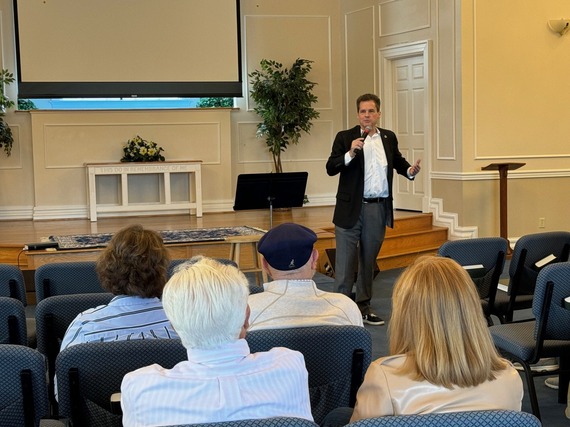 Please be advised of a Coffee with Your Councilman event Saturday, March 21 from 10:00am to 11:00am at First Baptist Church of Prospect, 8911 US-42, Prospect, KY 40059.
Coffee will be provided!
Come meet Councilman Reed in a relaxed setting and provide suggestions or ask questions about District 16, local policy, or the larger community.
WHEN: Saturday, March 21 from 10:00 am to 11:00 am
WHERE: First Baptist Church of Prospect, 8911 US-42 Prospect, KY 40059
Any questions, please contact the District 16 office at 574-1116 or email Jared Townes at Jared.Townes@Louisvilleky.gov.


As part of the Louisville Metro Police Department’s ongoing commitment to community engagement and transparency, the Eighth Division will host quarterly community meetings to allow residents to ask questions, and engage directly with division personnel. March 18, 2026, at the Berrytown Community Center (1300 Heafer Road) from 6:00 p.m. – 7:30 p.m.
June 24, 2026, at the Anchorage-Middletown Fire Station (9514 Featherbell Blvd), also from 6:00 p.m. – 7:30 p.m.
These meetings are part of our continued effort to strengthen partnerships, provide updates on public safety initiatives, and collaborate with residents to address concerns within the LMPD Eighth Division.
|
Have a question about zoning in your neighborhood? Wondering how developments get approved? Louisville Metro’s Office of Planning is hosting open Q&A sessions at library branches on select Tuesday afternoons. These sessions are free and open to the public – no RSVP required. Planning impacts how our neighborhoods grow, what the future of Louisville looks like, and where we live. The goal of these conversations is simple: to make the planning process clearer and easier to understand.

 Harbor House of Louisville is an Intergenerational Life Center that recently opened a Child Enrichment Center in the south end of Louisville. We have been serving adults with intellectual disabilities for over 30 years and just recently included children in our mission. We serve 31 zip codes and 5 different counties around the city of Louisville. We are hosting our Feathers and Friends Gala on March 21st.
Louisville, KY (March 13, 2026) – Louisville Mayor Craig Greenberg and the Louisville Zoo are pleased to announce that the Bunny Hop is returning this month as part of the Meet Me at the Zoo series. Guests can meet the Easter Bunny, snap seasonal photos, and participate in the Safari EGGventure virtual scavenger hunt. Guests can take their own photos, free of charge, with the Easter Bunny or may opt to purchase a photo package offered on-site. The Bunny Hop takes place March 28 and 29 from 10 a.m. to 2 p.m. and is free with Zoo admission.
Safari EGGventure
Guests may choose to join in a scavenger hunt to find zoo-themed eggs, answer trivia questions and compete in some EGGstra special challenges while they are exploring the Zoo. This free-to-play, app-based game can be played from March 14 to April 12. Guests can choose to play for fun or compete for prizes by obtaining a minimum score. To learn how to play, and to see a full list of rules and prizes, visit louisvillezoo.org/series/safari-eggventure.
Ticket information
The Bunny Hop and Safari EGGventure are free with Zoo admission or Louisville Zoo membership.
Meet me at the Zoo: Bunny Hop is presented by Norton Children’s.
***
The Louisville Zoo, the State Zoo of Kentucky, is the top, non-profit, paid attraction in the state. The Zoo is dedicated to bettering the bond between people and our planet by providing excellent care for animals, a great experience for visitors, and leadership in scientific research and conservation education. The Zoo is a member of the World Association of Zoos and Aquariums (WAZA) which is a global alliance of zoos and aquariums. The Zoo is accredited by the Association of Zoos and Aquariums (AZA).


New items or changes in project status are shown in bold
Inclement weather or other unforeseen circumstances may arise, and as such, the information provided below is for advisory purposes only and subject to change without prior notice.
Pothole patching, sweeping, drain & ditch cleaning, striping, pavement marking, and maintenance crews may work on major interstates during non-peak daytime hours and at night. Motorists should watch for roadside maintenance on interstates and highways daily throughout the district.
 **Following the recent snow and ice event, our crews are out across the district repairing potholes and addressing winter-related roadway wear. This is part of our routine maintenance efforts to keep state routes safe and drivable. **Following the recent snow and ice event, our crews are out across the district repairing potholes and addressing winter-related roadway wear. This is part of our routine maintenance efforts to keep state routes safe and drivable.
As crews move from location to location, drivers may encounter short-term lane closures or rolling operations on interstates and state highways. These repairs often happen quickly and as conditions are identified.
Please stay alert, reduce speed in work zones, and give our highway crews the space they need to complete pothole patching safely.**
| Jefferson County |
|
| I-65 Central Corridor |
Information related to the I-65 Central Corridor project can be found online at i65centralcorridor.com.
|
U.S. 31E (Main Street)
*Main Remade* |
*Construction phasing details, including traffic impacts, are available online at: www.MainRemade.com
Latest press release:
https://lnks.gd/2/33z8p--
|
| U.S. 60 (Shelbyville Road) |
Traffic Impacts: Daily lane closures are possible.
Date/Time: Utility relocation work by service providers is currently in the final stages, and full construction activities to widen U.S. 60 (Shelbyville Road) are expected to begin on or after Monday, March 2.
Project Limits: U.S. 60 (Shelbyville Road) between KY 2861 (Eastwood Cutoff Road) and Rockcrest Way.
Type of work: Widening and improvement project.
Other Details: Please visit the project webpage for additional information.
|
| I-64 East and West |
Traffic Impacts: Lane closures are possible as final items as part of the project are underway.
Date/Time: Daily/nightly.
Project Limits: I-64 East and West at mile point 11.799, near Exit 10 (Cannons Lane) on I-64 West, and near Exit 12 to I-264 (Watterson Expressway) on I-64 East.
Type of Work: Bridge replacement project.
Other Details: *Project announcement press release
|
| I-65 South (John F. Kennedy Memorial Bridge) |
**Feb. 17, 2026 Press Release: https://lnks.gd/3/3RJ3qVj
-----------------------------------------------
Contract crews have completed the replacement of the expansion joints in the right three lanes, allowing work to advance to replacing expansion joints in the left three lanes of the bridge.
Traffic is now shifted to the right three lanes while work takes place in the left three lanes to replace the remaining expansion joints.
**This traffic pattern will remain in place through project completion.
|
| I-71 Widening and Improvement Project |
**Traffic impacts available here.**
|
| I-264/U.S. 42 (Brownsboro Road) Improvement Project |
**Traffic impacts available here.**
|
| KY 864 (Logan Street/Shelby Street) |
Traffic Impacts: Sidewalk and lane closures are possible.
Date/Time: Daily and nightly.
Project Limits: Between Goss Avenue and East Gray Street.
Type of Work: One-way to two-way conversion of the roadway.
Other Details: Major work has resumed, with full completion expected by Spring 2026.
*Project Webpage
|
| KY 1819 (Billtown Road) |
Traffic Impacts: Lane closures and delays are possible.
Date/Time: Daily – 9 a.m. to 4 p.m.
Project Limits: Three sections of KY 1819 (Billtown Road):
- Easum Road through Mary Dell Lane
- Michael Edward Drive through Fairground Road
- Shady Acres Lane through Colonnades Place
Type of Work: Reconstruction of KY 1819 (Billtown Road) from North of Colonnades Place to south of Easum Road with new traffic signals, signal optimization, turn lanes, storage lanes, etc. (varying by intersection based on existing conditions and future traffic projections).
Other Details: The reconstruction project is expected to be completed by the Spring of 2026.
*Project webpage
|
| KY 1932 (Chenoweth Lane) |
Traffic Impacts: Lane closures and delays are possible.
Date/Time: Daily.
Project Limits: KY 1932 (Chenoweth Lane) between U.S. 60 (Shelbyville Road) and U.S. 42 (Brownsboro Road).
Type of Work: Construction activities include roadway modifications, sidewalk and pedestrian crossing improvements, and drainage enhancements designed to reduce flooding and improve overall travel conditions in the area.
Other Details: This project is expected to be completed by the Fall of 2026.
*Contract crews mobilzed the week of Monday, Feb. 2. Intermittent lane closures are possible from 9 a.m. to 3 p.m. daily. Motorists will be directed through the work zone via flagging operations. Drivers should heed flagging operations and use caution when traveling through the corridor.* |
I-264
*Various Exit Ramps |
Traffic Impacts: Ramp narrowing with intermittent lane and shoulder closures.
Project Limits: Various interchange Exit ramps on I-64 and I-264.
Type of Work: Installation and upgrade of wrong-way pavement markings and signs.
Other Details: The Highway Safety Improvement Project will install and enhance wrong-way signs and pavement markings on interstate Exit ramps to discourage wrong-way driving. Motorists should reduce speeds and obey traffic control while workers are present. This project is expected to be completed by the Fall of 2025. |
| |
|
| Bullitt County |
|
| KY 1526 (Bells Mill Road) |
Traffic Impacts: Road closure.
Date/Time: Beginning Monday, Nov. 17, through May 14, 2026.
Project Limits: KY 1526 (Bells Mill Road) will be closed at mile point 14.35 at the bridge over Floyds Fork.
Type of Work: Superstructure replacement.
Detour:
- For westbound traffic on KY 1526 (Bells Mill Road): Turn left onto KY 61 (Preston Highway) south toward Shepherdsville. At the signalized intersection, turn left onto KY 44 (East 4th Street) to reach KY 1526 (Bells Mill Road).
- For eastbound traffic on KY 1526 (Bells Mill Road): Turn right onto KY 44 (East 4th Street) through Shepherdsville. At the signalized intersection of KY 61 (Preston Highway), turn right to then reach KY 1526 (Bells Mill Road).
|
| KY 245 (Clermont Road) |
Traffic Impacts: Daily lane closures are possible.
Date/Time: Daily.
Project Limits: KY 245 (Clermont Road) between the I-65 interchange and Happy Hollow Road.
Type of Work: Widening and improvement project.
Other Details: Please visit the project webpage for additional information.
|
| |
|
| Franklin County |
|
| KY 12 (Flat Creek Road) |
Traffic Impacts: N/A.
Date/Time: Beginning Aug. 11, through the Fall of 2026.
Project Limits: KY 12 bridge over Flat Creek at mile point 12.46 (at the Franklin/Henry County line).
Type of Work: Bridge replacement project.
Other Details: Traffic will be maintained on the existing bridge until construction has been completed on the replacement bridge. |
| I-64 East and West |
**Alternating overnight lane closures are planned along I-64 West between mile marker 53 (near U.S. 127) and mile marker 58 (near U.S. 60) during the following times:
- From 7 p.m. Sunday, March 15, to 6 a.m. Monday, March 16
- From 7 p.m. Monday, March 16, to 6 a.m. Tuesday, March 17
- From 7 p.m. Tuesday, March 17, to 6 a.m. Wednesday, March 18
- From 7 p.m. Wednesday, March 18, to 6 a.m. Thursday, March 19
- From 7 p.m. Thursday, March 19, to 6 a.m. Friday, March 20**
Traffic Impacts: Lane closures and traffic shifts are possible.
Date/Time: Daily/nightly beginning Thursday, Sept. 4.
Project Limits: The I-64 East and West, between the Frankfort exits (mile markers 53 and 58).
Type of Work: The I-64 improvement project, between the Frankfort exits (mile markers 53 and 58), includes the milling and removal of the existing asphalt surface followed by resurfacing with new asphalt pavement. Other improvements to the 5-mile corridor include bridge repairs and bridge crash wall repairs.
Other Details:
- U.S. 60 (Versailles Road):
U.S. 60 (Versailles Road) will be reduced to one lane in each direction under the I-64 overpass bridge nightly from 9 p.m. to 6 a.m. beginning Monday, Sept. 15.
|
| KY 1900 (Peaks Mill Road) at the U.S. 127 Intersection |
Traffic Impacts: Closure of KY 1900 (Peaks Mill Road) at the U.S. 127 intersection.
Date/Time: From 7 a.m. on Monday, March 16, through 6 a.m. on Monday, March 23.
Project Limits: KY 1900 (Peaks Mill Road) at the U.S. 127 intersection.
Type of Work: This work is being performed as part of the roadway improvement project for U.S. 127 (Owenton Road) in Franklin County, and KY 55 (Freedoms Way) in Shelby County.
Other Details: Motorists are encouraged to follow the signed detour by taking U.S. 421 (Thornhill Bypass) to U.S. 460 (Georgetown Road), then KY 2822 (Steadmantown Lane) to reconnect with KY 1900 (Peaks Mill Road). The intersection closure is necessary to allow contract crews to replace the concrete and provide sufficient time for the new material to properly cure.
*U.S. 127 will remain open to traffic. However, vehicles will not be able to turn onto KY 1900 (Peaks Mill Road) at this intersection.
|
| U.S. 127/Vandalay Drive Intersection |
Traffic Impacts: Lane closures and traffic shifts are possible.
Date/Time: Daily from 9 a.m. to 3 p.m.
Project Limits: U.S. 127/Vandalay Drive intersection.
Type of Work: The scope of the project includes constructing a new roundabout at the intersection of Vandalay Drive and Westridge Drive; extending Vandalay Drive to Limestone Drive to create a direct connection to KY 676 (East-West Connector); extending Vandalay Drive to U.S. 127 near the I-64/U.S. 127 interchange; and adding dual receiving lanes to improve left-turn movements from U.S. 127 onto Westridge Drive.
Other Details: The project is scheduled to be completed by the summer of 2026. |
| KY 1665 (Bridgeport Benson Road) |
Traffic Impacts: Daily lane closures are possible.
Date/Time: Daily from 9 a.m. to 3 p.m. beginning Monday, Feb. 23.
Project Limits: KY 1665 (Bridgeport Benson Road) over South Benson Creek at mile point 3.93.
Type of Work: Concrete sealing.
Other Details: Motorists should heed signage, use caution, and expect delays when traveling through the work zone. |
| |
|
| Oldham County |
*Routine Maintenance* |
| |
|
| Spencer County |
*Routine Maintenance* |
| |
|
| Shelby County |
|
| I-64 Widening and Improvement Project |
**Traffic impacts here.**
|
| KY 55X/KY 43 |
Traffic Impacts: Daily lane closures are possible.
Date/Time: Daily from 9 a.m. to 3 p.m. beginning on or after Monday, March 2.
Project Limits: Intersection of KY 55X and KY 43.
Type of Work: Intersection improvement project. Intersection improvements include upgrading the existing traffic signal, adding right-turn lanes on all approaches, and constructing dedicated left-turn lanes for northbound and southbound KY 55X. These enhancements will improve traffic flow, reduce delays, and enhance safety for motorists traveling through the corridor.
Other Details: While much of the early work will take place off the roadway, drivers should anticipate changing traffic patterns, intermittent lane closures, and possible flagging operations as the project progresses. The project completion date anticipated for late this Summer. Additional project information is available online.
|
| |
|
| Henry County |
*Routine maintenance* |
| |
|
| Trimble County |
*Routine maintenance* |
| |
|
2025 Resurfacing Projects
Resurfacing projects will begin April 1, 2025, and
will be completed by the Fall of 2025.
Motorists should heed signage and use caution when traveling through the work zone.
| County / Road Name: |
Project Limits: |
| Jefferson County |
|
| U.S. 60 (Shelbyville Road) |
Begin at an asphalt joint west of U.S. 60A extending east to 53 ft west of Sherburn Ln Spur Conn/Ten Pin Ln, a distance of 01.85 miles |
| U.S. 60 (Shelbyville Road) |
Begin at Urton Lane/North English Station Road, extending east to an asphalt joint 0.038 miles west of Beckley Woods Drive/English State Way. |
U.S. 31 (West Main Street)
|
West Main St (US 31W southbound only) begins at US 150/West Main St, extending south to 145 ft north of US 31, a distance of 1.78 miles. |
| KY 907 (Valley Station Road/Third Street Road) |
Begin at U.S. 31E extending north to Arnoldtown Road, a distance of 3.99 miles |
| KY 1065 (Outer Loop) |
Begin at KY 907 extending east to a concrete joint at KY 1020, a distance of 02.48 miles |
| KY 61 (Preston Highway) |
Begin at the north end of the bridge over I-265 extending north to 0.026 miles south of Okolona Ter, a distance of 01.86 miles |
KY 1230 (Lower River Road)
|
From Tennis Blvd, west 0.093 miles, extending northerly to KY 1934, a distance of 2.62 miles. |
KY 2830 (Arthur Street)
*Completed* |
KY 2830 (Arthur Street) east of Brandies Avenue/KY 61 extending north to University Boulevard. |
U.S. 31E (Bardstown Road)
*Completed* |
U.S. 31E (Bardstown Road) at the Bullitt/Jefferson County line, extending south of Colonel Hancock Drive. |
KY 1631 (Crittenden Drive)
*Completed* |
KY 1631 (Crittenden Drive) at the beginning of state maintenance near the I-264 interchange, extending north to U.S. 60A (Eastern Parkway). |
KY 1531 (Johnson Road)
*Completed* |
KY 1531 (Johnson Road) from the railroad crossing extending north to Aiken Road. |
KY 61 (Arthur Street)
*Completed* |
KY 61 (Arthur Street) beginning east of Brandies Avenue extending north to I-65 ramp/East Gaulbert Avenue. |
KY 155 (Taylorsville Road)
*Completed* |
KY 155 (Taylorsville Road) beginning at KY 1747 (Hurstbourne Lane) extending north to KY 1932 (Breckenridge Lane). |
KY 329 (Covered Bridge Road)
*Completed* |
KY 329 (Covered Bridge Road) beginning at U.S. 42 extending east to the Jefferson/Oldham County line. |
| |
|
| Bullitt County |
|
KY 61 (Old Preston Highway)
|
Begin at KY 61 extending north to 0.165 miles north Hillsbrook Dr, a distance of 0.87 miles
|
KY 61 (North Preston Highway)
|
Begin 21 ft north of KY 2553 extending north to Bullitt/Jefferson County line, a distance of 01.58 miles
|
| KY 480 (Cedar Grove Road) |
Begin 0.113 miles east of Park Loop Rd/Valley Vw Dr extending east to 0.077 miles east of KY 1442, a distance of 0.42 miles |
KY 1442 (Ridge Road)
|
Ridge Rd/Clarks Ln from McCubbins Farm Ln, south 0.056 mile, extending easterly towards Paddock Rd, a distance of 4.90 miles. |
KY 1604 (Deatsville Road)
|
From KY 245, extending northerly towards Jackson Hollow Rd, a distance of 3.20 miles. |
KY 1531 (Dawson Hill Road)
*Completed* |
KY 1531 (Dawson Hill Road) from KY 1319 extending north to the Bullitt/Jefferson County line. |
KY 2672 (Knob Creek Road)
*Completed* |
KY 2672 (Knob Creek Road) from KY 1526 (Brooks Hill Road) extending north towards Lake Elmo Road. |
KY 2674 (Stringer Lane)
*Completed* |
KY 2674 (Stringer Lane) from U.S. 31E extending north to KY 44. |
| |
|
| Franklin County |
|
| U.S. 60 (Louisville Road) |
Begin at the east end of Benson Creek Bridge extending east to mile point .025 just east of Office Park Drive. |
| KY 12 (Dry Ridge Road/Flat Creek Road) |
KY 12 (Dry Ridge Road/Flat Creek Road) from the Shelby/Franklin County line extending east to Harvieland Road. |
| KY 1570 (St Johns Road) |
KY 1570 (St Johns Road) from the bridge at mile point 4.2, extending north to KY 12. |
| U.S. 127 (Wilkinson Boulevard) |
U.S. 127 (Wilkinson Boulevard) near Hall Street extending north to the south end of the U.S. 127/KY 2261 bridge. |
| |
|
| Oldham County |
|
| KY 53 (North First Avenue) |
Begin at KY 146 extending north to US 42 (MP 11.045), a distance of 03.99 miles |
KY 524 (Westport Road)
|
From US 42, extending northerly towards Smith Ln, a distance of 1 mile. |
KY 362 (Central Avenue)
*Completed* |
KY 362 (Central Avenue) from Rosswoods Drive extending south towards KY 146. |
KY 329 (Covered Bridge Road)
*Completed* |
KY 329 (Covered Bridge Road) from KY 329B extending east to mile point 8.754. |
| KY 393 (Crestwood to La Grange) |
Begin at KY 22 extending north to the south end of the North Fork Bridge, a distance of 1.99 miles |
KY 393 (Payton Lane)
|
From KY 1818, extending northerly to KY 22, a distance of 2.56 miles. |
KY 1694 (Gum Street)
*Completed* |
KY 1694 (Gum Street) from KY 329 extending north towards Mason Lane. |
KY 3223 (Old Sligo Road)
|
From KY 53, extending northerly to Ballard School Rd, a distance of 1.55 miles. |
U.S. 42
*Completed* |
U.S. 42 east of KY 1694 (Gum Street) extending east to the Oldham/Henry County line. |
| |
|
| Shelby County |
|
U.S.421 (Castle Highway)
|
Begin 21 feet north of KY 3322 extending north to KY 55, a distance of 2.82 miles. Castle Highway begins at Henry/Shelby County line extending north to the Shelby/Henry County line, a distance of 0.79 mile. |
KY 22 (Ballardsville Road)
|
Begin at Oldham/Henry County line extending east to KY 55, a distance of 7.02 miles |
KY 362 (Aiken Road)
*Completed* |
KY 362 (Aiken Road) from the Oldham/Shelby County line extending east near Webb Road. |
| U.S. 60 (Frankfort Road) |
U.S. 60 (Frankfort Road) beginning at KY 395 extending east to the Shelby/Franklin County line. |
KY 1408 (Floydsburg Road)
*Completed* |
KY 1408 (Loydsburg Road) from KY 362 extending west to the Shelby/Oldham County line. |
KY 322 (Lucas Road)
*Completed* |
KY 322 (Lucas Road) from KY 53 extending north to the Shelby/Henry County line. |
KY 53 (Mt. Eden Road)
*Completed* |
KY 53 (Mt. Eden Road) beginning at KY 714/KY 44 extending north to KY 1790 (Hooper Station Road). |
| |
|
| Spencer County |
|
KY 1392 (Grays Run Road)
*Completed* |
Begin at the east end of Simpsonville Creek Bridge extending east to KY 55, a distance of 2.64 miles |
KY 1633 (Elk Creek Road)
*Completed* |
KY 1633 (Elk Creek Road) from KY 1135 (Industrial Road) extending north to KY 55.
|
KY 1795 (Mill Road)
*Completed* |
KY 1795 (Mill Road) from Paradise Pointe Road extending east to KY 636. |
KY 55 (Shelbyville Road)
*Completed* |
KY 55 (Shelbyville Road) beginning at KY 155 extending north to the Spencer/Shelby County line. |
| |
|
| Henry County |
|
U.S.421 (Castle Highway)
|
Begin 21 feet north of KY 3322 extending north to KY 55, a distance of 2.82 miles. Castle Highway begins at Henry/Shelby County line extending north to the Shelby/Henry County line, a distance of 0.79 mile. |
U.S. 421 (Campbellsburg Road)
*Completed* |
U.S. 421 (Campbellsburg Road) at the I-71 overpass extending to the Henry/Trimble County line. |
KY 22 (Ballardsville Road)
|
Begin at Oldham/Henry County line extending east to KY 55, a distance of 7.02 miles
|
KY 1360 (Franklinton Road)
*Completed* |
KY 1360 (Franklinton Road) from KY 22 extending north to Bullitt Hill Road.
|
KY 241 (Pleasureville Road)
*Completed* |
KY 241 (Pleasureville Road) beginning at the Shelby/Henry County line extending north to U.S. 421. |
KY 1861 (Smithfield Road)
*Completed* |
KY 1861 (Smithfield Road) from KY 22 extending to KY 322. |
We now have a new way for you to map crime around you. Just click here and view our new interactive crime mapping tool for Division 5 & 8 or for each beat in Division 5 & 8. And save it in your favorites to view crime anytime it's updated daily. On the page is a Quickfind tool that allows you to put your address in and subscribe to crime trends, alerts and block watch reports for your police beat. Forward this email to your friends and family!
For further information on Councilman Scott Reed or District 16 please visit www.louisvilleky.gov/government/metro-council-district-16
You can also reach out directly by phone at 502.574.1116 or by email at scott.reed@louisvilleky.gov.
601 West Jefferson Street
Louisville, KY 40202
Having Trouble Viewing this eNewsletter? Click here to view it on the web.
|


