Contract crews to perform concrete slab repairs
LOUISVILLE, Ky. (May 16, 2025) – The Kentucky Transportation Cabinet (KYTC) advises motorists of weekend lane and ramp closures on Interstate 71 and Interstate 265 (Gene Snyder Freeway) beginning Friday, May 16, in Jefferson County as part of the I-Move KY project. Details regarding traffic impacts are below.
Friday, May 16, at 8 p.m. through 6 a.m. Monday, May 19:
- I-265 South will be reduced to one lane from mile point 34.4 (at the I-265/I-71 interchange) to mile point 32.1 (near KY 1447 (Westport Road)).
- The I-71 North to I-265 South ramp will be closed.
- The I-71 South to I-265 South ramp will be closed.
The lane and ramp closures are necessary for contract crews to perform concrete slab repairs. Drivers should heed signage, plan for increased travel times, and use caution when traveling through the work zone.
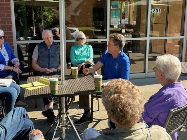 Please be advised of a Coffee with Your Councilman event Saturday, June 7th from 10:00 am to 11:00 am at Rudy Lane Panera Bread, 1801 Rudy Ln, Louisville, KY 40207.
Come meet Councilman Reed in a relaxed setting and provide suggestions or ask questions about District 16, annual budget process, local policy, or the larger community.
WHEN: Saturday, June 7th from 10:00 am to 11:00 am
WHERE: Panera Bread, 1801 Rudy Ln, Louisville, KY 40207
If you have any questions, please contact the District 16 office at 574-1116 or email my Legislative Assistant Jared Townes at Jared.Townes@Louisvilleky.gov.
 The Metro Council typically meets twice per month. This schedule is changes in May during our review of the Mayor’s FY26 Budget proposal. Instead of having two meetings in May, we adjust to having a single meeting to accommodate an additional 10-15 hours of budget hearings.
This week we heard testimony from the Metro Human Resources Department, Codes and Regulations, Economic Development and Facilities. Next week we will continue budget hearings with LMPD, Public Works, Parks and Recreation along with other departments scheduled to speak. We will end next week’s meeting with a public hearing where persons wanting to give comments on the budget are allowed to sign up and speak for up to three minutes on changes they would like to see made. If you have every wanted to participate in this, know that sign ups for the hearing will take place between 5pm and 6pm on the day of the hearing (May 22nd). Persons will be called to speak in the order in which they sign up, and the topics covered must relate to items or ideas related to the FY26 Metro Budget.
This week’s Metro Council Meeting included 11 items on old business ranging from zoning cases, to fire board appointments, to funding to support non-profit organizations. Below are a few of the highlighted pieces of legislation passed during the meeting:
Land Development Code – Public Awareness: Councilwoman Bast (District 14) and Councilman Dan Seum (District 13) proposed resolution (R-049-25) which seeks to improve the notice as well as the number of persons notified for changes proposed in zoning on properties.
Fire Board Appointments: 3 new Members to the Anchorage Middletown Fire Protection District were approved. Mr. Jason Smith, Ms. Andrea Oser and Mr. Clinton Hall were appointed to fill vacancies within the board.
Zoning Cases Approved: The Metro Council voted to approve zoning cases located on Crawford/Textile Avenue and a case on Camp Ground Road.
Signage Regulations: (R-037-25) Updated policies to allow for off-premise, modern, technologically enhanced signs to be constructed within the Downtown Business District. This request cam from leaders within the downtown area and will help to improve our abiily to host visitors and guests in our downtown core.
As stated earlier, next week (May 18th) will be a week of budget hearings followed by another week of budget hearings and committee meetings. The next scheduled meeting of the Louisville Metro Council is planned for June 12, 2025. All budget hearings as well as Metro Council Committee and regular meetings of the full Metro Council are televised live as well as available streaming on MetroTV as well as Facebook. For more information on anything contained within this article or for any questions about actions or events within Louisville Metro government, please contact my office at 574-1116 or via email at scott.reed@louisvilleky,gov.
Since April 29th, thieves have made off with at least 7 cars, 10 firearms, and assorted vehicle contents/valuables from the City of Prospect and the area immediately surrounding the city. Hunting Creek Estates, Fox Harbor, and The Landings are the locations of recent activity, as reported to Prospect PD. There were no home invasions or robberies as reported on some neighborhood apps, but the recent activity did include several garage burglaries.
All of these incidents began with an unlocked car in the driveway. It is critically important for residents to remove all valuables from vehicles (guns, money, keys, remotes, laptops, phones...) and lock the car. The same measures should be taken even if the car is located in a garage. The door accessing the living space from the garage should also be locked/dead bolted. Lastly, fobs should be far enough away from vehicles to prevent accessing the vehicle or cloning. Many of our residents are placing their fobs in a Faraday bag, which blocks the radio signal from the fob.
The City of Prospect, and surrounding areas, have been identified by groups of criminals called “Car Hoppers” as an area that easily yields high end property and vehicles because they don’t have to defeat any security measures. An extraordinary number of unlocked cars containing keys and ways to access attached garages are providing a “target rich environment”. Their MO is to flood an area with 5 or 6 people (driving a car they stole from somewhere else, which is why they're called "car hoppers") and go from house to house checking the cars in the driveway. If the car is locked, they go elsewhere. If the car is unlocked, they look for the fob/keys, money/valuables, guns, and the garage remote. If they find a remote, they open the garage. Then they repeat the process on the vehicles in the garage. Their primary goal is stealing the car, but their "flow" yields all manner of opportunities for other criminal activity.
Officers have identified the common times of occurrence and vigorously patrol during this time window. Prospect Police has also established relationships for real-time information sharing with adjacent jurisdictions allowing for more officers to respond to an area where car hoppers have been spotted.
Prospect Police has begun utilizing the Ring app as a means of sending out criminal activity notifications/warnings and prevention tips. It is also a place for residents to share Ring Doorbell footage with the community and police. It’s free to use and residents aren’t required to have a Ring Doorbell to join. Notices for the recent activity noted above were sent out via the app when the activity occurred. The other benefit is the information provided is directly from the Police and not the “expanded version” found on other neighborhood apps. Information can also be shared at citycops@prospectky.gov.
Important Contact Numbers
Jefferson County Dispatch
502-228-2677 or 502-574-5471
Oldham County Dispatch
502-222-0111
Prospect Police Administrative Contacts
502-228-1150 (Not monitored 24 hours)
citycops@prospectky.gov (Monitored by Asst Chief and Admin Asst)
House Watch: https://www.frontlinepss.com/prospectpdkycpc
Dispatch should be called for any reason where an officer is needed for a response. It doesn’t matter if it’s an emergency, a report run, tree down, or you would like to receive a phone call from an officer for something you believe is time sensitive; 911 and non-emergency dispatch numbers go to the same operators.
The admin contacts are for passing along information, or asking questions, which are not time sensitive or requiring an immediate response.
If you are calling after hours and need an officer, the admin contacts should not be used.
If you live in Oldham County, regardless of being in the City of Prospect, only call Oldham County Dispatch or you will encounter unnecessary delays. Priority runs will be shared with Prospect Police.
 May is National Water Safety Month. As the temperatures rise, everyone is drawn to pools, lakes, oceans, rivers, and other bodies of water! While swimming is a delightful pastime during the summer, it’s essential for everyone to prioritize water safety. Here are some tips on how children can stay safe in and around the water:
Learn basic swimming and water safety skills
Formal swimming lessons can reduce the risk of drowning. Children who have had swimming lessons still need close and constant supervision when in or around water. Learn more information on how to find swimming lessons in your area.
Build fences that fully enclose pools
Construct and use a four-sided fence that is at least 4 feet in height and fully encloses the pool. The fence should separate the pool from the house, with self-closing and self-latching gates. Remove all toys from the pool area that might attract children to the pool when the pool is not in use.
Supervise closely
Designate a responsible adult to supervise closely and constantly when children are in or near water (including bathtubs). You can assign a specific adult to supervise each child when they have access to water. Adults watching kids in or near water should avoid distracting activities like reading, using the phone, and consuming alcohol or drugs, because drowning happens quickly and quietly.
Wear a life jacket
Life jackets reduce the risk of drowning while boating for people of all ages and swimming abilities. Life jackets should be used by children for all activities while in and around natural water.
Life jackets can also be used by weaker swimmers of all ages in and around natural water and swimming pools. Do not rely on air-filled or foam toys, as these are not safety devices.
Learn CPR
Your CPR skills could save someone's life in the time it takes for paramedics to arrive. Many organizations such as American Red Cross and American Heart Association offer CPR training courses, both online and in-person.
Source: CDC
Join us for our annual Forest Fest, sponsored by Metro Council. This will be a fun-filled day of Bluegrass and Americana music, arts & crafts, family activities, and local food. This year's lineup features the Tray Wellington Band, Tommy Prine, Kentucky Gentlemen, Relaay, and Miles Nielson & the Rusted Hearts. Follow the @ForestFest Facebook page for information leading up to the event! All Ages Welcome. Family Friendly. Open to the public. Parking fee: $15/vehicle. May 17th 12P-7P". If you need any extra info, please contact us at forest@louisvilleky.gov
Travel Back in Time 65 Million Years and Still Make it Home for Dinner
LOUISVILLE, Ky. (May 13, 2025) – Louisville Mayor Craig Greenberg is inviting guests to travel back in time 65 million years — and still make it home for dinner — when Dinopalooza stomps into the Louisville Zoo on Saturday, May 17. Nineteen animatronic giants from the prehistoric era will bring ferocious fun to families through Sept. 1, 2025.
“I know a lot of people of all ages from around the region are going to be very excited about this latest attraction at the Louisville Zoo,” said Mayor Greenberg. “From a chance to see life-size dinosaurs to digging for fossils, Dinopalooza has something every family can enjoy.”
Miniature dino experts at home will no doubt recognize—and eagerly school anyone around them on — the 65-foot-long Brachiosaurus, the 40-foot-long Tyrannosaurus rex, and the 30-foot-long Parasaurolophus. Good luck pronouncing that last one … not to mention Dsungaripterus or Quetzalcoatlus!
Budding paleontologists will have time to master all of the dinosaur names as they explore the interactive dig pit to uncover dino fossils.
These Jurassic giants will be spread throughout the Zoo for maximum prehistoric impact.
Dinopalooza is included with Zoo admission and free for Zoo members.
Zoo Hours
The Zoo is open daily year-round. Now through September 21, 2025, Zoo hours are 10 a.m. ─ 5 p.m. (stay until 6 p.m.). The Zoo is closed on Thanksgiving, Christmas and New Year’s Day. Visit louisvillezoo.org for more info.
New items or changes in project status are shown in bold
Inclement weather or other unforeseen circumstances may arise, and as such, the information provided below is for advisory purposes only and subject to change without prior notice.
| I-Move KY |
|
| I-265 (Gene Snyder Freeway) |
Beginning Friday, May 16, at 8 p.m., through Monday, May 19, at 6 a.m.:
- I-265 South (Gene Snyder Freeway) will be reduced to one lane from mile point 34.4 (at the I-265/I-71 interchange) to mile point 32.1 (near KY 1447 (Westport Road)).
- The I-71 North to I-265 South ramp will be reduced to one lane.
- The I-71 South to I-265 South ramp will be closed.
Daily from 9 a.m. to 3 p.m. beginning Monday, May 19, through Wednesday, May 21:
- I-265 North will be reduced to two lanes from mile point 32.1 (near KY 1447/Westport Road) to mile point 34.2 (near KY 22/Brownsboro Road).
Beginning Monday, May 19, from 8 p.m. through Tuesday, May 20, at 6 a.m.:
- The right two lanes of I-64 West will be closed near mile marker 17 at Exit 17 to KY 913/Blankenbaker Parkway.
Nightly from 8 p.m. to 6 a.m. beginning Monday, May 19, through Wednesday, May 21:
- The ramp from I-64 East to I-265 North will be closed.
Beginning Wednesday, May 21, at 8 p.m. through Thursday, May 22, at 6 a.m.:
- I-265 North will be reduced to one lane from mile point 32.1 (near KY 1447/Westport Road) to mile point 34.2 (near KY 22/Brownsboro Road).
|
| Jefferson County |
|
| I-64 East and West |
Traffic Impacts: Lane closures and traffic shifts are possible.
Date/Time: Daily and nightly.
Project Limits: I-64 East and West at mile point 11.799, near Exit 10 (Cannons Lane) on I-64 West, and near Exit 12 to I-264 (Watterson Expressway) on I-64 East.
Type of Work: Bridge replacement project.
Other Details: **Eastbound and westbound traffic is shifted to the outer shoulders. Construction is currently taking place in the median, and two 11-foot lanes will remain open in each direction for the duration of the project.
*Press release
|
| I-65 South (John F. Kennedy Memorial Bridge) |
Date/Time: Once expansion joints have been fabricated as part of the expansion joint replacement project, additional details regarding the project's timing will be shared.
Project Limits: I-65 South (John F. Kennedy Memorial Bridge).
Other Details: The project is expected to be completed by April 2026, and intermittent lane closures are to be anticipated throughout the duration of construction.
*March 31, 2025 press release
*February 27, 2025 press release
|
| KY 864 (Logan Street/Shelby Street) |
Traffic Impacts: Sidewalk and lane closures are possible.
Date/Time: Daily and nightly.
Project Limits: Between Goss Avenue and East Gray Street.
Type of Work: One-way to two-way conversion of the roadway.
Other Details: Work is underway ahead of asphalt resurfacing and the two-way conversion of the roadway.
*Work was temporarily paused on this project as KYTC engineers coordinated with contractors and utility providers to reduce utility conflicts along the corridor. Major work is expected to resume this Spring, with full completion expected by the Spring of 2026. |
| KY 1819 (Billtown Road) |
Traffic Impacts: Lane closures and delays are possible.
Date/Time: Daily – 9 a.m. to 4 p.m.
Project Limits: Three sections of KY 1819 (Billtown Road):
- Easum Road through Mary Dell Lane
- Michael Edward Drive through Fairground Road
- Shady Acres Lane through Colonnades Place
Type of Work: Reconstruction of KY 1819 (Billtown Road) from north of Colonnades Place to south of Easum Road with new traffic signals, signal optimization, turn lanes, storage lanes, etc. (varying by intersection based on existing conditions and future traffic projections).
Other Details: The reconstruction project is expected to be completed by the Summer of 2025.
*Project webpage
|
| Clark Station Road |
Traffic Impacts: Road/bridge closure.
Project Limits: Clark Station Road Bridge over Long Run Creek.
Type of Work: Bridge replacement project.
Other Details: Construction will require the full closure of the existing bridge through August 1, 2025. |
| South Pope Lick Road |
Traffic Impacts: Full closure of the bridge.
Date/Time: Beginning Wednesday, May 7, through Friday, June 6.
Project Limits: The South Pope Lick Road bridge over I-265 (Gene Snyder Freeway), between Poplar Lane and Tucker Station Road.
Type of Work: Bridge deck restoration and latex overlay.
Detour: Motorists are advised to follow the signed detour route: Pope Lick Road to Tucker Station Road, then to Plantside Drive and Rehl Road, before rejoining Pope Lick Road.
Other Details:
*During preliminary work, contract crews identified additional deterioration on the bridge's deck that was visually obstructed prior to work beginning. The scope of the project has been updated, thus requiring the full closure of the bridge for 30 days. |
| I-64 and I-264 *Various Exit Ramps |
Traffic Impacts: Ramp narrowing and shoulder closures.
Project Limits: Various interchange Exit ramps on I-64 and I-264.
Type of Work: Installation and upgrade of wrong-way pavement markings and signs.
Other Details: The Highway Safety Improvement Project will install and enhance wrong-way signs and pavement markings on interstate Exit ramps to discourage wrong-way driving. Motorists should reduce speeds and obey traffic control while workers are present. This project is expected to be completed by the Fall of 2025. |
| |
|
| Bullitt County |
|
| I-65/KY 480 (Cedar Grove Road) |
Traffic Impacts: Changing traffic patterns, lane shifts, and lane closures are possible as construction progresses.
Date/Time: Daily and nightly.
Project Limits: KY 480 (Cedar Grove Road) between I-65 between mile points 0.6 and 1.4.
Type of Work: Reconstruction of the KY 480/I-65 interchange, including the construction of a double crossover diamond.
Other Details: The interchange reconstruction project is expected to be completed by the Fall of 2025.
|
| I-65 *Various Exit Ramps |
Traffic Impacts: Intermittent lane and ramp closures.
Date/Time: Nightly – 8 p.m. to 6 a.m. | Daily – 9 a.m. to 3 p.m.
Project Limits: Various interchange Exit ramps on I-65.
Type of Work: Upgrade and install wrong way pavement markings and signs.
Other Details: The Highway Safety Improvement Project will install and enhance wrong way signs and pavement markings on various interstate exit ramps to discourage wrong way driving. Motorists should reduce speeds and obey traffic control while workers are present. This project is set to be completed by the fall of 2025. |
| |
|
| Franklin County |
|
| I-64/U.S. 127 Interchange |
Traffic Impacts: Lane closures and traffic shifts are possible.
Date/Time: Nightly.
Project Limits: The I-64/U.S. 127 interchange.
Type of Work: The realigning of the I-64 West off-ramp to U.S. 127 North and the I-64 West on-ramp from U.S. 127. Other improvements include the installation of a new signalized intersection on U.S. 127 to provide access to development entrances, which will be activated following project completion. Additionally, the intersection of Westridge Drive and Leonardwood Drive will be reconstructed to accommodate dual left turns onto Westridge Drive from U.S. 127.
Other Details: Traffic is now in its final configuration. The interchange reconstruction project is expected to be completed by the Summer of 2025.
*Press release
|
| I-64 *Various Exit Ramps |
Traffic Impacts: Intermittent lane and ramp closures.
Date/Time: Nightly – 8 p.m. to 6 a.m. | Daily – 9 a.m. to 3 p.m.
Project Limits: Various interchange Exit ramps on I-64.
Type of Work: Upgrade and install wrong way pavement markings and signs.
Other Details: The Highway Safety Improvement Project will install and enhance wrong way signs and pavement markings on various interstate exit ramps to discourage wrong way driving. Motorists should reduce speeds and obey traffic control while workers are present. This project is set to be completed by the fall of 2025. |
| |
|
| Oldham County |
|
| I-71 *Various Exit Ramps |
Traffic Impacts: Intermittent lane and ramp closures.
Date/Time: Nightly – 8 p.m. to 6 a.m. | Daily – 9 a.m. to 3 p.m.
Project Limits: Various interchange Exit ramps on I-71.
Type of Work: Upgrade and install wrong way pavement markings and signs.
Other Details: The Highway Safety Improvement Project will install and enhance wrong way signs and pavement markings on various interstate exit ramps to discourage wrong way driving. Motorists should reduce speeds and obey traffic control while workers are present. This project is set to be completed by the fall of 2025. |
| |
|
| Spencer County |
*Routine maintenance* |
| |
|
| Shelby County |
|
| I-64 Widening and Improvement Project |
*Traffic impacts here.
|
| |
|
| Henry County |
|
| *Various Locations |
Traffic Impacts: Lane closures and delays are possible as part of a mobile operation.
Date/Time: Daily – 7 a.m. to 9 p.m.
Type of Work: Pavement striping.
Other Details: Motorists should provide plenty of space to crews displaying "WET PAINT" signage and be observant of slowed vehicles while traveling through the work zone. |
| |
|
| Trimble County |
|
| *Various Locations |
Traffic Impacts: Lane closures and delays are possible as part of a mobile operation.
Date/Time: Daily – 7 a.m. to 9 p.m.
Type of Work: Pavement striping.
Other Details: Motorists should provide plenty of space to crews displaying "WET PAINT" signage and be observant of slowed vehicles while traveling through the work zone.
|
| 2025 Resurfacing Projects |
*Resurfacing projects will begin on or after April 1, 2025, and will be completed by the Fall of 2025. Motorists should heed signage and use caution when traveling through the work zone.* |
| |
|
| Jefferson County |
|
| KY 2830 (Arthur Street) |
Project Limits:
KY 2830 (Arthur Street) east of Brandies Avenue/KY 61 extending north to University Boulevard. |
| U.S. 31E (Bardstown Road) |
Project Limits:
U.S. 31E (Bardstown Road) at the Bullitt/Jefferson County line, extending south of Colonel Hancock Drive. |
KY 1631 (Crittenden Drive)
*Completed* |
Project Limits:
KY 1631 (Crittenden Drive) at the beginning of state maintenance near the I-264 interchange, extending north to U.S. 60A (Eastern Parkway). |
| KY 1531 (Johnson Road) |
Project Limits:
KY 1531 (Johnson Road) from the railroad crossing extending north to Aiken Road. |
KY 61 (Arthur Street)
*Completed* |
Project Limits:
KY 61 (Arthur Street) beginning east of Brandies Avenue extending north to I-65 ramp/East Gaulbert Avenue. |
| KY 155 (Taylorsville Road) |
Project Limits:
KY 155 (Taylorsville Road) beginning at KY 1747 (Hurstbourne Lane) extending north to KY 1932 (Breckenridge Lane). |
| KY 329 (Covered Bridge Road) |
Project Limits:
KY 329 (Covered Bridge Road) beginning at U.S. 42 extending east to the Jefferson/Oldham County line.
*Completed* |
| |
|
| Bullitt County |
|
| KY 1531 (Dawson Hill Road) |
Project Limits:
KY 1531 (Dawson Hill Road) from KY 1319 extending north to the Bullitt/Jefferson County line. |
| KY 2672 (Knob Creek Road) |
Project Limits:
KY 2672 (Knob Creek Road) from KY 1526 (Brooks Hill Road) extending north towards Lake Elmo Road. |
| KY 2674 (Stringer Lane) |
Project Limits:
KY 2674 (Stringer Lane) from U.S. 31E extending north to KY 44. |
| |
|
| Franklin County |
|
| KY 12 (Dry Ridge Road/Flat Creek Road) |
Project Limits:
KY 12 (Dry Ridge Road/Flat Creek Road) from the Shelby/Franklin County line extending east to Harvieland Road. |
| KY 1570 (St Johns Road) |
Project Limits:
KY 1570 (St Johns Road) from the bridge at mile point 4.2, extending north to KY 12. |
| U.S. 127 (Wilkinson Boulevard) |
Project Limits:
U.S. 127 (Wilkinson Boulevard) near Hall Street extending north to the south end of the U.S. 127/KY 2261 bridge. |
| |
|
| Oldham County |
|
| KY 362 (Central Avenue) |
Project Limits:
KY 362 (Central Avenue) from Rosswoods Drive extending south towards KY 146. |
| KY 329 (Covered Bridge Road) |
Project Limits:
KY 329 (Covered Bridge Road) from KY 329B extending east to mile point 8.754.
*Completed* |
| KY 1694 (Gum Street) |
Project Limits:
KY 1694 (Gum Street) from KY 329 extending north towards Mason Lane. |
| U.S. 42 |
Project Limits:
U.S. 42 east of KY 1694 (Gum Street) extending east to the Oldham/Henry County line. |
| |
|
| Shelby County |
|
| KY 362 (Aiken Road) |
Project Limits:
KY 362 (Aiken Road) from the Oldham/Shelby County line extending east near Webb Road. |
| U.S. 60 (Frankfort Road) |
Project Limits:
U.S. 60 (Frankfort Road) beginning at KY 395 extending east to the Shelby/Franklin County line. |
| KY 1408 (Loydsburg Road) |
Project Limits:
KY 1408 (Loydsburg Road) from KY 362 extending west to the Shelby/Oldham County line. |
| KY 322 (Lucas Road) |
Project Limits:
KY 322 (Lucas Road) from KY 53 extending north to the Shelby/Henry County line. |
| KY 53 (Mt. Eden Road) |
Project Limits:
KY 53 (Mt. Eden Road) beginning at KY 714/KY 44 extending north to KY 1790 (Hooper Station Road). |
| |
|
| Spencer County |
|
| KY 1633 (Elk Creek Road) |
Project Limits:
KY 1633 (Elk Creek Road) from KY 1135 (Industrial Road) extending north to KY 55.
*Completed* |
KY 1795 (Mill Road)
*Completed* |
Project Limits:
KY 1795 (Mill Road) from Paradise Pointe Road extending east to KY 636. |
| KY 55 (Shelbyville Road) |
Project Limits:
KY 55 (Shelbyville Road) beginning at KY 155 extending north to the Spencer/Shelby County line. |
| |
|
| Henry County |
|
| U.S. 421 (Campbellsburg Road) |
Project Limits:
U.S. 421 (Campbellsburg Road) at the I-71 overpass extending to the Henry/Trimble County line. |
| KY 1360 (Franklinton Road) |
Project Limits:
KY 1360 (Franklinton Road) from KY 22 extending north to Bullitt Hill Road. |
| KY 241 (Pleasureville Road) |
Project Limits:
KY 241 (Pleasureville Road) beginning at the Shelby/Henry County line extending north to U.S. 421. |
| KY 1861 (Smithfield Road) |
Project Limits:
KY 1861 (Smithfield Road) from KY 22 extending to KY 322. |
| |
|
| Trimble County |
|
| KY 1256 (Fisher Ridge Road) |
Project Limits:
KY 1256 (Fisher Ridge Road) from Detmer Lane extending east to KY 625.
*Completed* |
| KY 3175 (Sulphur-Bedford Road) |
Project Limits:
KY 3175 (Sulphur-Bedford Road) from Hoskins Lane extending north to U.S. 42.
*Completed* |
We now have a new way for you to map crime around you. Just click here and view our new interactive crime mapping tool for Division 5 & 8 or for each beat in Division 5 & 8. And save it in your favorites to view crime anytime it's updated daily. On the page is a Quickfind tool that allows you to put your address in and subscribe to crime trends, alerts and block watch reports for your police beat. Forward this email to your friends and family!
For further information on Councilman Scott Reed or District 16 please visit www.louisvilleky.gov/government/metro-council-district-16
You can also reach out directly by phone at 502.574.1116 or by email at scott.reed@louisvilleky.gov.
601 West Jefferson Street
Louisville, KY 40202
Having Trouble Viewing this eNewsletter? Click here to view it on the web.
|