Flood Prone Area & Special Flood Hazard Area
By Doug Wagner, Division of Water
Floodplain administrators who review building plans and permit applications, as required for communities that participate in the National Flood Insurance Program (NFIP), must understand what is meant by “Flood Prone Area” and “Special Flood Hazard Area.” The Indiana model floodplain ordinance defines these terms as follows:
Flood Prone Area means any land area acknowledged by a community as being susceptible to inundation by water from any source.
Special Flood Hazard Area (SFHA) means those lands within the jurisdiction of a community subject to inundation by the regulatory flood. The SFHAs of a community are generally identified on the community’s Flood Insurance Rate Map (FIRM), prepared by the Federal Emergency Management Agency (FEMA) with the most recent date. In the absence of a published FEMA map, or absence of identification on a FEMA map, the SFHA shall be as provided by the Indiana Department of Natural Resources (DNR), including but not limited to areas mapped on the best available floodplains data layer as provided by the DNR.
It is important that floodplain administrators understand that not all SFHAs are identified on the community’s FIRM panels. Many existing flood hazard areas have not yet been studied and are not currently shown on the FIRM maps due to the cost associated with mapping processes. Some existing flood hazard areas simply were given low priority when most of the state’s initial FIRMs were produced due to of the lack of land development, or the land use at that time. Many of these areas were agricultural at the time the FIRMs were first developed. The highest consideration was given to existing areas of high development and/or the larger streams/waterbodies. Some communities have recognized the need for additional flood studies within their jurisdiction and invested in having portions of their flood hazards studied, ultimately revising their FIRMs through the Letter of Map Revision (LOMR) process.
Lack of identification of the flood hazard can result in communities allowing non-compliant and/or unwise development of SFHAs without realizing it. This is more prone to happen when a community is growing—trying to attract new businesses, or wanting to develop subdivisions to attract residents on properties that may lie near a stream or other waterbody. When a FIRM later becomes effective and/or a detailed study is completed by FEMA that identifies flood hazards not previously reflected on the FIRM, it may leave a property owner saddled with costly flood insurance premiums. A community may also face violations if it is allowing construction in a floodway of a stream that does not appear on the FIRM. This may lead to the removal of a residence or other structure after it is completed.
While the effective FIRM is the official map that lenders and agents must use for making determinations in regard to federal mandatory flood insurance requirements, it is not the only resource for regulatory flood data used for permitting and construction purposes. This is an important distinction. This requirement is the reason local ordinances include language to provide the basis for establishing the regulatory flood data. This includes language specifically to address the regulatory flood elevation, floodway, and fringe limits for watercourses in the absence of a published FEMA map, or absence of identification on a FEMA map. A floodplain (floodway and flood fringe) exists for each waterway even if an area is not delineated on a map.
In accordance with the Flood Control Act IC 14-28-1, the DNR has regulatory authority over any stream having an upstream drainage area greater than one square mile. DNR also provides the Base Flood Elevation (BFE) and Floodway or Fringe determination for these streams. Recently, DNR completed the mapping of more than 19,000 stream miles that were Zone A (approximate study) or previously unmapped. This was done largely through the use of LiDAR data providing better analysis without the costly field surveys being required in a detailed study.
It will be important for local officials to share this information with their community members so they may reap the benefits of the lower BFEs when applicable, or investigate retrofitting of pre-FIRM structures, when appropriate, to reduce the flood risk and the corresponding flood insurance cost. They should also share the best available floodplain data developed for the community to assist in controlling development in these areas. This will make property owners aware of their true flood risk.
Required Floodplain Administrator Training
Many Indiana communities participate in the National Flood Insurance Program (NFIP). Participation in the NFIP is based on an agreement between local communities and the federal government that states that if a community will implement and enforce measures to reduce future flood risks to new construction in special flood hazard areas, the federal government will make flood insurance available within the community as a financial protection against flood losses. As a participating community in the NFIP, your community’s floodplain management ordinance has designated a floodplain administrator to administer and implement the provisions of the ordinance.
The Department of Natural Resources Division of Water is the state coordinating office for the NFIP in Indiana. We would like to remind you of recent legislation that affects the floodplain administrator for your community. On July 1, 2023, Senate Enrolled Act (SEA) 242 became law. SEA 242 requires floodplain administrators to obtain approved training by June 30, 2025, to serve as the floodplain administrator of a county or a municipality. A document that provides information on the new requirement including the training options available and the reporting process can be found here.
The floodplain administrator, along with any other staff authorized and directed to enforce the provisions of your floodplain ordinance, need to complete the training. Other staff that work with permitting in flood hazard areas are strongly encouraged to attend the trainings.
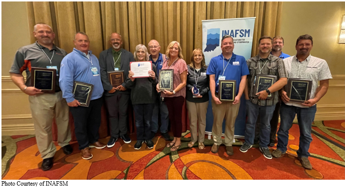
2023 INAFSM Conference
By Doug Wagner, Division of Water
The Indiana Association for Floodplain and Stormwater Management (INAFSM) hosted its 27th Annual Conference Sept. 13-15 at Belterra Resort in Florence.
The conference had an excellent offering of educational classes and sessions and a record 265 people in attendance.
INAFSM again presented awards to recognize member achievement at the reception dinner on Wednesday evening.
The Excellent Strides in Floodplain Management Award recognizes the most improved floodplain management program. It may be bestowed annually to a local unit of government that has succeeded in, or has made a noteworthy effort towards, significantly improving its floodplain management program. This year the award was presented to Robbie Miller, Director of the LaGrange County Planning Commission. Miller has served in this role since October 2017, and her responsibilities include serving as the county’s zoning and floodplain administrator. She has established a permitting process that captures all development for LaGrange County communities, including those that are not participating. Permits were reviewed for development such as utility crossings, seawalls, piers, and grading that sometimes seem to slip past local officials. Miller’s attention to detail and thorough review of all development ensures LaGrange County remains prepared for future flooding events.
The Outstanding Stormwater Project Award recognizes a superior project, designed, or constructed by a firm for a local government or a private entity. This award may be bestowed annually upon both the project owner and the representing firm. This award was presented to the Town of Dyer, owner of the Hart Ditch Improvement Project, and project consultant Christopher B. Burke Engineering, LLC (CBBEL). Hart Ditch is a channelized stream that conveys more than 36 square miles from Illinois into Dyer. The ditch had nearly vertical banks with little aquatic and terrestrial habitat and frequent flooding. The project includes the creation of a two-stage channel with floodplain benches on one or both sides of the channel. The benches are as wide as physically possible and planted with native grasses, sedges, shrubs, and trees. The banks are stabilized using bioengineering techniques including wrapped earth, branch packing, live stakes, and joint planting depending on the location and flow velocity. A path along the top was incorporated to connect to a local park and the trail system.
The project serves as an outdoor classroom with stormwater BMPs and nature interpretation signage. There is a significant flooding reduction for the adjacent residential areas and the hospital. Since project completion there is an increase in riparian quantity and quality, water quality and aquatic habitat, recreation, and public education. This project is a model for other segments of Hart Ditch and other streams.
The Outstanding Floodplain Project Award recognizes an outstanding floodplain project studied, designed, or constructed by a firm for a local unit of government or a private entity. This award may be bestowed annually upon both the project owner and the representing firm. This year’s award went to the city of Goshen’s Flood Resilience Plan Project and project consultant CBBEL. The City of Goshen experienced catastrophic damage from flooding, most recently in February 2018 and again in March 2019 as the Elkhart River overtopped its banks. The city retained CBBEL to prepare a flood resilience plan. The approach is two-pronged. The first incorporates land-use planning policies to direct growth, economic development, and capital improvement projects to areas that are less vulnerable to flooding. This will help to prevent the problem from spreading and getting worse.
The second implements projects to protect the people and critical assets that already exist in the vulnerable flood risk areas. This approach recognizes the city may not be able to mitigate the increasing extreme rainfall events the state has been experiencing from climate change and which are forecasted to further intensify into the foreseeable future. The plan does, however, emphasize strategies to adapt to the unavoidable climate change impacts through adoption and implementation of appropriate flood resilience strategies. This will result in the most immediately achievable and sustainable positive outcome for the city.
The Education/Outreach Award recognizes an outstanding education and outreach program, project, or specialist promoting the advancement of floodplain and/or stormwater management education and outreach. This award may be bestowed annually upon a local unit of government, an individual, or a project owner and representing firm. This award was presented to Elkhart County SWCD’s Interactive Rain Barrel Roving Display.
Rain Barrel education efforts have traditionally been in the form of fact sheets, handouts, press releases and/or reminders on stormwater web pages. The Elkhart County SWCD has taken rain barrel education to a whole new level with an interactive, aesthetically pleasing, fully functional and mobile 3-dimensional Rain Barrel display. The display utilizes unique elements (re-purposed Barn Door, Rain Chain, etc.) along with a colorful display of various plants that conveys a multi-pronged message of ease of use and significant benefit from the use of rain barrels. The full-scale display can be easily disassembled and transported from location to location to reach the largest audiences possible.
The Excellence in Floodplain Management Award recognizes an outstanding floodplain management program or an outstanding floodplain manager. This award may be bestowed annually upon a local unit of government or an individual, affiliated with the state or a local government, who has consistently demonstrated leadership in the area of floodplain management and has instituted a proactive approach consistent with the INAFSM vision of sound water resources management in the State of Indiana. This year’s award went to Darren Pearson of the Indiana Department of Natural Resources. As a result of Pearson's guidance and direction as the NFIP state coordinator, Indiana has moved to a classification of "Proficient". FEMA uses a Tiered State Framework (TSF) score to rate each of the states participating in the NFIP's Community Assistance Program to determine the amount of funding provided to each of them. The possible classifications for TSF are: Below Foundational, Foundational, Proficient, and Advanced.
Pearson also continually works with newer staff reviewing and assisting with general technical assistance questions from local floodplain administrators to develop the skills and abilities of our regional planners.
The Excellence in Stormwater Management Award recognizes an outstanding stormwater management program or stormwater manager. This award may be bestowed annually upon a local unit of government or an individual, affiliated with the state or a local government, who has consistently demonstrated leadership in the area of stormwater management and has instituted a pro-active approach consistent with the INAFSM vision of sound water resources management in the State of Indiana. This year’s award was presented to Karan Barnhill, Storm Water Coordinator for the city of Evansville. Through her leadership, the Southwest Indiana Stormwater Partnership was recently formed. This partnership brought several MS4s in the area together to work on similar issues thereby saving their taxpayers time and money. She is always willing to share her skills as a stormwater manager and serves as a mentor to others.
The Lifetime Achievement Membership Award recognizes the lifetime career achievements of an outstanding stormwater and/or floodplain manager, who has consistently demonstrated leadership consistent with the INAFSM vision of sound water resources management in the State of Indiana. This year’s recipients were Anita Nance and Bob Bullock.
Nance is the manager for DNR’s floodplain management section. She began her public service as the deputy recorder for Pike County for eight years then as the recorder for eight years. She joined DNR in 1995 and moved to the floodplain management section in 1997 as Southern Region Planner. Since then, Nance has held all positions within the section being promoted to section manager in 2018. Anita became the first Division of Water employee to become a CFM in 2000.
Bullock currently serves as the building commissioner and floodplain administrator for the towns of Hagerstown and Greens Fork. He has been the building commissioner for 32 years and a firefighter for 54 years. In his role as floodplain administrator, Bob has attended every INAFSM Conference and served as the photographer for many years.
The final award was the Chairman’s Award for Outstanding Service in Support of the INAFSM, which seeks to recognize an individual with outstanding service in support of INAFSM. This award may be bestowed annually upon an individual (member or non-member) that, in the opinion of the INAFSM Chair, has provided an outstanding service in support of the association. This year the award was presented to the 2023 INAFSM Conference Planning Committee.
|
Division of Water Staff Changes
The Division of Water has gone through several staff changes this year.
In October, Jessica Mooney joined the Floodplain Management Section. Jessica has been assigned responsibility for the NFIP communities in the northern region of the state. She has earned a Master of Science degree in Environmental Sciences at Louisiana State University and a Bachelor of Science degree in Biology and Communication at Valparaiso University. Before joining the DNR, Jessica taught middle school science in Baton Rouge, LA and high school biology in Indianapolis.
The technical services section added two new staff. Lydia Gibson came from the private sector and Caitlin Stigler came from graduate school. In addition, Amanda McCollum was promoted to South Basin Team Leader. The section is still looking to fill two vacancies.
Virginia (Gin) Ranly joined our compliance and enforcement section as the outreach program director in July. Gin worked previously in the section part-time from 2016 – 2019.
Suzanne Delay transferred from the compliance and enforcement section to the dam and levee safety section as a hydraulic engineer.
In the engineering section, Amanda Brock was promoted to hydraulic engineer supervisor. Namita Lenka and Wren Weyenberg joined the section as hydraulic engineers. Seth Farmer and Paul Brayton were promoted to Hydraulic Engineer – 1. Engineering was also split into two groups. One will work on federal tasks of the Cooperating Technical Partner (CTP) grants and Letter of Map Revision (LOMR) activities. The other will work on state activities to include flood control act permits and the Best Available Floodplain Layer (BAFL). The section is looking to fill one vacancy.
News and Notes
Substantial Damage Quick Guide
A new Substantial Damage Quick Guide has been published on FEMA.gov. This guide provides information about Substantial Improvement (SI) and Substantial Damage (SD), what it means, what costs should be included when estimating repairs or improvements, how to determine market value, and community roles and responsibilities. National Flood Insurance Program (NFIP) participating communities have a responsibility to assess impacts to structures within the Special Flood Hazard Area before repairs are made no matter the cause of the damage. This is a great resource for community staff, and you are encouraged to share this information broadly.
Community Disaster Resilience Zones (CDRZs)
On September 6, FEMA announced the identification of CDRZs. These zones are a result of the CDRZs Act signed into federal law last December. The act requires FEMA to:
- Maintain a natural hazard assessment program and update products based on input from the public and other federal agencies that show the risk of hazards through ratings.
- Use a natural hazards risk-based approach to identify and designate “Community Disaster Resilience Zones” at the census tract level.
A total of 483 CDRZs based on census tracts have been identified across the country and 68 in Region 5, which Indiana is a part of. Designated CDRZs will have increased access to financial and technical assistance for resilience or mitigation projects within, or primarily benefiting, a designated zone. Additionally, the act allows FEMA to create an optional review process for the agency to certify mitigation projects submitted by communities that would primarily benefit a designated zone. This is an authority that FEMA will be exploring in future phases of implementation after the first designations.
Visit Community Disaster Resilience Zones | FEMA.gov for additional information about CDRZs and for an interactive map.
FEMA Designates First Communities to Receive Targeted Assistance for Hazards Resilience | FEMA.gov
Nearly 500 US Communities Named 'Resilience Zones' by FEMA - Bloomberg
Upcoming Training Opportunities

(Information from FEMA, ASFPM, and other websites)
Association of State Floodplain Managers (ASFPM)
ASFPM has an online training program, and new training is added regularly. See floods.org/training-knowledge-center for more information.
FEMA’s Emergency Management Institute (EMI)
In-person classes have resumed at the EMI in Emmitsburg, MD, however it still offers many courses through self-study webinars. Currently, E0273: Managing Floodplain Development through the NFIP is scheduled for February, March, April, and September 2024. For additional information on EMI classes and webinars, please visit EMI’s training calendar website at training.fema.gov/emicourses/schedules.aspx and its course catalog at firstrespondertraining.gov/frt/npccatalog/EMI.
FEMA Region 5 announces continued training opportunities
FEMA Region 5 is conducting regular webinars on various topics such as floodplain management, flood insurance, and National Flood Insurance Program (NFIP) requirements to educate and train community officials on managing their community’s floodplains. Each webinar lasts an hour, and one ASFPM CFM CEC is available by attending a session. The virtual webinar is open to all; however, local and county officials working in emergency management, building code administration, and floodplain management are strongly encouraged to attend. The webinar is presented by FEMA Region 5’s Mitigation Division, Floodplain Management and Insurance Branch.
FEMA Region 5 resumes flood insurance webinars
FEMA Region 5's Regional Flood Insurance Liaison announces a return of NFIP training webinars. Currently, two are scheduled and registration information is below. All are welcome to participate.
This one-hour webinar provides an overview of the Federal Emergency Management Agency's (FEMA's) National Flood Insurance Program (NFIP).
This webinar provides instruction on the essentials of the NFIP, including the following course highlights:
- A brief history of the NFIP
- The difference between disaster assistance and flood insurance
- Eligibility to purchase flood insurance through the NFIP
- What flood insurance through the NFIP covers
- Claims, appeals, customer experience, and resources
At the end of the webinar, participants will have a better understanding of flood insurance through the NFIP and the knowledge and tools to promote better flood risk management.
Extra time has been allocated for an optional question and answer session at the end of the webinar. You may register for more than one session; however, a separate registration is required for each session.
For more information on either series or to register, see dnr.IN.gov/water/events-and-training.
STATE TRAINING OPPORTUNITIES
Indiana Department of Natural Resources
For upcoming events and training hosted by the DNR Division of Water, check dnr.IN.gov/water/events-and-training. We will post training videos and other opportunities as they are developed or scheduled.
Save the Date: The Operation Stay Afloat Conference will be held on Wednesday, March 6 at the Indiana State Government Center South building. This conference highlights flood preparedness and all-hazard mitigation. Target audience members for the conference are local floodplain administrators, local building officials, local emergency management officials, representatives from regional planning groups or river basin commissions, engineers and other consultants who work with local jurisdictions, volunteer groups involved with floodplain issues and disaster recovery, local CEOs, and state legislators. More details and a call for abstracts and exhibitors will be released in the coming weeks as the conference is planned.
Other workshops being planned for 2024 include Substantial Improvement - Substantial Damage and Indiana’s NFIP 101. Details will be posted on our website as they become available.
Indiana Department of Homeland Security
Please visit the Indiana Department of Homeland Security’s training calendar for upcoming courses and trainings at oas.dhs.IN.gov/hs/training/public/calendar.do.
Certification
The Certified Floodplain Manager (CFM) exam is now digital and may be taken at your convenience at a Meazure Learning (formerly Scantron) test site or from your home or office. For information on the exam or to register visit ASFPM’s website, floods.org/certification-program-cfm.
|
THANK YOU
Thanks to those contributing to this issue: Dave Knipe, Jennifer Ware, Anita Nance, Darren Pearson, Alysson Oliger, Moumita Mukherjee, Virginia Ranly, Marty Benson, Don Kaczorowski, and Ed Reynolds.
Editor – Doug Wagner
The work that provides the basis for this newsletter was supported by funding under a cooperative agreement with the Federal Emergency Management Agency. The author and publisher are solely responsible for the accuracy of the statements and interpretations contained in the publication. Such interpretations do not necessarily reflect the views of the federal government.
Waterlines is produced quarterly as a public service by the DNR Division of Water.
Waterlines is available on the Web at dnr.IN.gov/water/publications/waterlines-newsletter/.
Having trouble viewing this email? View it as a Web page.
|