 |
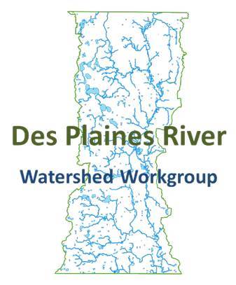
The Des Plaines River Watershed Workgroup (DRWW) is a voluntary, dues-paying organization with a mission to bring together a diverse coalition of stakeholders to work together to improve water quality in the Des Plaines River and its tributaries in a cost-effective manner to meet Illinois EPA requirements. Membership of the DRWW consists of communities, Publicly Owned Treatment Works (POTWs), and other interested parties. The Workgroup consists of Agency members represented by NPDES permit holders, Associate members, which are non-permit holding organizations, and individual members. The DRWW will monitor water quality in the river and tributaries, prioritize and implement water quality improvement projects, and secure grant funding to offset the cost. Monitoring data will allow for a greater understanding of the water quality impairments, identify priority restoration activities, and track water quality improvements. The Workgroup is committed to an approach to attaining water quality standards that focuses on stakeholder involvement, monitoring, and locally-led decision-making based on sound science.
The DRWW, with the help of the North Shore Water Reclamation District (NSWRD), began a three-year continuous water quality monitoring program in June 2020. Multiprobe sondes were installed in the Des Plaines River Mainstem at Russel Road,
Highway 120 and Half Day Road. The sondes will record specific conductivity, pH, water temperature, dissolved oxygen, chlorophyll a, and turbidity every 30 minutes. This data will be used to support the development of a Nutrient Assessment and Reduction Plan (NARP) for the Des Plaines River Watershed, assess watershed impacts from winter road maintenance, and determine sediment transport impacts.
For more information on this and other efforts, please visit the DRWW website; https://www.drww.org.
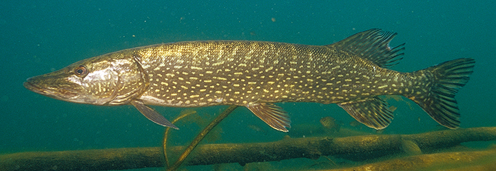
One of Lake County's most voracious predators begins their annual migration to marshes and sloughs with temperatures starting to creep up. The Northern Pike (Esox lucius) is found mainly north of Peoria in Illinois but has been introduced in many lakes and rivers. In Lake County, Pike can be found in many lakes and rivers like the aforementioned Des Plaines River. They are generally the first fish in Lake County to reproduce each year, sometimes in shallow open areas with ice still on the main lake. Eggs are deposited on shallow plants where they receive no parental care and hatch about two weeks later. While it usually takes Pike three or four years to mature and are only about 18 inches in length, some pike can grow to four feet long and weigh more than 60 lbs. The Illinois state record was caught in 1989 and was 26 pounds 15 ounces!
Pike play a critical role in their ecosystem, helping keep other fish species in check. While they eat mostly other fish (sometimes other Pike), they have been known to snack on invertebrates, mice, and even ducks. They are an ambush predator that are very likely to strike an angler's lure. While they are a boney fish, they make great table fare as well, with a white flakey flesh.
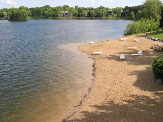 The Health Department's Lakes Management Unit samples Lake Michigan beaches four days a week from May to September. In addition, beaches on inland lakes are tested biweekly (two times per month). The water samples are tested for E Coli bacteria, which are found in the intestines of almost all warm-blooded animals. While not all strains of E Coli are the same, certain strains can make humans sick if ingested in high enough concentrations.
Visit our Beach Advisory page for current bacteria levels and to see which beaches are being monitored.
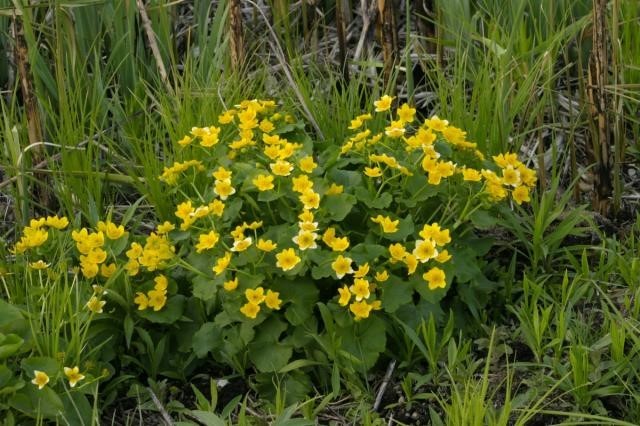 marsh marigold (Caltha palustris)
Photo © 2009, River Valley Photographic Resources, Ltd., rvprltd.com
The native Marsh Marigold occurs primarily in central and northern Illinois, where it is found occasionally. Marsh Marigold prefers sunny areas where the soil is consistently wet from underground seepage of water, although it also occurs in other wetlands. Marsh Marigold is one of the first wildflowers to bloom during the Spring in sunny wetlands. The flowers are showy and conspicuous because of their bright color and relatively large size with attractive bright green foliage. The plant may reach two feet in height. It completes its life cycle by mid-summer and will retain leaves longer if it is grown in moist soil.
Coming soon! Water Quality Specialists Gerard Urbanozo and James Fitzgerald will follow up their talk "Aquatic Plant Management for Lake Owners" with a hands-on Plant Identification Workshop. If you missed the talk, you can request a recording of the Zoom presentation. Please email jfitzgerald2@lakecountyil.gov, and we will send you a link.
Our Team
Alana Bartolai, Ecological Services Program Coordinator
Gerard Urbanozo, Water Quality Specialist
James Fitzgerald, Water Quality Specialist
|