|
Record flooding continues in Lake County from the Chain O’Lakes, Fox River and
Des Plaines River, and we are continuing to monitor flooding of several
rivers, streams and lakes.
Fox River/Chain O'Lakes
The Fox River gauge at New Munster, WI has crested at 17.5 feet and is going
down. This is about three feet higher than the 2013 crest level.
The Chain O'Lakes is currently predicted to crest between 8 and 8.2 feet today. The crest in 2013 was 7.9 feet. Floodwaters will take SEVERAL WEEKS to subside fully.
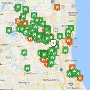
The Lake County Stormwater
Management Commission has UPDATED inundation maps for the Chain
O’Lakes which show a prediction of additional structures that will be impacted
by floodwaters. View the Chain O'Lakes and Fox River
Inundation Maps.
Des Plaines River
The Des Plaines River at Russell, Gurnee and Lincolnshire remain at major flood stage. The river at Russell set a new record crest of 12.15 feet. It has now crested and is starting to go down. The river in Gurnee at IL Rte 120 set a record high level of 12.01 feet and has crested. . At Lincolnshire, the river is holding steady at 15.95 feet, and is predicted to fall below major flood stage on Tuesday.
Lake County Emergency Management will soon be reaching to coordinate amongst communities strategies for the collection and disposal of flood-contaminated debris, including used sandbags and flood-soaked personal property.
As a reminder, EMA partners are encouraged to contact Lake County Emergency Management at 847-377-7100 if you need assistance. We have the following on-hand.
- Sandbags (315,000)
- Clean-Up Kits (600)
- Assistance to identify volunteers needed to help with clean-up (*need advanced notice)
- Assistance with equipment. We can also assist with locating equipment for you.
- Partners can submit resource requests here.
IEMA: FAQ's for Governments Affected by Flooding
IEMA: FAQ's for Residents Affected by Flooding
REMINDER Damage Assessment Form Workshop
A damage assessment form workshop will be held Tuesday, July 18 at 1 p.m. at Libertyville Village Hall, 118 West Cook Ave., Libertyville.
All community partners are welcome. We have also invited IEMA to attend.
Damage Assessment Form: You can fill out IEMA damage assessment forms to be submitted directly to the Lake County Emergency Management Agency by email at room-43200@room.veoci.com.
- Click this link to download the IA Form for private structures, such as houses or businesses: https://goo.gl/xmzQB1
- Click this link to download the PA Form for public costs, such as debris removal, damage to buildings and parks, etc: https://goo.gl/MFCpU6
If you have questions filling out these forms, attend the workshop on Tuesday. Future workshops will be announced. You can also reach Lake County Emergency Management at 847-377-7100.
2. Lake County EMA has posted several resources that we encourage you to view. This includes Chain Inundation Maps, Fox River Maps, and an IEMA Disaster Impact Form. View Resources
 We created a form for the public to submit to LC EMA so we know how they have been impacted by the recent flooding. So far, we have received 600 submissions from residents. Please share this link with others in your community: https://goo.gl/5bG3pU
|
While many roadways have been able to open back up for travel,
there are still road closures throughout the county. For updated road
conditions, please visit Lake County PASSAGE at www.lakecountypassage.com or listen to 1620 AM.
The Red Cross has two reception centers open to assist residents
displaced by flooding. The following locations will be open tonight,
and Red Cross will assess the need for reception centers on a day-by-day
basis.
-
Magee
Middle School
500 N. Cedar Lake Road
Round Lake
-
Jefferson Middle School
600 South Lewis Avenue
Waukegan, IL 60085.
|