|
Strengthening communities, building capacity |
|
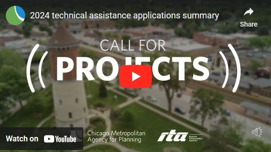
Record number of communities apply for technical assistance
The Chicago Metropolitan Agency for Planning (CMAP) and the Regional Transit Authority (RTA) are excited to share that this year's call for projects for technical assistance resulted in a historically high number of applications. This program assists communities with planning and implementation, provides interagency expertise that can build up their capacity, and helps them better leverage the region's transit network.
More than 120 applications were received from 96 jurisdictions including local governments, community organizations, and government agencies. Many applications are from cohort 3 and 4 communities. This historically high level of interest reflects the great need for quality planning assistance that communities have throughout northeastern Illinois. The top three categories of assistance receiving the highest number of applications included ADA self-evaluation and transition plans, bicycle and pedestrian plans, and transit station activation projects.
CMAP and the RTA are thoroughly reviewing each application, meeting with select applicants, and researching needs. Awarded projects will be announced in June.
To learn more about the response to this year's call for project, a summary of applications submitted is available, along with a brief video recap.
|
|
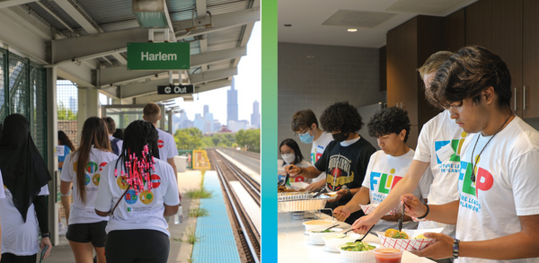
Summer 2024 Future Leaders in Planning program accepting applications
Future Leaders in Planning (FLIP) is CMAP's summer program for high school students in northeastern Illinois. FLIP is a free leadership development program for students to explore the field of urban planning and learn about the issues that shape our region and communities. High school students from Cook, DuPage, Kane, Kendall, Lake, McHenry, and Will counties who want to learn about urban planning and our region and share ideas about how to make northeastern Illinois a better place to live, go to school, work, and play are encouraged to apply. This year's program runs from Monday, July 15 through Friday, July 19, from 10:00 a.m. to 4:00 p.m. It will take place in-person at CMAP's office in the Old Post Office in downtown Chicago, and will include field trips to various sites throughout the region.
Applications are due by 11:59 p.m. on May 22, 2024.
|
|
Make no small plans l Project highlights |
|
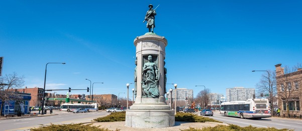
Bronzeville Black Metropolis National Heritage Area
CMAP is working with the Black Metropolis Heritage Area Commission on a National Park Service Management Plan for the newly designated Bronzeville-Black Metropolis National Heritage Area. The plan will develop themes that interpret the Great Migration to Chicago (1910 - 1970) and its impact on the nation, as well as develop a strategy to grow Black heritage tourism and related economic development in Bronzeville.
We need your input –– please take our survey to help us to craft narratives that will educate, inspire, and better reach residents and visitors to Chicago. The plan is expected to be finished by the end of 2025.
|
|
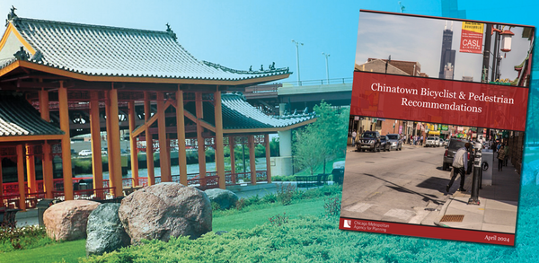
NEXT Chinatown Implementation
The first phase of the NEXT Chinatown Implementation project –– the creation of a bicycle and pedestrian memo –– is now complete. This memo contains recommendations to guide key as the Chicago Department of Transportation, the Coalition for a Better Chinese American Community, and 11th Ward Alderman Nicole Lee and her staff, in creating safer and more pleasant walking and biking conditions. The memo is due in great part to the involvement of many partners. Extensive community engagement and data-driven decision making helped to craft these safety recommendations, which will make Chinatown a safer place for all, no matter age or physical ability
|
|
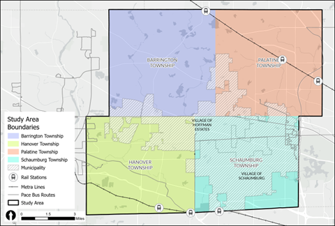
Northwest Cook County Transit Coordination study
The Northwest Cook County Transit Coordination Study will assess current transit services in the area and propose solutions for a more seamless, easy-to-use transit system where riders are more able to cross township and village boundaries. The project is currently undergoing extensive community engagement across the study area. Our first engagement event was a senior luncheon in the village of Schaumburg, where CMAP staff and project consultants (SRF and Metro Strategies) distributed surveys to attendees.
|
|
Richmond Bicycle & Pedestrian Plan
CMAP is excited work with the Village of Richmond on a new bicycle and pedestrian plan. The plan will benefit residents and visitors alike. Work on the plan began in January of this year and is currently in the initial planning stages of researching existing conditions.
Mark your calendars to participate in the first community engagement event –– Pedalpalooza –– which is scheduled for Saturday, May 18, at 11:00 a.m.
Other next steps include ongoing stakeholder engagement and the existing conditions report, after which we'll ramp up work on the key plan recommendations. The plan is expected in spring 2025.
Additionally, members of the public are invited to share their insights to guide the plan's direction and recommendations, shaping a safer, more accessible community for cyclists and pedestrians. Visit the project website to provide public comment as well as to drop a pin on an interactive map to highlight opportunities for improvements.
|
|
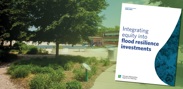
CMAP releases new guide to make flood investments equitable
Flooding affects nearly every community in northeastern Illinois –– and climate change will cause it to become more frequent and intense in the coming decades.
But flooding doesn’t affect all communities equally. Decades of disinvestment and marginalization have caused a disproportionate number of people of color and people with low incomes to live in areas with high flood risk.
As northeastern Illinois governments invest in flood resilience, prioritizing communities that face disproportionate flood impacts will be crucial and will help ensure that residents have access to the resources they need to thrive.
CMAP's new guide, Integrating equity into flood resilience investments, was developed alongside community-based organizations and is grounded in the needs of the communities they represent. The guide shows engineers, planners, and decision makers why investments must be made equitably, outlines key considerations for integrating equity (from planning and design to maintenance and funding), and highlights successful examples.
|
|
CMAP's updated Land Use Inventory now available to download
Are you interested in how policies have affected land use in your community? CMAP has updated the latest Land Use Inventory for 2020. CMAP updates the inventory every few years, with data going back to 1990 that can track changes over time.
The Land Use Inventory is a resource for planners, transportation agencies, federal and state agencies, university researchers, non-governmental organizations, consulting firms, and more. It can help you understand land uses when creating a comprehensive plan and tracking progress toward goals. For example, you can monitor what impact policies have had on transit-oriented development.
|
|
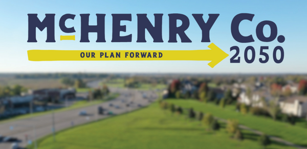
McHenry County shares draft 2050 Comprehensive Plan
A draft of McHenry County's new comprehensive plan is available for the public to review. Once approved, it will help guide development and land use in McHenry County over the next 25 years. A public hearing will be held at 6 p.m. on Thursday, May 16, in Conference Room A of the County Administration Building, 667 Ware Road, Woodstock
|
|
Empowering tomorrow's planners |
|
CMAP engages and inspires the next generation of planners
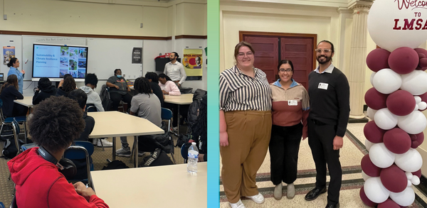
CMAP staff take great joy in sharing their work, educating and engaging with communities across northeastern Illinois on the importance of inclusive planning. A special treat is sharing our passion with students and inspiring the next generation of planners. Recently, CMAP staff joined staff from the City of Chicago's Department of Housing to lead presentations and excersises to a group of students at Lindbloom High School in Chicago. They discussed and developed solutions to timely topics around affordable housing, business development, open space preservation, and urban agriculture. Students explored different scenarios using the city's ChiBlockBuilder program along with data from CMAP's Community Data Snapshots to understand particular land uses in West Englewood. Each student group reported their scenario findings to the class, highlighting how data supported, or didn't support, particular land uses. CMAP also introduced students to ongoing work on climate and economic development planning.
|
|
|
|
|