|
Having trouble viewing this email? View it as a Web page.
|
|
|
|

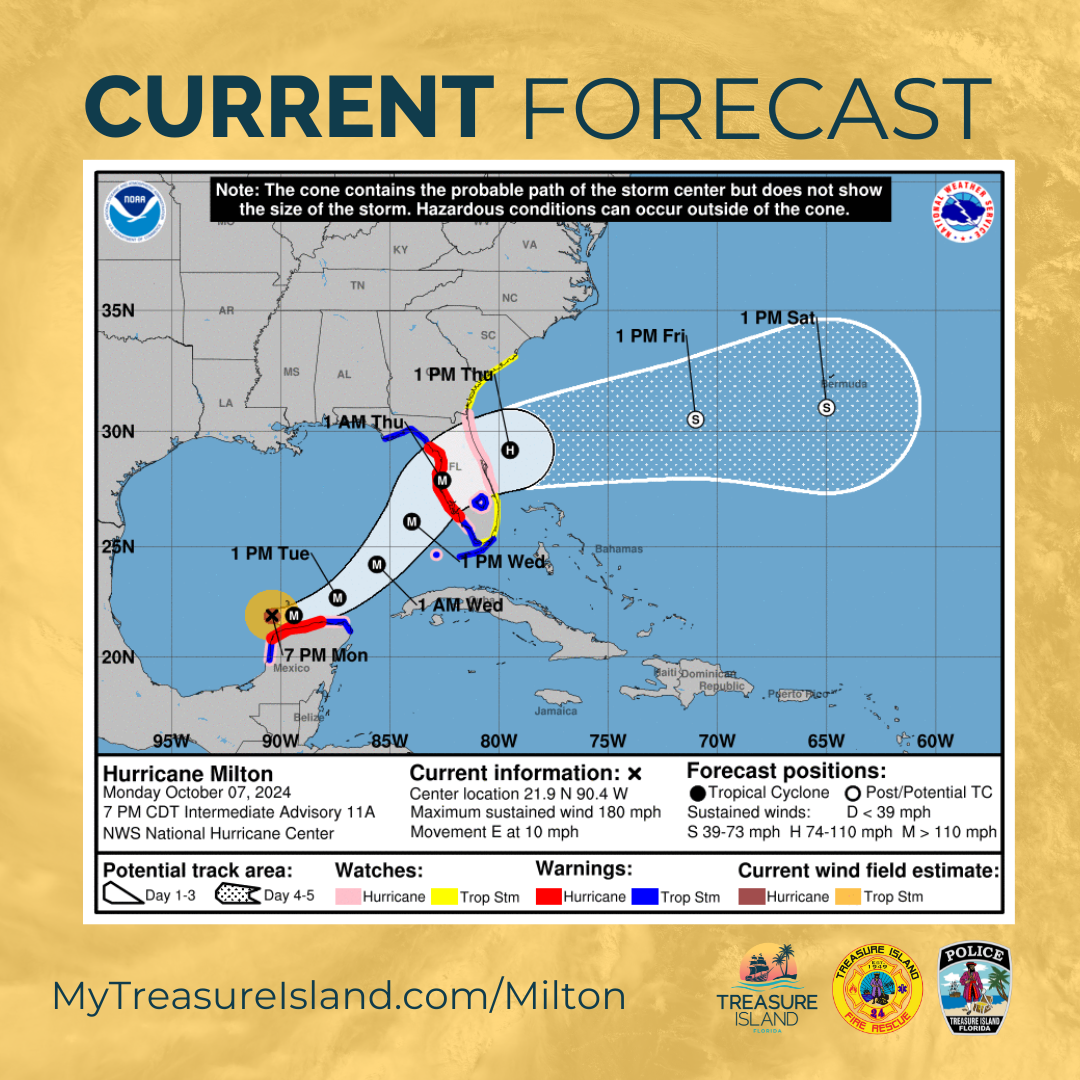
UPDATE: OCT. 7 | 8:15 p.m.
The current track of Hurricane Milton continues to be a worst-case scenario for the Tampa Bay region. Forecasted to be a Cat 3 by the time it makes landfall,
A Hurricane Warning and a Storm Surge Warning are now in effect for Pinellas County. A Flood Watch is also in effect.
Impacts:
• Timing of impacts to the area looks to be as early as early Wednesday morning and continuing into midday Thursday.
• 10-15 foot storm surge forecasted
• 5-10 inches of rain
• Max sustained winds of 120mph
Main points
• Evacuation Ordered – EVACUATE THE ISLAND! This is forecasted to be a dangerous storm.
• Access to Treasure Island is now restricted
• Shelters opened
• 7 p.m. | Oct. 8 | NO ACCESS to Treasure Island
• Sewage shutoff by Wednesday, Oct. 9
• Turn off the power at the breaker before evacuating
• Take pictures and videos of home/vehicles
• Grab medications, pets, and important insurance documents
• Move electric or hybrid vehicles, E-bikes, or lithium-ion battery-powered devices off the island if possible.
• Residents with special needs or who need transportation help to a shelter should call the County Information Line at 727-464-4333.
• Sign up for Alert Pinellas at MyTreasureIsland.com/StormReady and download the Ready Pinellas app in the App Store or Google Play store for real-time storm updates.
Debris
• More than 4.500 cubic yards of debris have been removed from the island. Contractors will continue working tomorrow to collect as much debris as possible.
• All debris will not be able to be collected. To help minimize even more damage, if you can secure the debris in front of your home, please do so.
|
|
|
|
|