|
By Peter Kleinhenz
What
do anglers, ducks and a historic Florida governor have in common? Don’t worry;
I’m not trying to make a cheap joke at the expense of any of these entities.
The connection they have can be found in a landscape of salt marsh, pine
flatwoods and scrub that stretches about 10 miles down the Atlantic coast
between Jacksonville and St. Augustine. Like a loud boom of thunder hidden
behind dense clouds, the history of this place reverberates through everything
nearby even though its source will never be seen.
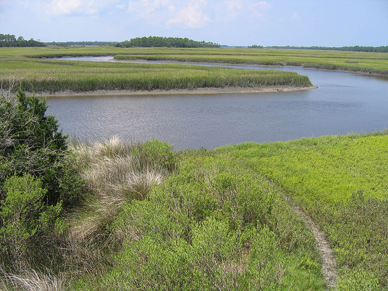
 Looking over Guana River Wildlife Management Area from observation tower on Capo Road, FWC photo
Before
Florida was even really Florida, James Grant started farming indigo in what is
now known as Guana River Wildlife Management Area (WMA). Grant was not just any
old farmer. This was a man who, before ever planting his first indigo crop, was
named governor of newly established East Florida and who led British troops in
most major conflicts of the Revolutionary War.
Grant,
deeply loyal to his homeland of Great Britain, nevertheless worked hard to
create a profitable farm that would attract British citizens to set up shop “across
the pond.” In a decade, the East Florida governor was growing a wide variety of
crops, in addition to his indigo. Grant was nothing if not a strategist and, in
the same way that he planned battles in the Revolutionary War, he came up with
innovative ideas to suit the land to his agricultural needs. |
|
 |
James Grant, State Archives of Florida
James Grant or, more accurately, his slaves constructed a
series of drainage ditches, levees and dikes to maximize the amount of dry
land. The modifications enhanced the profitability of the land, although no
agricultural improvements could prevent the sickness that caused Grant to
return to Britain and the subsequent political changes that kept him there.
After his move, the farm languished.
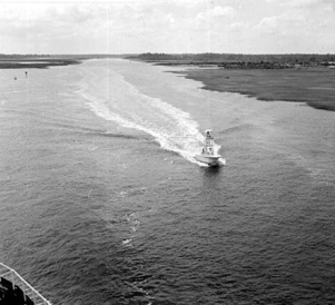 The
land alterations that Governor Grant oversaw, however, paled in comparison to
what would come later. Floridians extended the Atlantic Intracoastal Waterway
right through the salt marshes of the area in the first half of the 20th
century. This, in addition to impoundments constructed to create waterfowl
hunting opportunities and ditches to control mosquitoes, ensured that the
landscape would forever be changed.
Atlantic Intracoastal Waterway near Guana River WMA, 1972, State Archives of Florida
|
The Florida Fish and Wildlife Conservation Commission
(FWC) began to manage what became Guana River WMA in 1984. Due to the
significant modifications made to the landscape, FWC adopted a unique approach
with the site. The impoundments, such as 2,300-acre Lake Ponte Vedra,
provided waterfowl with prime habitat along the Atlantic Flyway. Management of
these birds, and the variety of other wildlife living in and around the
impoundments, required biologists to work with the existing infrastructure.
“On
Lake Ponte Vedra we have an annual cycle where we draw the water level down
once per year for a few reasons,” Wade Brenner, the area biologist for Guana River
WMA, told me. “It provides nesting and foraging habitat for the migratory
shorebirds, the wading birds and the waterfowl. And when we draw the lake down,
it exposes mudflats on the north end of the lake. The exposed mudflats get
oxidized which breaks down the organic matter and helps the lake not become
silted in, and this kind of kicks the muck conditions back a bit. Also, by
exposing those mudflats, we create a seedbed for emergent and submerged
vegetation which is an important part of growing food for waterfowl.”
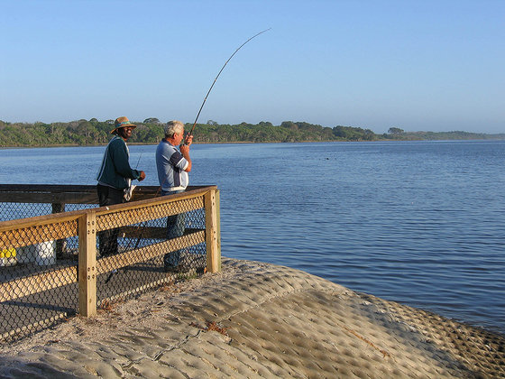 Catching fish at the lake at Guana River Wildlife Management Area, FWC photo
Birds, ranging from hundreds of lesser
scaup to the peregrine falcons that feed on them, benefit from these management
actions. Under the surface, redfish and spotted sea trout exist in numbers
widely recognized throughout Northeast Florida. The number of birders, anglers
and waterfowl hunters visiting Lake Ponte Vedra generally rises right along
with the water each year.
The
impoundments at Guana River WMA, at least in their current form, have been
around for decades, yet the water control structure on Lake Ponte Vedra has
only been around since the days when Hanson and Super Nintendo were popular. At
this point, it’s almost hard to wonder what people and wildlife in the area did
before the water levels could be manipulated. Justin Ellenberger worked as the
area biologist at Guana River WMA for 12 years and has witnessed the response
of wildlife firsthand.
 Beautiful view of the habitat at Guana River Wildlife Management Area, FWC photo
“We can provide more food and cover resources for
wildlife than an unmanaged system,” he told me matter-of-factly. “By spending
more than a decade here, you’re able to see the results of your habitat
projects. You know, change in the habitat going from unsuitable habitat for
some species to being really suitable habitat for many species.”
I
wonder what ole Governor Grant would say if he could see the property now. I’d
like to think that, instead of dishing out the harsh criticism he was
well-known for in his lifetime, he would just look out over the property, run a
hand through his powdered wig, and crack a faint, satisfied smile.
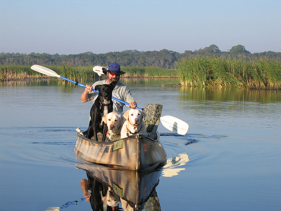 A duck hunter paddles through the marsh with his retrievers at Guana River WMA, FWC photo
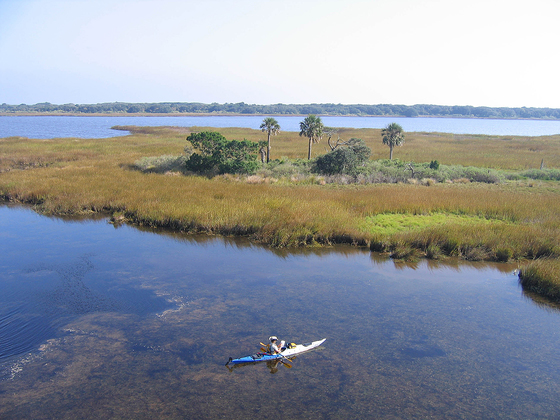
Guana
River WMA, and many other wildlife management areas statewide, offer excellent
opportunities to view wildlife, paddle, or engage in a
whole suite of other
recreational activities. Visit a WMA near you and send
us photos from your visit for a chance to win our 75th
Anniversary Photo Contest. A statewide geocaching
challenge, bioblitzes
and a chance to contribute data to our biologists through the Florida Nature Trackers program
offer even more chances to interact with our WMAs. See you out there!
|