5 Day Statewide Weather Outlook: Thur. 12/28 to Thu. 1/4
Florida Division of Emergency Management sent this bulletin at 12/28/2023 12:34 PM EST
This update is intended for government and emergency response officials, and is provided for informational and situational awareness purposes only. Forecast conditions are subject to change based on a variety of environmental factors. For additional information, or for any life safety concerns with an active weather event please contact your County Emergency Management or Public Safety Office or local National Weather Service forecast office.
You are subscribed to 5 Day Weather Outlook for Florida Division of Emergency Management. This information has recently been updated, and is now available.
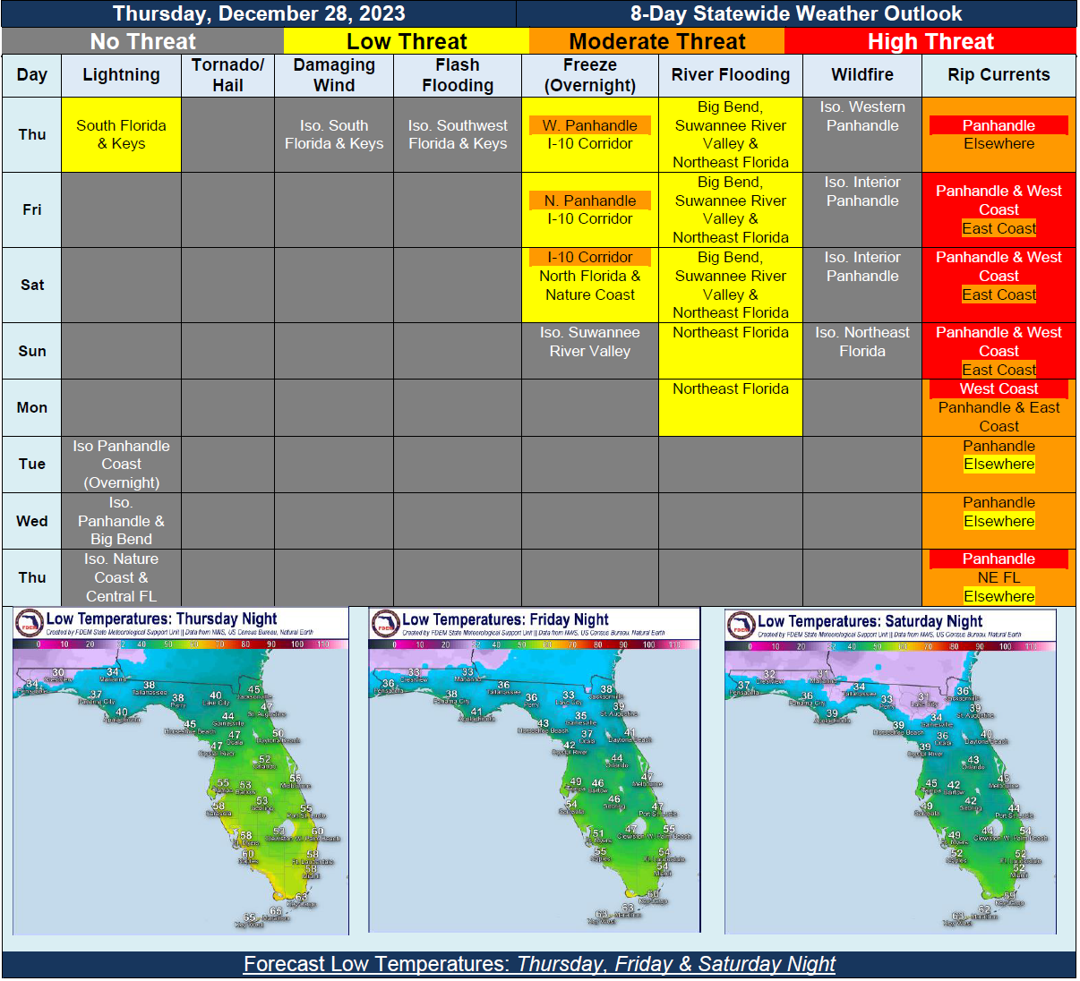
…Upper-Level Disturbance Moving Across Southern Peninsula and Keys Bringing Widespread Rainfall to the Peninsula…Isolated Thunderstorms Possible Thursday Morning Near Florida Keys…Cold Front Pushing Eastward Across Panhandle During the Day and Into Peninsula Overnight…Below Normal Temperatures for this Time of Year Setting Up Overnight Thursday and Into Holiday Weekend…Patchy to Widespread Frost and Light Freeze Across Much of North Florida and Towards I-4 Corridor Overnight Friday and Into Saturday Morning…Temperatures Rebound Slightly for New Years…Second Cold Front Moving In Early Next Week; Not Much In Terms of Rainfall Anticipated…Another Upper-Level Disturbance Moving Along Northern Gulf of Mexico Mid-Week…