|
Recent eNews survey results

Thanks to all who took part in the recent survey soliciting feedback about this eNews. Overwhelmingly, participants expressed satisfaction with the current content of the eNews. Comments included some suggestions to add more stories about projects, other agencies (local and State), water conservation, catchment science, water rights, subsidence, and drought, among others. Since its inception in the early 2000s, this eNews has grown its subscription base to more than 5,200 readers. Thank you for helping to make this newsletter what it is. If you have any stories or links that you think may interest others, please use the “Comments and Suggestions” link at the bottom of this eNews to pass along that information.
|
Discover the potential of OpenET at May 5 webinar
The Internet of Water Coalition will host a webinar discussing the value of OpenET on Tuesday, May 5, from 10 to 11 a.m. OpenET: Strengthening Water Resilience with Satellite-Based Evapotranspiration Data will explore OpenET’s approach to making critical evapotranspiration data accessible and transparent for farmers, water managers, and policymakers. Featured speaker Sara Larsen, CEO of OpenET Inc., will dive into the OpenET platform, sharing why it is needed, how it was created by a unique public-private-philanthropic partnership, and who is using it. She’ll also share what’s on the horizon for OpenET, including plans for expansion and new features. Registration is open now for this free online event.
|
AQPI: Groundbreaking atmospheric river forecasting
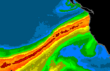
A new forecasting system called the Advanced Quantitative Precipitation Information (AQPI), developed by NOAA Research, Colorado State University’s Cooperative Institute for Research in the Atmosphere, and The Scripps Institution for Oceanography at UC San Diego (Scripps) Center for Western Weather and Water Extremes (CW3E), is now operational in the San Francisco Bay Area. The new system improves precipitation forecasts for atmospheric rivers — storms responsible for up to half of the state’s annual rainfall but also accountable for more than 80% of flood damages. Traditional radar struggles to detect low-elevation rainfall in coastal terrain, limiting accuracy. AQPI addresses this issue with a network of specialized radars that capture detailed, near-surface precipitation data, updated every two minutes for real-time “nowcasts.” The system integrates radar data with national weather models to enhance short-term forecasts, runoff predictions, and flood warnings. Combined with existing models, AQPI enhances short-term forecasts, runoff estimates, and flood predictions. A user dashboard provides customizable data for local agencies, helping them manage floods, water resources, and emergency responses. Beginning in July 2026, CW3E will oversee operations, ensuring continued improvements in hazard preparedness and community resilience. The AQPI system complements the Atmospheric River Reconnaissance program (AR Recon), which is also co-led by NOAA and Scripps. AR Recon collects data to improve forecasts of atmospheric rivers from 1 to 15 days before a storm hits, while AQPI improves observations and forecasts of heavy rainfall both hours before and during the storm. To learn more about AQPI, see the recent article on the Scripps website.
|
Bridging the gap between new climate science & water planning

A new Maven’s Notebook feature article discusses bridging the gap between new climate science and water planning in California. The state’s water system is being reshaped in unprecedented ways by climate change, making traditional planning methods outdated. Historically, snowpack provided reliable water storage, but warming temperatures now reduce snowfall, increase rain, and cause earlier melting. In April when DWR measured the snowpack at Phillips Station in the Sierra Nevada, barely any snow existed because of the record heat wave in March. This unexpected disappointment may become the norm, climate experts warn. Climate research shows future conditions will bring shrinking snowpacks, stronger atmospheric rivers, and sharper swings between drought and flooding. Experts stress that relying on historical data models is no longer a sufficient or predictable way to forecast for the future. The Emerging Climate Science Symposium, held last September at UC Davis, highlighted the need to integrate updated climate science into water management, despite uncertainties like El Niño and El Niña weather patterns and ecosystem responses. Recommended approaches include scenario planning, adaptive strategies, and improved monitoring. Practical steps involve shared decision frameworks and tools, such as satellite-based water tracking like OpenET. Agencies must act proactively, using evolving science to prepare for increasingly extreme and uncertain water conditions. Also, agencies must consider ecological aspects, such as how the future climate will affect fish ― not just water for people.
|
Water Education Foundation open house and reception, May 7

During the afternoon of May 7, the Water Education Foundation will host an open house and reception at its office in Sacramento. Those interested in learning more about the nonprofit organization’s work are encouraged to stop by anytime between 2 and 6 p.m. to enjoy happy hour refreshments and appetizers while mingling with Water Education Foundation team members. The open house also offers an excellent opportunity to catch up on the Water Education Foundations latest tours, conferences, maps, water news, and training programs for teachers and emerging water leaders. The event is free, but please RSVP! For more information and directions, visit the Water Education Foundation 2026 Open House and Reception webpage.
|
Russian River Telemetry Study advances water management
How can real-time water data help balance the needs of agriculture, communities, and the environment? That question is being answered with the Russian River Telemetry Study, a first-of-its-kind project exploring how real-time water monitoring can reduce reporting burdens for users while improving water management for everyone. The study, which runs from 2025 to 2027, tests watershed-scale telemetry to improve water management and reduce reporting burdens for farmers, with the goal of developing approaches that work for both local water users and State regulators. The study is led by the Telemetry Research Unit at the California State Water Resources Control Board, with support from the California Water Data Consortium, Balance Hydrologics, and local partners. The California Water Data Consortium has produced an informative seven-minute video explaining the project and its goals from the perspective of local landowners, water managers, and State officials and explores how better data can help balance the needs of agriculture, communities, and the environment.
|
|
|
|
|
|

