Watershed Studies online data portal and metrics dashboard
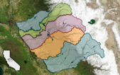
Last December, DWR released the San Joaquin Basin Flood-MAR Watershed Studies (Watershed Studies) — five individual reports (covering the Calaveras, Stanislaus, Tuolumne, Merced, and Upper San Joaquin watersheds) and a summary document that together provide an in-depth look at the future climate challenges and adaptation opportunities within the San Joaquin Basin. The Watershed Studies examined 185 performance metrics tracking system-wide conditions across three major water management sectors — flood, water supply (surface and groundwater), and ecosystems. The results were collected at and aggregated across various reporting units, including watershed study areas, groundwater subbasins, districts, reservoirs, rivers and creeks, flood control points, diversion locations, and stream reaches. This information is now publicly available through the San Joaquin Basin Watershed Studies Metric Dashboard, an interactive tool for exploring the climate vulnerabilities and adaptation potential of flood-managed aquifer recharge (Flood-MAR) strategies in the San Joaquin River Basin. An equally valuable tool, the San Joaquin Basin Watershed Studies Data Download Portal provides access to all results documented in the Watershed Studies reports. Users can search and download specific data based on location or metrics type. Both the dashboard and the portal websites offer video tutorials on how to navigate the database to view various results and how to use filters to download data.
|
Public Survey: Design of Prop 4 Watershed Resilience Program
DWR is seeking public participation in a new survey: Design of Proposition 4 Watershed Resilience Program. The survey aims to help inform development of the upcoming Proposition 4 Watershed Resilience Program. This new program will make approximately $152 million available for grants statewide by combining funding from the two sections of Proposition 4: Section 91019 (Conservation) and Section 91031 (Climate Resilience). Public feedback is essential to ensure that these solicitations are designed to effectively support watershed-scale solutions, local priorities, equity considerations, and climate resilience goals across California. The survey is open now through Friday, March 6. For more information, see DWR’s public notice about this survey.
|
Fresno State CWI report on building a sustainable water future
The California Water Institute (CWI) at California State University, Fresno released a new report highlighting how its applied research, education programs, and partnerships are helping communities address California’s ongoing water challenges, including drought, climate extremes, and groundwater pressures. Building a Sustainable Water Future: Research, Partnerships, and Innovation at the California Water Institute emphasizes CWI’s role in providing practical, science-based tools to support long-term water resilience, especially in the San Joaquin Valley at the crossroads of California’s most complex water issues. Key projects featured in the report include groundwater recharge studies, climate resilience research, urban water planning tools, water-agriculture integration studies, and workforce development programs. Through collaborations with local, State, and federal partners, CWI works to turn research into actionable solutions that promote equitable access to safe, reliable water. The full report is available online. Its release coincides with new federal water infrastructure legislation, underscoring the need for research, data, and coordinated planning to prepare for future conditions.
|
Revolutionary new data tool: IoW Storm Events Database
The National Oceanic and Atmospheric Administration (NOAA) has been tracking data related to storms — type, cost, and the human toll — but accessing that data required deep technical expertise, until now. A new intuitive, user-friendly tool, the IoW Storm Events Database (developed for the Internet of Water Coalition [IoW] in partnership with Duke University's Nicholas Institute for Energy, Environment, and Sustainability: Earth Genome; and The Commons) stores and organizes data from more than 2 million storm events worldwide dating back to 1950. Using this tool, decision-makers and planners can easily access and download the data they need to make critical decisions for the safety of their communities. Learn more about this revolutionary tool, and the significant advances it provides in weather data accessibility, on the IoW website.
|
California Water Quality Monitoring Council 2026 meeting dates
The California Water Quality Monitoring Council has set the dates of its 2026 quarterly council meetings: February 26, May 28, August 27, and November 19. Each date is on a Thursday. The meetings run from 9 a.m. to 3 p.m., depending on agenda length. A notice and detailed agenda will be distributed prior to each meeting and posted on the Monitoring Council Meetings webpage. Meetings will be held virtually via Zoom or in a hybrid format. Registration is required for each meeting, and registration for all meetings can be done at the same time. If you have already registered, please re-register as the Zoom information has changed slightly. Re-registering will ensure that you have the correct details. Please contact Lori Webber with any meeting-related questions.
|
To subscribe to California Water Plan eNews, visit the DWR email subscription page and select the “California Water Plan eNews” option.
Subscribe to the Save Our Water newsletter.
|