|
If your GSA and/or GSP Plan Manager Point of Contact (POC) is not current, or you are not sure, please visit the SGMA Portal to ensure that your contact information is up-to-date. When logged in, the Portal allows edits to be made to previously submitted contact information.
If you have SGMA Portal questions, please email them to GSPSubmittal@water.ca.gov.
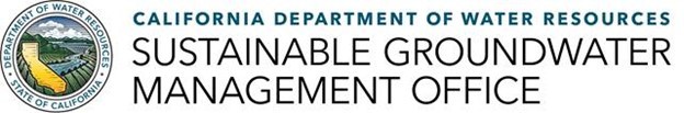
California Statewide Groundwater Elevation Monitoring (CASGEM) Program Monitoring Entities (MEs) and GSAs are required to collect groundwater elevation measurements from their monitoring networks and submit the information to DWR. Please be sure to submit all monitoring data for fall 2024 to the CASGEM Online System or the SGMA Portal’s Monitoring Network Module (MNM).
As a reminder, following the submittal of a GSP to the DWR, CASGEM MEs are no longer required to report seasonal groundwater elevation readings to the CASGEM Online System. Instead, GSAs will be responsible for submitting groundwater elevations to the MNM. Please note that CASGEM MEs may continue to voluntarily upload data into the CASGEM Online System from wells not included in a GSP.
For additional information or questions regarding the submittal of groundwater data to CASGEM, please contact us at CASGEM@water.ca.gov. For information or questions pertaining to the MNM, contact us at GSPSubmittal@water.ca.gov.
Consider subscribing to DWR's California Statewide Groundwater Elevation Monitoring (CASGEM) email list to stay up to date on the latest CASGEM Program information.
As part of DWR's technical assistance to GSAs, other water managers, and the public, DWR actively maintains the SGMA Data Viewer. The SGMA Data Viewer is an interactive mapping tool that provides access to groundwater related datasets that are organized by the requirements of SGMA and the GSP Regulations for the purpose of supporting GSP development and implementation.
Recent improvements to the Viewer include the addition of a Basin Characterization tab that displays maps and datasets that are related to DWR’s Basin Characterization Program. Sections within the tab are structured to show maps and data related to Hydrogeologic Conceptual Models, Geologic Maps, and Lithology and Geophysical Data. New map and data to highlight include an AEM Surficial Recharge Map, the locations of San Joaquin Basin Fluvial Fans, a Soil-Sand Texture (0-60 cm) map, the USGS Corcoran Clay (thickness, depth, extent) maps, and the USGS Basement (elevation) map. Additionally, updates to DWR AEM Surveys: Profile Images map allows users to view the AEM electrical resistivity and interpretation profiles (x-sections) within popups.
Dry Domestic Well Susceptibility Tool
DWR, in coordination with the State Water Resources Control Board, developed an interactive mapping tool, called the Dry Well Susceptibility Tool. This tool identifies areas within groundwater basins throughout the State that may be prone to water supply shortages in drinking water wells. Susceptibility is identified based on recent groundwater level measurements and potential 5-year water level decline.
The initial susceptibility map was based on groundwater conditions in Spring of 2021. DWR will update the Dry Well Susceptibility Tool with maps that are based on groundwater conditions in Spring of 2022, 2023, and 2024.
The Dry Well Susceptibility Tool is housed on the California's Groundwater Live web-based platform, which contains the latest information and data on groundwater conditions across the state. State and local agencies and well owners can use this tool to anticipate where wells may go dry based on historical conditions to inform drought preparedness decision-making. To use this tool, navigate to California’s Groundwater Live website and click the Dry Domestic Well Susceptibility tab. A fact sheet on this tool, as well as DWR’s Dry Well Reporting System, is available here.
Dry Well Reporting Public Outreach Templates
To support counties and local agencies with their outreach and communication with well owners regarding dry well emergency assistance, DWR developed public outreach material templates that are available for download, local customization, and immediate use.
- The California Partnership for the San Joaquin Valley developed outreach materials for the following ten counties: Fresno, Kern, Kings, Madera, Mariposa, Merced, Stanislaus, Tulare, San Joaquin, and Los Angeles Counties.
- For all remaining counties, DWR developed a downloadable outreach template with instructions for counties and local agencies to customize the template, proactively outreach, and communicate with well owners on how to report dry wells and receive emergency water supply assistance. This template is available for download in the following additional languages:
These materials can also be found by clicking the Resources button on DWR’s Dry Well Reporting System website, under the Public Outreach Materials section.
‘Be Well Prepared’ Website and Flyer
DWR's Be Well Prepared program provides information and resources to help well owners, well users, and local agencies be ready for impacts on groundwater supplies and drinking water wells, including information about groundwater conditions, well maintenance, assistance programs, dry well reporting and more.
You can also share these informational flyers to help well owners in your community Be Well Prepared:
Please feel free to pass this information on to neighbors, family, and friends that may live in a household with a well or may be experiencing dry well conditions.
Please contact sgmps@water.ca.gov with any questions. To find more information about the State’s Drought Response and Assistance, please visit drought.ca.gov.
DWR’s written translation service is available to help local agencies with communication to non-English speaking constituents. Translation services for materials are available in Chinese, Hmong, Korean, Laotian, Punjabi, Spanish, Tagalog, and Vietnamese. Applicants can submit written translation requests for up to 15,000 words per basin/subbasin.
For details, visit the Written Translation tab on the Assistance and Engagement webpage.
DWR’s Facilitation Support Services (FSS) program is available to help local agencies work through challenging water management situations. This service provides the help of professional facilitators to foster discussions among diverse water management interests and local agencies when developing and implementing GSPs.
Additionally, DWR has developed an interactive map tool, showing basins where the FSS program has been provided (shown as 'closed' services) and is currently being provided (shown as 'active').
The FSS interactive map tool and more information about the FSS program can be found on the Facilitation Support tab on the Assistance and Engagement webpage.
DWR's Verbal Interpretation Services (VIS) program was developed to make engagement equally accessible to all community members by offering GSAs and local entities simultaneous interpretation services at GSA and other local SGMA related events. Providing verbal interpretive services can assist GSAs to better engage their communities, to incorporate feedback, and capture more collective views from their basin for successful implementation of SGMA.
GSAs can request interpretation support for upcoming meetings and engagement events, whether in-person, virtual, or hybrid in one or more of the following languages: American Sign Language (ASL), Chinese, Hmong, Korean, Laotian, Punjabi, Spanish, Tagalog, Vietnamese, and more. Interpreters speak into a discreet microphone (pictured above), and listeners can hear their preferred language through headphones. If your basin/subbasin could benefit from a language not identified above, please submit the application and the program contact will reach out regarding the request. Agencies utilizing verbal interpretation services will receive assistance translating meeting invitations and materials into their target language to empower the GSA with the resources to effectively invite attendees if they don’t already have these materials.
For details, visit the Verbal Interpretation tab on the Assistance and Engagement webpage.
DWR has designated basin points of contact (POC) to assist local agencies as they develop and implement their groundwater sustainability plans and to assist with applications for Technical Support Services and Facilitation Support Services. Find your DWR Region Office POC at the links below:
Northern Region
North Central Region
South Central Region
Southern Region
For regional inquiries, contact sgmp_rc@water.ca.gov.
For general inquiries, contact sgmps@water.ca.gov.
Maven’s Notebook’s Groundwater Exchange is a central, collaborative, and publicly accessible online resource center connecting water managers, water users, and community members with tools and resources to support the development and implementation of GSPs. While not a DWR website, DWR representatives have been on the Exchange’s Advisory Board since its inception as it supports the sharing of information and resources for SGMA implementation.
|