 Your Voice, Your Belmont - Help Us Draw Our Future
Last Tuesday evening after a series of public meetings on District Election Mapping; the City Council received a presentation from City Consultant Districting Partners, on the first round of draft district maps. The maps presented were submitted by the public through the DistrictR mapping tool found on the District Elections | City of Belmont website. During the public comment and Council discussion portion of the meeting, Council and members of the public provided Districting Partners with relevant feedback on the maps and Communities of Interest (COI). More conversation is needed to define how communities can be preserved within a district. Watch the discussion here. And find the consultants presentation here.
The city will continue to hold public hearings and community workshops to receive public input on where district lines should be drawn. At these events you can share feedback and suggestions for new district lines in the City of Belmont. You can also participate remotely through online forms and mapping tools.
MAPPING TOOL WORKSHOP
A mapping workshop is scheduled for February 19, 2022 - 10 a.m. to noon at the Belmont Twin Pines Community Center. This is an in person event open to all Belmont residents.
Visit the District Elections | City of Belmont for other outreach locations throughout the City during the month of February.
CIty Council, Commission, Committee Meetings
Planning Commission Meeting, Tuesday, Feb. 15, 2022
City Council Special Meeting - Commission Interviews, Wednesday, Feb 16, 2022
City Council Special Meeting - Commission Interviews, Thursday, Feb 17, 2022
Updates
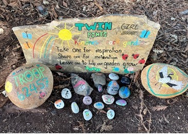
The Cipriani Dog Park
The park will be closed for seasonal maintenance next week Tuesday and Wednesday, February 15 and 16.
Parks, Recreation and Open Space Master Plan – We want to hear from YOU!
Visit BelmontProsPlan.com to view draft recommendations for ALL of Belmont’s parks. Tell us what you think. Or, check out the January, February, and March Park & Recreation Commission meetings to hear discussions about specific parks, as well as updates on the Open Space Management Plan, and more!
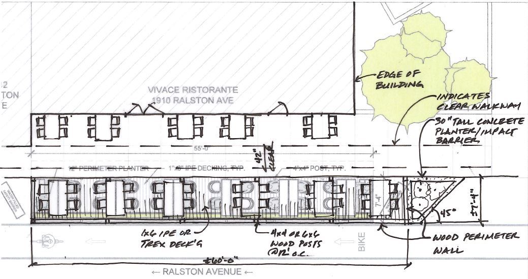
Vivace Parklet Permitted To Return On A Temporary Basis
The outdoor dining structure has been redesigned to improve sight lines, reduce infringements to Ralston Avenue travelers, and expand the outdoor seating options at Vivace Restaurant near Villa Avenue across from the Carlmont Shopping Center. The City is still in the process of developing a citywide policy for how parklets should be designed and where they are best located. In the meantime, a temporary encroachment permit has been granted to allow the redesigned parklet to return at this location. It will need to be removed in the near-term when the Ralston 3 contractor is ready to completed roadway repairs and restriping this Spring.
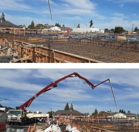
Windy Hill Housing Development Project Update
WL Butler Construction is on Week 41 of the project located at 1325 Old County Road. As it stands, they have completed the concrete garage (1 level below ground) including the entrance ramp from O’Neill Rd. Level 1 PT Podium is about 40% complete and the structural steel subcontractor has started erecting steel columns at level 1. The offsite waterline upgrade is nearing 65% completion. WL Butler has a new waterline installed on Old County Road that branches off through Elmer Street and O’Neill Avenue. This Windy Hill Development is bringing 250 new residential units to central Belmont, within walking distance of the Caltrain Station and high-frequency bus service along El Camino Real.
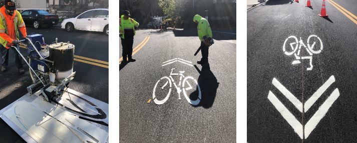
Sharrows placed on Carlmont Drive
This week, the Public Works Street Division placed sharrows on a stretch of Carlmont Drive. A sharrow is not a bike lane as it does not create road space nominally reserved for bicycles. Instead, it is meant to be used in situations where cyclists and drivers must coexist in the same lane. Primarily, it’s a positioning tool that tells you where to ride to avoid both flung-open car doors and vehicles passing too closely. In theory, if you ride where the sharrow is placed, you won’t find yourself squeezed in a lane too narrow for cars and bikes together. The sharrow also conveys information; It is meant to help cyclists stay on recommended bike routes, avoid wrong-way riding.
Thermoplastic material consisting of pigments, binders and glass beads is the used makiang the stripes reflective and visible at night. Heated to approximately 400 degrees, this type of material is melted first and then forms durable, longer lasting lines and symbols with nighttime visibility. Thermoplastic pavement marking is ready for use almost immediately, without drying time, so there is no need to shut down lanes of traffic.
|