|
|
07/25/2024 @ 4:17 PM MST by Malloy, J.
Phone: 602-506-8701 (Alert Room), 480-404-0516 (Cell)
MESSAGE 1 ALERT
Valid Time: Now - 6:00pm
COMMENTS:
-
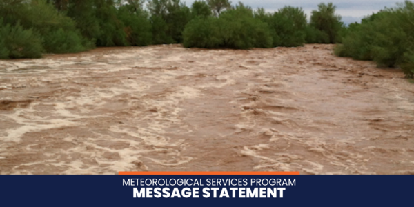
Strong to severe t-storms are impacting portions of the Wickenburg Forecast Zone.
-
Storms are moving southeast 5-10mph. Wind gusts to 30-60+mph will be possible along with frequent lightning and hail.
-
Rainfall potential: 0.50"-1.00" with localized greater totals around 1.50" possible due to slow storm movement or storms training. Additional storm development is possible through the late afternoon and early evening.
FLOOD THREAT:
Low
AFFECTED WASHES/ROADS/STRUCTURES:
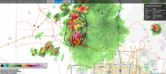
Normally dry washes may begin to flow in parts of the zone as well as water ponding in low lying areas and on area roadways. We will keep a close eye on local washes (Tiger, Grass, Centennial Washes) for any excessive runoff and further updates will be issued if necessary.
AREAS OF GREATEST CONCERN (highlighted in green below):
Town of Wickenburg, Local area washes, US60/93 Corridors
|
|
This weather statement is not intended for public dissemination. Please expedite this information to affected emergency response organizations (police, fire, transportation, etc.) within your area. Also, please take appropriate actions to prepare for possible flooding. Further information will be provided as it becomes available.
|
|
ALERT Data Display
Get real-time rainfall, streamflow and weather information.
Click here
|
Flood Threat Categories
Flood Threat Categories explanations
Click here
|
Custom Products
Looking for custom products, maps, plans?
Click here
|
|
|
The Flood Control District of Maricopa County | 2801 W. Durango Street | 602-506-1501
|
|
|
|