|
|
Wednesday, April 24th, 2024 @ 09:40 AM MST by Malloy, J.
One more day to get through with above normal temperatures during the afternoon. Today, expect mostly sunny weather, daytime breeziness out of the southwest (10-20mph; localized gusts up to 30mph), and temps peaking in the low to mid-90s for lower desert locales, including the Phoenix metropolitan area.
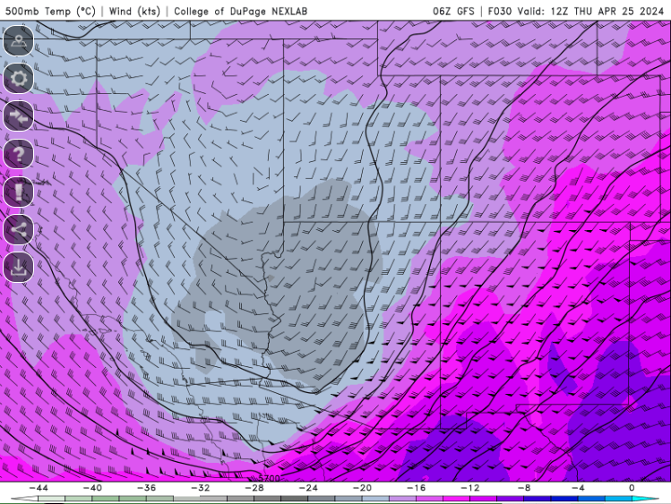
Attention then turns to the well advertised cooldown to below normal readings beginning Thursday in response to a transition from high pressure ridging to general low pressure troughing over the southwestern U.S. The big weather headlines for south-central AZ between Thursday and Saturday are breezy to windy conditions at times (15-25mph; daytime localized gusts 30-35mph), especially over elevated terrain features, and afternoon highs in the Valley retreating to near 80-84°F, while higher terrain desert communities like Wickenburg can enjoy the mid-70s. Morning lows also fall back to seasonable ranging in the mid to upper 50s in the rural deserts and low 60s for interior Phoenix.
Additionally, some atmospheric instability aided by cool air advection aloft combining with an increase in moisture content during this period, albeit modest, does conceptually lend an opportunity for shower/virga activity in AZ, including portions of northern/eastern Maricopa County...
|
|
Precipitation by Forecast Zones
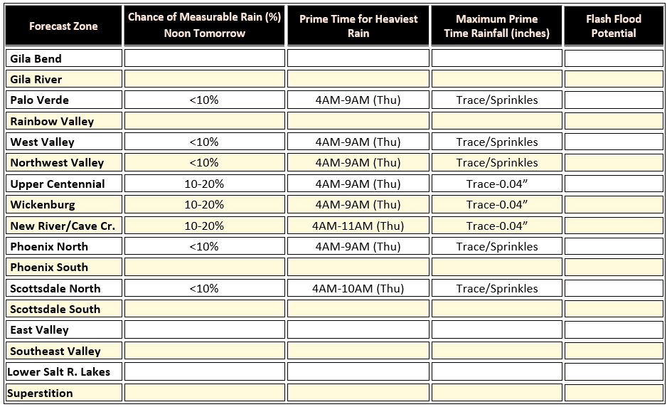 Click for full table
|
|
ALERT Data Display
Get real-time rainfall, streamflow and weather information.
Click here
|
Forecast Zone Locator
Find your forecast zone on our interactive map.
Click here
|
Custom Products
Looking for custom products, maps, plans?
Click here
|
|
 |
|
Normal High 87˚F (Record Warmest 99˚F in 1987; Record Coolest 68°F in 1915)
Normal Low 63˚F (Record Warmest 73˚F in 1977; Record Coolest 41°F in 1923)
Daily Record Precipitation (0.17” in 1990)
|
 |
|
Today’s Sunset – 7:06 PM
Tomorrow's Sunrise – 5:45 AM
Moon Phase – Waning Gibbous (99%)
|
|
|
Weather Tutor
 What is “upper-level forcing”? Concerning weather forecasting, we are always on the lookout for ways to lift moisture up in the atmosphere to cool and condense into clouds. An approaching upper-level weather disturbance (e.g., a low pressure trough or short-wave trough) helps with vertical moisture transport throughout the atmospheric column by increasing the temperature contrast between the surface and higher altitudes. In other words, more robust rising motion occurs when the upper-levels are very cold while near-surface temperatures are warm. But, it really is about the contrast in vertical temperatures that generates forced ascent. This is why scattered “instability” showers or virga may still erupt behind a passing cold frontal boundary (even if only briefly) as lingering moisture continues to rise under the broader area of upper-level forcing associated with the larger low pressure trough passing overhead.
|
|
|
|