
Thank you for updating your state information. We'll send you local updates and show you how Census Bureau data impacts your community. In the meantime, you can learn more about our new data experience at data.census.gov.
Thank you for updating your state information. We'll send you local updates and show you how Census Bureau data impacts your community. In the meantime, you can learn more about our new data experience at data.census.gov.
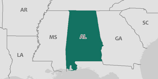
Alabama has a total area of 50,633 square miles, including 1,773.2 square miles of water, making it the 28th-largest state by area. Alabama is bordered by Mississippi, Tennessee, Florida, and Georgia.
POPULATION
4,874,747
MEDIAN HOUSEHOLD INCOME
$48,123
POVERTY RATE
16.9%
EMPLOYMENT RATE
52.9%
38.9 +/- 0.2
Median age in Alabama
38.1 +/- 0.1
Median age in the United States
5.9%
Under 5 years
77.6%
18 years and older
16.5%
65 years and older
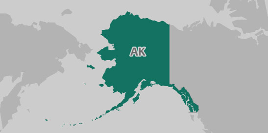
Alaska has a total area of 570,487.3 square miles, including 94,720.7 square miles of water, making it the largest state by area.
POPULATION
739,795
MEDIAN HOUSEHOLD INCOME
$73,181
POVERTY RATE
11.1%
EMPLOYMENT RATE
60.2%
34.5 +/- 0.3
Median age in Alaskaa
38.1 +/- 0.1
Median age in the United States
7.2%
Under 5 years
75.0%
18 years and older
11.2%
65 years and older
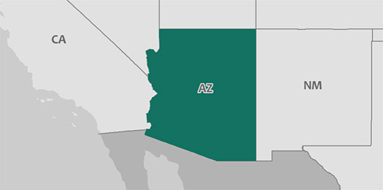
Arizona has a total area of 113,560.6 square miles, including 396.6 square miles of water, making it the 6th-largest state by area. Arizona is bordered by Nevada, California, Colorado, New Mexico, and Utah.
POPULATION
7,016,270
MEDIAN HOUSEHOLD INCOME
$56,581
POVERTY RATE
14.9%
EMPLOYMENT RATE
56.1%
37.7 +/- 0.1
Median age in Arizona
38.1 +/- 0.1
Median age in the United States
6.2%
Under 5 years
76.7%
18 years and older
17.1%
65 years and older
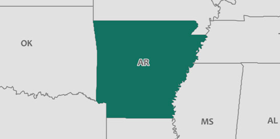
Arkansas has a total area of 52,021.8 square miles, including 1,142.6 square miles of water, making it the 27th-largest state by area. Arkansas is bordered by Louisiana, Oklahoma, Mississippi, Texas, Missouri, and Tennessee.
POPULATION
3,004,279
MEDIAN HOUSEHOLD INCOME
$45,869
POVERTY RATE
16.4%
EMPLOYMENT RATE
54.6%
38.1 +/- 0.3
Median age in Arkansas
38.1 +/- 0.1
Median age in the United States
6.2%
Under 5 years
76.4%
18 years and older
16.5%
65 years and older
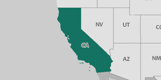
California has a total area of 155,751.4 square miles, including 7,900.2 square miles of water, making it the 3rd-largest state by area. California is bordered by Arizona, Oregon, and Nevada.
POPULATION
39,536,653
MEDIAN HOUSEHOLD INCOME
$71,805
POVERTY RATE
13.3%
EMPLOYMENT RATE
59.5%
36.5 +/- 0.2
Median age in California
38.1 +/- 0.1
Median age in the United States
6.2%
Under 5 years
77.1%
18 years and older
13.9%
65 years and older
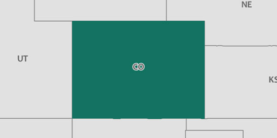
Colorado has a total area of 103,613.7 square miles, including 453.6 square miles of water, making it the 8th-largest state by area. Colorado is bordered by Arizona, Wyoming, New Mexico, Nebraska, Oklahoma, Kansas, and Utah.
POPULATION
5,607,154
MEDIAN HOUSEHOLD INCOME
$69,117
POVERTY RATE
10.3%
EMPLOYMENT RATE
64.6%
36.8 +/- 0.2
Median age in Colorado
38.1 +/- 0.1
Median age in the United States
5.9%
Under 5 years
77.5%
18 years and older
13.8%
65 years and older
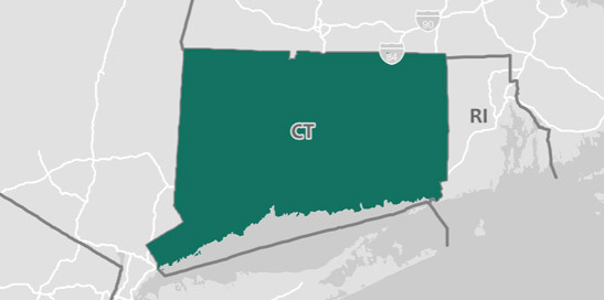
Connecticut has a total area of 4,841.5 square miles, including 700.8 square miles of water, making it the 48th-largest state by area. Connecticut is bordered by Massachusetts, New York, and Rhode Island.
POPULATION
3,588,184
MEDIAN HOUSEHOLD INCOME
$74,168
POVERTY RATE
9.6%
EMPLOYMENT RATE
61.4%
40.9 +/- 0.2
Median age in Connecticut
38.1 +/- 0.1
Median age in the United States
5.1%
Under 5 years
79.3%
18 years and older
16.8%
65 years and older
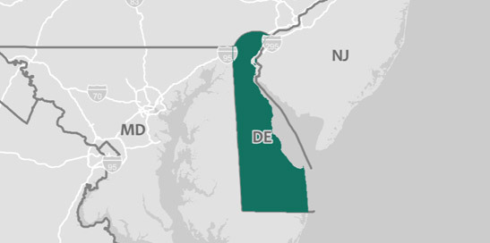
Delaware has a total area of 1,948.2 square miles, including 539.9 square miles of water, making it the 49th-largest state by area. Delaware is bordered by Pennsylvania, Maryland, and New Jersey.
POPULATION
961,939
MEDIAN HOUSEHOLD INCOME
$62,852
POVERTY RATE
13.6%
EMPLOYMENT RATE
55.8%
40.1 +/- 0.3
Median age in Delaware
38.1 +/- 0.1
Median age in the United States
5.7%
Under 5 years
78.8%
18 years and older
18.0%
65 years and older
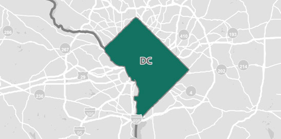
District of Columbia has a total area of 61.1 square miles, including 7.2 square miles of water. District of Columbia is bordered by Maryland and Virginia.
POPULATION
693,972
MEDIAN HOUSEHOLD INCOME
$82,372
POVERTY RATE
16.6%
EMPLOYMENT RATE
65.3%
34.0 +/- 0.2
Median age in the District of Columbia
38.1 +/- 0.1
Median age in the United States
6.5%
Under 5 years
82.0%
18 years and older
12.1%
65 years and older
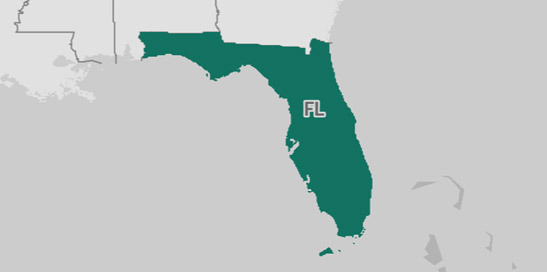
Florida has a total area of 53,624.7 square miles, including 12,115 square miles of water, making it the 26th-largest state by area. Florida is bordered by Georgia and Alabama.
POPULATION
20,984,400
MEDIAN HOUSEHOLD INCOME
$52,594
POVERTY RATE
14.0%
EMPLOYMENT RATE
54.9%
42.0 +/- 0.2
Median age in Florida
38.1 +/- 0.1
Median age in the United States
5.4%
Under 5 years
80.0%
18 years and older
20.1%
65 years and older
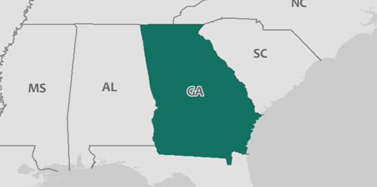
Georgia has a total area of 57,579.6 square miles, including 1,830.1 square miles of water, making it the 21st-largest state by area. Georgia is bordered by North Carolina, South Carolina, Tennessee, Florida, and Alabama.
POPULATION
10,429,379
MEDIAN HOUSEHOLD INCOME
$56,183
POVERTY RATE
14.9%
EMPLOYMENT RATE
59.1%
36.8 +/- 0.1
Median age in Georgia
38.1 +/- 0.1
Median age in the United States
6.3%
Under 5 years
75.9%
18 years and older
13.4%
65 years and older

Hawaii has a total area of 6,420.8 square miles, including 4,546.2 square miles of water, making it the 47th-largest state by area.
POPULATION
1,427,538
MEDIAN HOUSEHOLD INCOME
$77,765
POVERTY RATE
9.5%
EMPLOYMENT RATE
59.0%
39.2 +/- 0.2
Median age in Hawaii
38.1 +/- 0.1
Median age in the United States
6.3%
Under 5 years
78.6%
18 years and older
17.8%
65 years and older
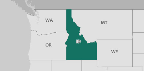
Idaho has a total area of 82,620.6 square miles, including 925.9 square miles of water, making it the 11th-largest state by area. Idaho is bordered by Washington, Wyoming, Oregon, Nevada, Utah, and Montana.
POPULATION
1,716,943
MEDIAN HOUSEHOLD INCOME
$52,225
POVERTY RATE
12.8%
EMPLOYMENT RATE
59.2%
36.3 +/- 0.2
Median age in Idaho
38.1 +/- 0.1
Median age in the United States
6.8%
Under 5 years
74.2%
18 years and older
15.3%
65 years and older
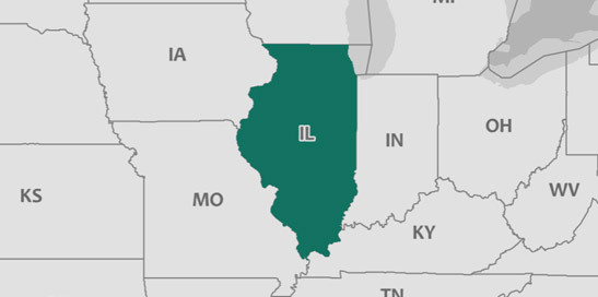
Illinois has a total area of 55,502.4 square miles, including 2,395.8 square miles of water, making it the 24th-largest state by area. Illinois is bordered by Indiana, Wisconsin, Michigan, Kentucky, Iowa, and Missouri.
POPULATION
12,802,023
MEDIAN HOUSEHOLD INCOME
$62,992
POVERTY RATE
12.6%
EMPLOYMENT RATE
60.8%
38.0 +/- 0.1
Median age in Illinois
38.1 +/- 0.1
Median age in the United States
6.0%
Under 5 years
77.4%
18 years and older
15.2%
65 years and older
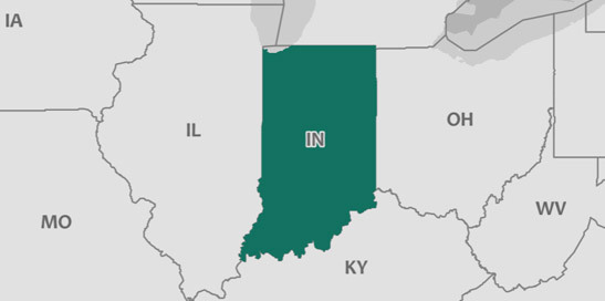
Indiana has a total area of 35,817.2 square miles, including 593.2 square miles of water, making it the 38th-largest state by area. Indiana is bordered by Illinois, Ohio, Michigan, and Kentucky.
POPULATION
6,666,818
MEDIAN HOUSEHOLD INCOME
$54,181
POVERTY RATE
13.5%
EMPLOYMENT RATE
60.4%
37.7 +/- 0.2
Median age in Indiana
38.1 +/- 0.1
Median age in the United States
6.3%
Under 5 years
76.4%
18 years and older
15.4%
65 years and older
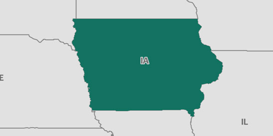
Iowa has a total area of 55,841.7 square miles, including 416 square miles of water, making it the 23rd-largest state by area. Iowa is bordered by Illinois, Wisconsin, Nebraska, South Dakota, Missouri, and Minnesota.
POPULATION
3,145,711
MEDIAN HOUSEHOLD INCOME
$58,570
POVERTY RATE
10.7%
EMPLOYMENT RATE
64.8%
38.3 +/- 0.2
Median age in Iowa
38.1 +/- 0.1
Median age in the United States
6.3%
Under 5 years
76.8%
18 years and older
16.7%
65 years and older
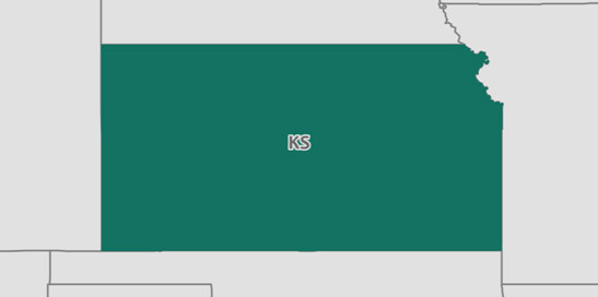
Kansas has a total area of 81,736.8 square miles, including 519.6 square miles of water, making it the 13th-largest state by area. Kansas is bordered by Nebraska, Colorado, Oklahoma, and Missouri.
POPULATION
2,913,123
MEDIAN HOUSEHOLD INCOME
$56,422
POVERTY RATE
11.9%
EMPLOYMENT RATE
63.0%
36.7 +/- 0.2
Median age in Kansas
38.1 +/- 0.1
Median age in the United States
6.6%
Under 5 years
75.5%
18 years and older
15.4%
65 years and older
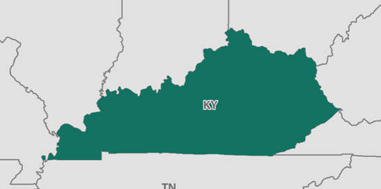
Kentucky has a total area of 39,474.8 square miles, including 922.1 square miles of water, making it the 36th-largest state by area. Kentucky is bordered by West Virginia, Indiana, Illinois, Ohio, Missouri, Tennessee, and Virginia.
POPULATION
4,454,189
MEDIAN HOUSEHOLD INCOME
$48,375
POVERTY RATE
17.2%
EMPLOYMENT RATE
55.6%
38.9 +/- 0.2
Median age in Kentucky
38.1 +/- 0.1
Median age in the United States
6.2%
Under 5 years
77.2%
18 years and older
15.9%
65 years and older
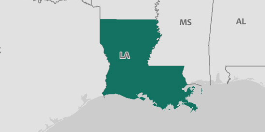
Louisiana has a total area of 43,195.3 square miles, including 9,166.1 square miles of water, making it the 33rd-largest state by area. Louisiana is bordered by Mississippi, Texas, and Arkansas.
POPULATION
4,684,333
MEDIAN HOUSEHOLD INCOME
$46,145
POVERTY RATE
19.7%
EMPLOYMENT RATE
54.7%
36.8 +/- 0.1
Median age in Louisiana
38.1 +/- 0.1
Median age in the United States
6.5%
Under 5 years
76.3%
18 years and older
14.9%
65 years and older
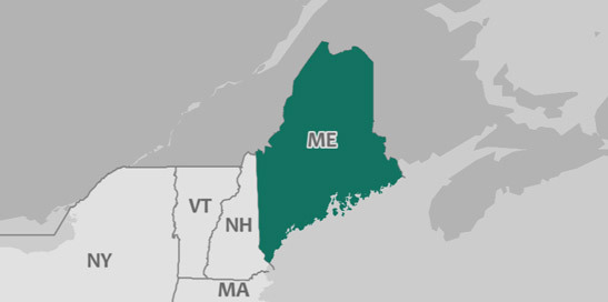
Maine has a total area of 30,835.7 square miles, including 4,535 square miles of water, making it the 39th-largest state by area. Maine is bordered by New Hampshire.
POPULATION
1,335,907
MEDIAN HOUSEHOLD INCOME
$56,277
POVERTY RATE
11.1%
EMPLOYMENT RATE
60.3%
44.6 +/- 0.2
Median age in Maine
38.1 +/- 0.1
Median age in the United States
4.8%
Under 5 years
81.0%
18 years and older
20.0%
65 years and older
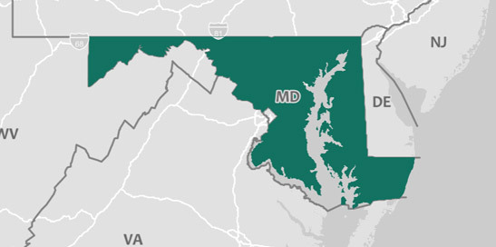
Maryland has a total area of 9,707 square miles, including 2,695.6 square miles of water, making it the 42nd-largest state by area. Maryland is bordered by West Virginia, Pennsylvania, Delaware, Virginia, and District of Columbia.
POPULATION
6,052,177
MEDIAN HOUSEHOLD INCOME
$80,776
POVERTY RATE
9.3%
EMPLOYMENT RATE
63.8%
38.7 +/- 0.2
Median age in Maryland
38.1 +/- 0.1
Median age in the United States
6.0%
Under 5 years
77.7%
18 years and older
14.9%
65 years and older
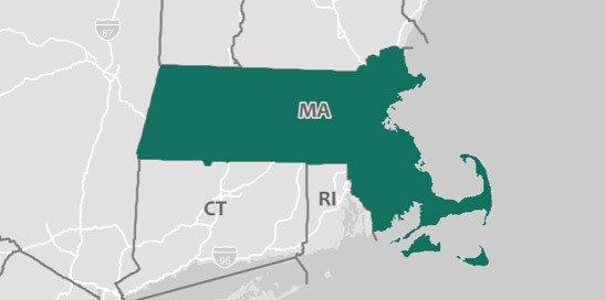
Massachusetts has a total area of 7,798.9 square miles, including 2,752.4 square miles of water, making it the 45th-largest state by area. Massachusetts is bordered by New Hampshire, Connecticut, Vermont, New York, and Rhode Island.
POPULATION
6,859,819
MEDIAN HOUSEHOLD INCOME
$77,385
POVERTY RATE
10.5%
EMPLOYMENT RATE
63.6%
39.5 +/- 0.1
Median age in Massachusetts
38.1 +/- 0.1
Median age in the United States
5.3%
Under 5 years
80.0%
18 years and older
16.1%
65 years and older
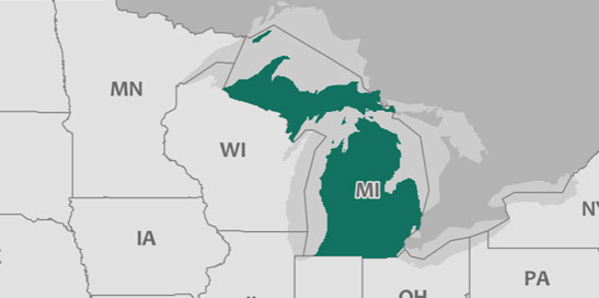
Michigan has a total area of 56,531.7 square miles, including 40,156.2 square miles of water, making it the 22nd-largest state by area. Michigan is bordered by Indiana, Illinois, Ohio, Wisconsin, and Minnesota.
POPULATION
9,962,311
MEDIAN HOUSEHOLD INCOME
$54,909
POVERTY RATE
14.2%
EMPLOYMENT RATE
57.8%
39.8 +/- 0.1
Median age in Michigan
38.1 +/- 0.1
Median age in the United States
5.7%
Under 5 years
78.2%
18 years and older
16.7%
65 years and older
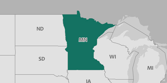
Minnesota has a total area of 79,605.7 square miles, including 7,306.7 square miles of water, making it the 14th-largest state by area. Minnesota is bordered by Wisconsin, Nebraska, Michigan, South Dakota, Iowa, and North Dakota.
POPULATION
5,576,606
MEDIAN HOUSEHOLD INCOME
$68,388
POVERTY RATE
9.5%
EMPLOYMENT RATE
66.9%
37.9 +/- 0.2
Median age in Minnesota
38.1 +/- 0.1
Median age in the United States
6.3%
Under 5 years
76.7%
18 years and older
15.4%
65 years and older
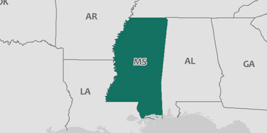
Mississippi has a total area of 46,910.6 square miles, including 1,517.2 square miles of water, making it the 31st-largest state by area. Mississippi is bordered by Arkansas and Alabama.
POPULATION
2,984,100
MEDIAN HOUSEHOLD INCOME
$43,529
POVERTY RATE
19.8%
EMPLOYMENT RATE
52.2%
37.5 +/- 0.2
Median age in Mississippi
38.1 +/- 0.1
Median age in the United States
6.1%
Under 5 years
76.1%
18 years and older
15.6%
65 years and older
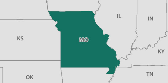
Missouri has a total area of 68,728.3 square miles, including 960.2 square miles of water, making it the 18th-largest state by area. Missouri is bordered by Illinois, Nebraska, Oklahoma, Kentucky, Iowa, Kansas, Tennessee, and Arkansas.
POPULATION
6,113,532
MEDIAN HOUSEHOLD INCOME
$53,578
POVERTY RATE
13.4%
EMPLOYMENT RATE
59.8%
38.5 +/- 0.2
Median age in Missouri
38.1 +/- 0.1
Median age in the United States
6.1%
Under 5 years
77.3%
18 years and older
16.5%
65 years and older
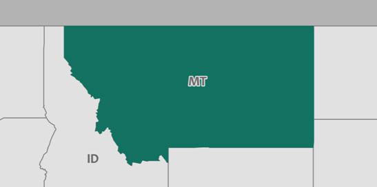
Montana has a total area of 145,508.5 square miles, including 1,492.7 square miles of water, making it the 4th-largest state by area. Montana is bordered by Wyoming, South Dakota, Idaho, and North Dakota.
POPULATION
1,050,493
MEDIAN HOUSEHOLD INCOME
$53,386
POVERTY RATE
12.5%
EMPLOYMENT RATE
61.3%
40.0 +/- 0.4
Median age in Montana
38.1 +/- 0.1
Median age in the United States
5.8%
Under 5 years
78.1%
18 years and older
18.1%
65 years and older
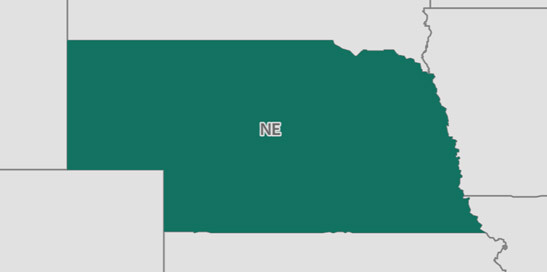
Nebraska has a total area of 76,803.5 square miles, including 523.5 square miles of water, making it the 15th-largest state by area. Nebraska is bordered by Wyoming, Colorado, South Dakota, Iowa, Missouri, and Kansas.
POPULATION
1,920,076
MEDIAN HOUSEHOLD INCOME
$59,970
POVERTY RATE
10.8%
EMPLOYMENT RATE
67.4%
36.5 +/- 0.2
Median age in Nebraska
38.1 +/- 0.1
Median age in the United States
6.9%
Under 5 years
75.3%
18 years and older
15.4%
65 years and older

Nevada has a total area of 109,751.1 square miles, including 790.3 square miles of water, making it the 7th-largest state by area. Nevada is bordered by California, Arizona, Oregon, Idaho, and Utah.
POPULATION
2,998,039
MEDIAN HOUSEHOLD INCOME
$58,003
POVERTY RATE
13.0%
EMPLOYMENT RATE
59.6%
38 +/- 0.1
Median age in Nevada
38.1 +/- 0.1
Median age in the United States
6.1%
Under 5 years
77.2%
18 years and older
15.3%
65 years and older
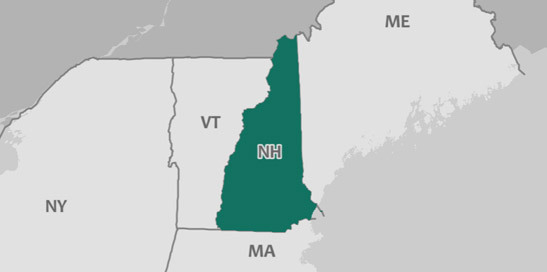
New Hampshire has a total area of 8,950.3 square miles, including 397.1 square miles of water, making it the 44th-largest state by area. New Hampshire is bordered by Maine, Massachusetts, and Vermont.
POPULATION
1,342,795
MEDIAN HOUSEHOLD INCOME
$73,381
POVERTY RATE
7.7%
EMPLOYMENT RATE
65.1%
43.2 +/- 0.3
Median age in New Hampshire
38.1 +/- 0.1
Median age in the United States
4.7%
Under 5 years
80.8%
18 years and older
17.6%
65 years and older
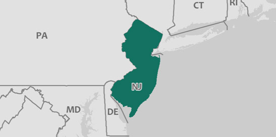
New Jersey has a total area of 7,353.6 square miles, including 1,367.2 square miles of water, making it the 46th-largest state by area. New Jersey is bordered by Delaware and New York.
POPULATION
9,005,644
MEDIAN HOUSEHOLD INCOME
$80,088
POVERTY RATE
10.0%
EMPLOYMENT RATE
61.8%
39.8 +/- 0.2
Median age in New Jersey
38.1 +/- 0.1
Median age in the United States
5.8%
Under 5 years
78.0%
18 years and older
15.7%
65 years and older
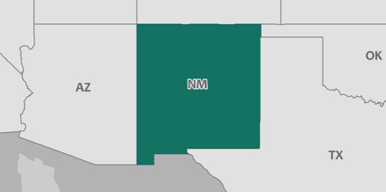
New Mexico has a total area of 121,269.4 square miles, including 291.7 square miles of water, making it the 5th-largest state by area. New Mexico is bordered by Arizona, Colorado, Oklahoma, Texas, and Utah.
POPULATION
2,088,070
MEDIAN HOUSEHOLD INCOME
$46,744
POVERTY RATE
19.7%
EMPLOYMENT RATE
52.6%
37.7 +/- 0.3
Median age in New Mexico
38.1 +/- 0.1
Median age in the United States
6.1%
Under 5 years
76.5%
18 years and older
16.8%
65 years and older
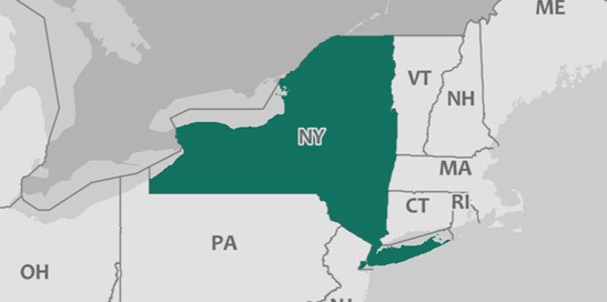
New York has a total area of 47,112.5 square miles, including 7,427.8 square miles of water, making it the 30th-largest state by area. New York is bordered by Pennsylvania, Massachusetts, Connecticut, Vermont, New Jersey, and Rhode Island.
POPULATION
19,849,399
MEDIAN HOUSEHOLD INCOME
$64,894
POVERTY RATE
14.1%
EMPLOYMENT RATE
59.6%
38.7 +/- 0.1
Median age in New York
38.1 +/- 0.1
Median age in the United States
5.8%
Under 5 years
79.1%
18 years and older
15.9%
65 years and older
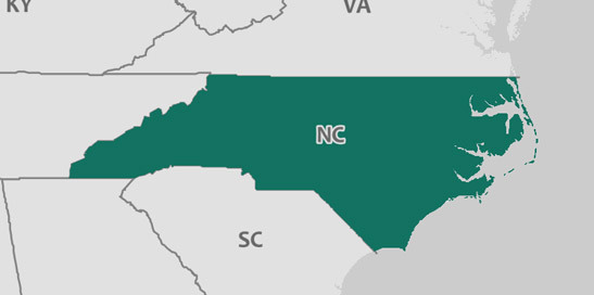
North Carolina has a total area of 48,605.6 square miles, including 5,199.4 square miles of water, making it the 29th-largest state by area. North Carolina is bordered by South Carolina, Tennessee, Virginia, and Georgia.
POPULATION
10,273,419
MEDIAN HOUSEHOLD INCOME
$52,752
POVERTY RATE
14.7%
EMPLOYMENT RATE
58.0%
38.8 +/- 0.1
Median age in North Carolina
38.1 +/- 0.1
Median age in the United States
5.9%
Under 5 years
77.6%
18 years and older
15.9%
65 years and older
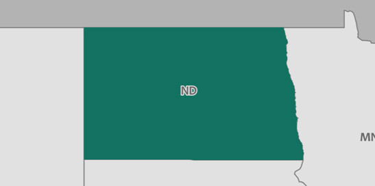
North Dakota has a total area of 68,982.8 square miles, including 1,698.1 square miles of water, making it the 17th-largest state by area. North Dakota is bordered by South Dakota, Minnesota, and Montana.
POPULATION
755,393
MEDIAN HOUSEHOLD INCOME
$61,843
POVERTY RATE
10.3%
EMPLOYMENT RATE
67.9%
35.4 +/- 0.3
Median age in North Dakota
38.1 +/- 0.1
Median age in the United States
7.0%
Under 5 years
77.1%
18 years and older
14.9%
65 years and older
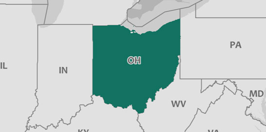
Ohio has a total area of 40,851.6 square miles, including 3,962.1 square miles of water, making it the 35th-largest state by area. Ohio is bordered by West Virginia, Indiana, Pennsylvania, Michigan, and Kentucky.
POPULATION
11,658,609
MEDIAN HOUSEHOLD INCOME
$54,021
POVERTY RATE
14.0%
EMPLOYMENT RATE
59.6%
39.3 +/- 0.1
Median age in Ohio
38.1 +/- 0.1
Median age in the United States
6.0%
Under 5 years
77.7%
18 years and older
16.6%
65 years and older
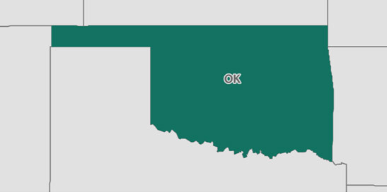
Oklahoma has a total area of 68,578.2 square miles, including 1,302.3 square miles of water, making it the 19th-largest state by area. Oklahoma is bordered by New Mexico, Colorado, Texas, Missouri, Kansas, and Arkansas.
POPULATION
3,930,864
MEDIAN HOUSEHOLD INCOME
$50,051
POVERTY RATE
15.8%
EMPLOYMENT RATE
57.2%
36.6 +/- 0.1
Median age in Oklahoma
38.1 +/- 0.1
Median age in the United States
6.7%
Under 5 years
75.5%
18 years and older
15.3%
65 years and older
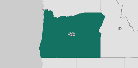
Oregon has a total area of 95,961.2 square miles, including 2,391.3 square miles of water, making it the 10th-largest state by area. Oregon is bordered by Washington, Nevada, California, and Idaho.
POPULATION
4,142,776
MEDIAN HOUSEHOLD INCOME
$60,212
POVERTY RATE
13.2%
EMPLOYMENT RATE
59.1%
39.3 +/- 0.2
Median age in Oregon
38.1 +/- 0.1
Median age in the United States
5.6%
Under 5 years
78.9%
18 years and older
17.1%
65 years and older
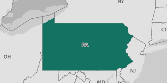
Pennsylvania has a total area of 44,730.5 square miles, including 1,311.2 square miles of water, making it the 32nd-largest state by area. Pennsylvania is bordered by West Virginia, Ohio, Maryland, Delaware, and New York.
POPULATION
12,805,537
MEDIAN HOUSEHOLD INCOME
$59,195
POVERTY RATE
12.5%
EMPLOYMENT RATE
59.0%
40.8 +/- 0.1
Median age in Pennsylvania
38.1 +/- 0.1
Median age in the United States
5.5%
Under 5 years
79.2%
18 years and older
17.8%
65 years and older
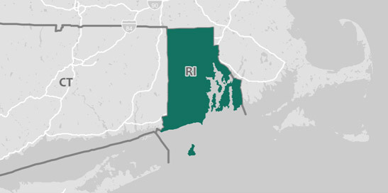
Rhode Island has a total area of 1,033.7 square miles, including 510.9 square miles of water, making it the 50th-largest state by area. Rhode Island is bordered by Massachusetts, Connecticut, and New York.
POPULATION
1,059,639
MEDIAN HOUSEHOLD INCOME
$63,870
POVERTY RATE
11.6%
EMPLOYMENT RATE
61.3%
39.5 +/- 0.4
Median age in Rhode Island
38.1 +/- 0.1
Median age in the United States
5.2%
Under 5 years
80.5%
18 years and older
16.7%
65 years and older
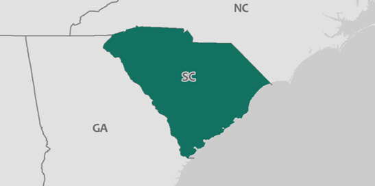
South Carolina has a total area of 30,054.6 square miles, including 1,957.4 square miles of water, making it the 40th-largest state by area. South Carolina is bordered by North Carolina and Georgia.
POPULATION
5,024,369
MEDIAN HOUSEHOLD INCOME
$50,570
POVERTY RATE
15.4%
EMPLOYMENT RATE
56.1%
39.4 +/- 0.2
Median age in South Carolina
38.1 +/- 0.1
Median age in the United States
5.8%
Under 5 years
78.1%
18 years and older
17.2%
65 years and older
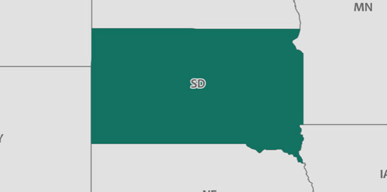
South Dakota has a total area of 75,790.5 square miles, including 1,305 square miles of water, making it the 16th-largest state by area. South Dakota is bordered by Wyoming, Nebraska, Iowa, North Dakota, Minnesota, and Montana.
POPULATION
869,666
MEDIAN HOUSEHOLD INCOME
$56,521
POVERTY RATE
13.0%
EMPLOYMENT RATE
65.1%
36.9 +/- 0.3
Median age in South Dakota
38.1 +/- 0.1
Median age in the United States
7.0%
Under 5 years
75.5%
18 years and older
16.3%
65 years and older
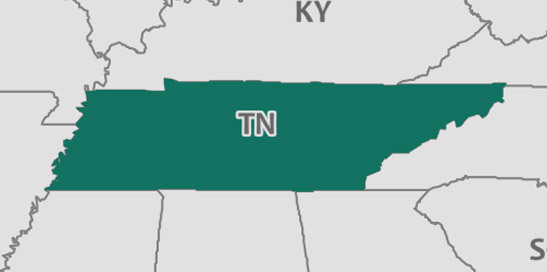
Tennessee has a total area of 41,223.9 square miles, including 909.1 square miles of water, making it the 34th-largest state by area. Tennessee is bordered by North Carolina, Mississippi, Kentucky, Missouri, Arkansas, Virginia, Georgia, and Alabama.
POPULATION
6,715,984
MEDIAN HOUSEHOLD INCOME
$51,340
POVERTY RATE
15.0%
EMPLOYMENT RATE
58.1%
38.6 +/- 0.1
Median age in Tennessee
38.1 +/- 0.1
Median age in the United States
6.0%
Under 5 years
77.5%
18 years and older
15.9%
65 years and older
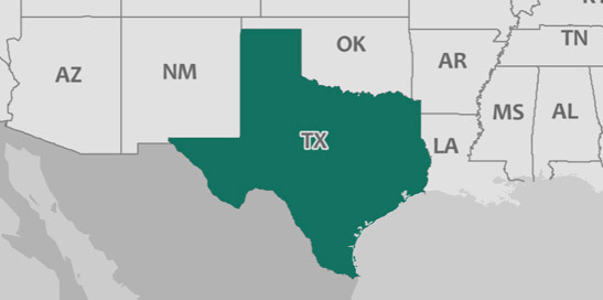
Texas has a total area of 261,180.5 square miles, including 7,344 square miles of water, making it the 2nd-largest state by area. Texas is bordered by Louisiana, New Mexico, Oklahoma, and Arkansas.
POPULATION
28,304,596
MEDIAN HOUSEHOLD INCOME
$59,206
POVERTY RATE
14.7%
EMPLOYMENT RATE
60.7%
34.7 +/- 0.2
Median age in Texas
38.1 +/- 0.1
Median age in the United States
7.1%
Under 5 years
74.0%
18 years and older
12.2%
65 years and older
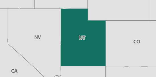
Utah has a total area of 82,173.8 square miles, including 2,701.8 square miles of water, making it the 12th-largest state by area. Utah is bordered by Nevada, Arizona, Colorado, Wyoming, Idaho, and New Mexico.
POPULATION
3,101,833
MEDIAN HOUSEHOLD INCOME
$68,358
POVERTY RATE
9.7%
EMPLOYMENT RATE
66.0%
31 +/- 0.1
Median age in Utah
38.1 +/- 0.1
Median age in the United States
8.2%
Under 5 years
70.2%
18 years and older
10.8%
65 years and older
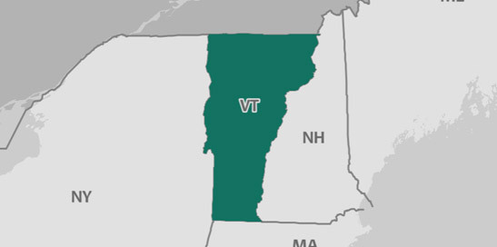
Vermont has a total area of 9,215.2 square miles, including 398 square miles of water, making it the 43rd-largest state by area. Vermont is bordered by New Hampshire, Massachusetts, and New York.
POPULATION
623,657
MEDIAN HOUSEHOLD INCOME
$57,513
POVERTY RATE
11.3%
EMPLOYMENT RATE
62.8%
42.6 +/- 0.2
Median age in Vermont
38.1 +/- 0.1
Median age in the United States
4.8%
Under 5 years
81.1%
18 years and older
18.8%
65 years and older
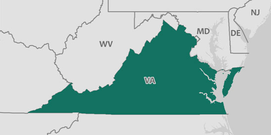
Virginia has a total area of 39,471.3 square miles, including 3,292 square miles of water, making it the 37th-largest state by area. Virginia is bordered by West Virginia, North Carolina, Maryland, Kentucky, Tennessee, and District of Columbia.
POPULATION
8,470,020
MEDIAN HOUSEHOLD INCOME
$71,535
POVERTY RATE
10.6%
EMPLOYMENT RATE
61.1%
38.2 +/- 0.2
Median age in Virginia
38.1 +/- 0.1
Median age in the United States
5.9%
Under 5 years
77.9%
18 years and older
15.0%
65 years and older
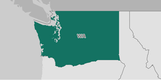
Washington has a total area of 66,435.8 square miles, including 4,847.6 square miles of water, making it the 20th-largest state by area. Washington is bordered by Oregon and Idaho.
POPULATION
7,405,743
MEDIAN HOUSEHOLD INCOME
$70,979
POVERTY RATE
11.0%
EMPLOYMENT RATE
60.6%
37.7 +/- 0.2
Median age in Washington
38.1 +/- 0.1
Median age in the United States
6.1%
Under 5 years
77.8%
18 years and older
15.1%
65 years and older
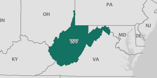
West Virginia has a total area of 24,034.5 square miles, including 189.1 square miles of water, making it the 41st-largest state by area. West Virginia is bordered by Ohio, Pennsylvania, Maryland, Kentucky, and Virginia.
POPULATION
1,815,857
MEDIAN HOUSEHOLD INCOME
$43,469
POVERTY RATE
19.1%
EMPLOYMENT RATE
48.8%
42.4 +/- 0.2
Median age in West Virginia
38.1 +/- 0.1
Median age in the United States
5.4%
Under 5 years
79.4%
18 years and older
19.3%
65 years and older
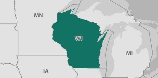
Wisconsin has a total area of 54,145.6 square miles, including 11,333.5 square miles of water, making it the 25th-largest state by area. Wisconsin is bordered by Illinois, Michigan, Iowa, and Minnesota.
POPULATION
5,795,483
MEDIAN HOUSEHOLD INCOME
$59,305
POVERTY RATE
11.3%
EMPLOYMENT RATE
63.9%
39.5 +/- 0.2
Median age in Wisconsin
38.1 +/- 0.1
Median age in the United States
5.8%
Under 5 years
77.9%
18 years and older
16.5%
65 years and older
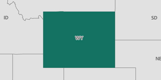
Wyoming has a total area of 97,065.5 square miles, including 718.5 square miles of water, making it the 9th-largest state by area. Wyoming is bordered by Nebraska, Colorado, South Dakota, Idaho, Utah, and Montana.
POPULATION
579,315
MEDIAN HOUSEHOLD INCOME
$60,434
POVERTY RATE
11.3%
EMPLOYMENT RATE
61.9%
37.5 +/- 0.3
Median age in Wyoming
38.1 +/- 0.1
Median age in the United States
6.5%
Under 5 years
76.2%
18 years and older
15.6%
65 years and older