Collection Highlights
Newly Processed: Street Vending Records
Our volunteer Ilias Bowen-Sicalides recently finished processing a set of Engineering Department records that gives us a fascinating look at street vending carts in the 1970s and 1980s.
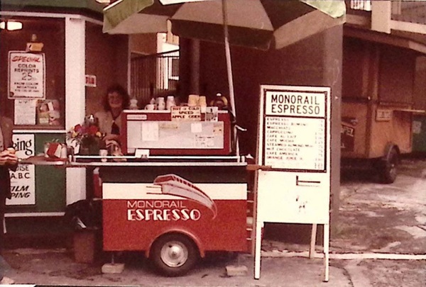 Monorail Espresso cart, circa 1979. Photo from Street Cart Scrapbook, box 2, folder 1 (Series 2618-07).
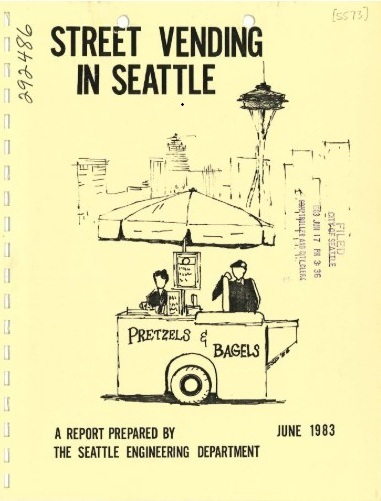
The Board of Public Works authorized street vending carts in 1972, with a one-page document providing all of the regulations for cart owners. As the number of vendors increased over the next decade, the city saw a need to update those regulations and commissioned a report from the Engineering Department to clarify existing regulations and recommend improvements.
This collection includes that report, its drafts and appendices, records of public forums, and correspondence about the new regulations. It also includes research done into other cities’ regulations, news clippings about response to the updates, and a collection of street vendor permits and invoices from before and after the new regulations took effect.
See our blog post about the collection to learn more!
|
Find of the Month: Determinants of City Form
An unusual Department of Community Development report from 1971 was meant to incorporate ecological and urban design factors into Seattle’s city planning efforts. Titled "Determinants of City Form," the document is more or less an atlas of stylized maps with accompanying narratives. A transmittal letter to the mayor declared the study "a major milestone in laying the groundwork for the evolution of a city which can match the excitement and beauty of its natural setting."
The report emphasized Seattle’s uniqueness, and the language got a little flowery at times. For example: "Some cities are more memorable than others. A city's milieu frequently borders on a mystique which is difficult to define. It is not only the parts of the city but also the composite of the various phenomena that gives a city character."
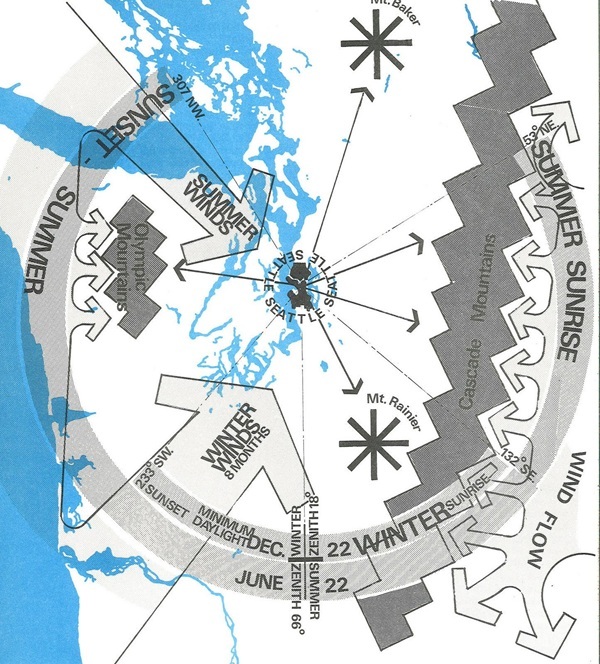 Climate map of Seattle, Document 1295 (Series 1801-92), SMA
The maps are the real stars of the document. Some are fairly typical, illustrating topography, population density, or neighborhoods. Others are more unusual, like a "word map" or maps showing view orientation or peak shadows. More esoteric maps depict concepts like activity clusters, time envelopes, and massing of building bulk.
The section of transportation maps includes some interesting visualizations. A movement systems map shows arrows of varying widths illustrating roads, transit, and ferry routes. A time-distance map shades the city based on travel times from a central point at 4th and Madison. Other maps show traffic volume and public transportation systems.
The report declared itself to be "an inventory of the existing forces that have shaped and are shaping the quality of the environment." However, it pointed out that social issues and human needs were also important factors that should be taken into account in the city planning process, and urged that these be incorporated into decision making to meet "the changing needs of the human user of the city."
Explore other Find of the Months on our website!
|