|
Historic Columbia River Highway temporarily reopened March 24 at Larch Mountain Road while work continues.
March 25, 2025
For media inquiries: David House, 503-551-8641
For questions or comments: Dee Hidalgo, 971-352-5719
TROUTDALE - The Historic Columbia River Highway, also known as U.S. 30, temporarily reopened at Larch Mountain Road on Monday.
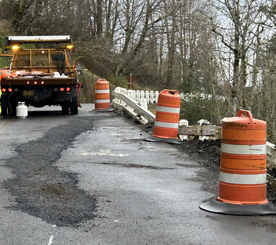
ODOT closed the section between Portland Women’s Forum and Vista House on March 12 due to roadway settling east of the split with Larch Mountain Road.
After evaluating the recent land movement, we sealed the cracking and placed orange drums for improved visibility, and we were able to reopen the highway Monday. We will continue to monitor the slope daily and keep it open as long as it appears safe for traffic.
Please check TripCheck.com before you use this route because work will continue in this slide area. We may need temporary lane or full closures occasionally, so travelers may experience delays.
Long-term repairs this summer, when the ground dries, will require closures. This section of the historic highway sits on an ancient landslide, so ODOT has monitored it closely for decades.
Note: Please also note that the Historic Highway remains closed just west of Multnomah Falls for structural repair work on the Multnomah Falls Viaduct project. We expect to reopen this area for the summer tourist season.
History
The Larch Mountain landslide is a deep, massive landslide complex that occupies more than 100 acres of the Crown Point State Scenic Corridor. The Historic Highway skirts around the perimeter of this massive landslide, but about 800 feet of the highway crosses an active section just east of the intersection with Larch Mountain Road, about one-half mile west of Crown Point.
When the Historic Highway was built over 100 years ago, the ancient Larch Mountain Slide was a challenge. The original design for the highway at this location was a viaduct, or a bridge over land, though the structure could not accommodate the continuous movement of the landslide, and the viaduct was removed in the 1960s when ODOT built the current alignment. In 1983 and again in 2007, ODOT constructed a retaining wall to support the Historic Highway. Continued ground movement, sometimes up to 12 inches in a year has required annual repaving and reassessment.
|