
NEWS RELEASE: Wyoming Geological Survey and USGS Announce Release of High-Resolution Geophysical Data for Central Wyoming
Wyoming State Geological Survey sent this bulletin at 02/14/2024 02:00 PM MST
February 14, 2024
******FOR IMMEDIATE RELEASE******
Media Contact:
Christina George, Public Information Officer
christina.george@wyo.gov
WSGS and USGS Announce Release of High-Resolution Geophysical Data for Central Wyoming
High-resolution radiometric and magnetic data collected during an airborne geophysical survey of central Wyoming are now available for public use. The data are the result of a collaboration between the Wyoming State Geological Survey (WSGS) and U.S. Geological Survey (USGS) that aims to better understand the area’s geologic framework for critical and other essential mineral resources.
Helicopters flew last summer into fall, covering about 3,340 square miles encompassing the southern end of the Wind River Range, the Granite Mountains, Rattlesnake Hills, and the Seminoe-Ferris mountains west of Pathfinder Reservoir.
Dr. Erin Campbell, Wyoming State Geologist and Director of the WSGS, noted the significance of this dataset.
“Geophysical surveys are a common early step in mineral exploration, and this survey is among the first of such datasets to be made publicly available in Wyoming,” says Campbell. “The data are the foundation for understanding the geology and mineral resources of the region. They will also provide invaluable information for energy and groundwater mapping, as well as identifying potential geologic hazards.”
Geophysical investigations are an efficient way to detect rocks and trends across a large area and are a useful tool for helping understand an area’s geology and mineral resources. Magnetic data record the intensity of the earth’s magnetic field, and can be used to identify faults, compositional differences in neighboring rocks, and other geologic features at depths down to about 3,300 feet below the ground surface. Radiometric data indicate the relative amounts of naturally occurring potassium, uranium, and thorium in shallow, near-surface rocks and soil.
This region has long been a target for mineral exploration, as historical mining has occurred across most of the survey footprint. More recently, active exploration in central Wyoming has focused on elements such as gold, copper, nickel, uranium, and lithium.
This survey was funded by the State of Wyoming and contracted through the USGS Earth Mapping Resources Initiative (Earth MRI). Earth MRI is a partnership between the USGS and state geological surveys across the United States to modernize our understanding of the nation’s fundamental geologic framework and knowledge of mineral resources. The USGS Earth MRI program has funded several other large aerial geophysical surveys in Wyoming, in both the Sierra Madre and Medicine Bow Mountains. For more information on these surveys, as well as other Earth MRI projects in Wyoming and throughout the country, visit the Earth MRI Acquisitions Viewer.
Processed geophysical data for the South Pass-Granite Mountains survey can be downloaded through the USGS. The survey covers an area of approximately 3,340 square miles and includes 29,810 line-miles of magnetic and radiometric data. Data were collected from a helicopter flown at a terrain clearance of 330 feet above topography along north-south flight lines spaced at 650-foot intervals. Tie lines were flown in an east-west direction every 6,560 feet. Data were collected by New Sense Geophysics Ltd. and Merrick-Surdex Joint Venture under contract with the USGS using a helicopter equipped with a stinger-mounted magnetometer and gamma-ray spectrometer.
The survey was funded and contracted in early 2023, and conducted out of the Rawlins and Lander airports from July through September 2023. Available files include flight line data and images for the magnetic and radiometric surveys and a report describing the survey parameters, field operations, quality control, and data reduction procedures.
Images of the magnetic and radiometric data are also viewable on the WSGS Mineral Resources interactive map. For more information on ongoing WSGS minerals-related projects, see the WSGS current projects website. For more information on USGS mineral research, see the USGS Mineral Resources Program website or follow the USGS on X, formerly known as Twitter.

(Caption: Map showing magnetic anomalies in the area of Jeffrey City and Muddy Gap. The top image shows existing low-resolution magnetics data that were collected decades ago and are only useful for large-scale regional interpretation. The bottom image is from the new, high-resolution magnetics dataset collected by the South Pass-Granite Mountains aerial geophysical survey that will help guide mineral exploration as well as a greater understanding of the region's geology. The South Granite Mountains fault system is marked by the linear feature running west from Muddy Gap. The Rattlesnake Hills volcanics are the blue circular features in the northeast corner of the map. WSGS map)
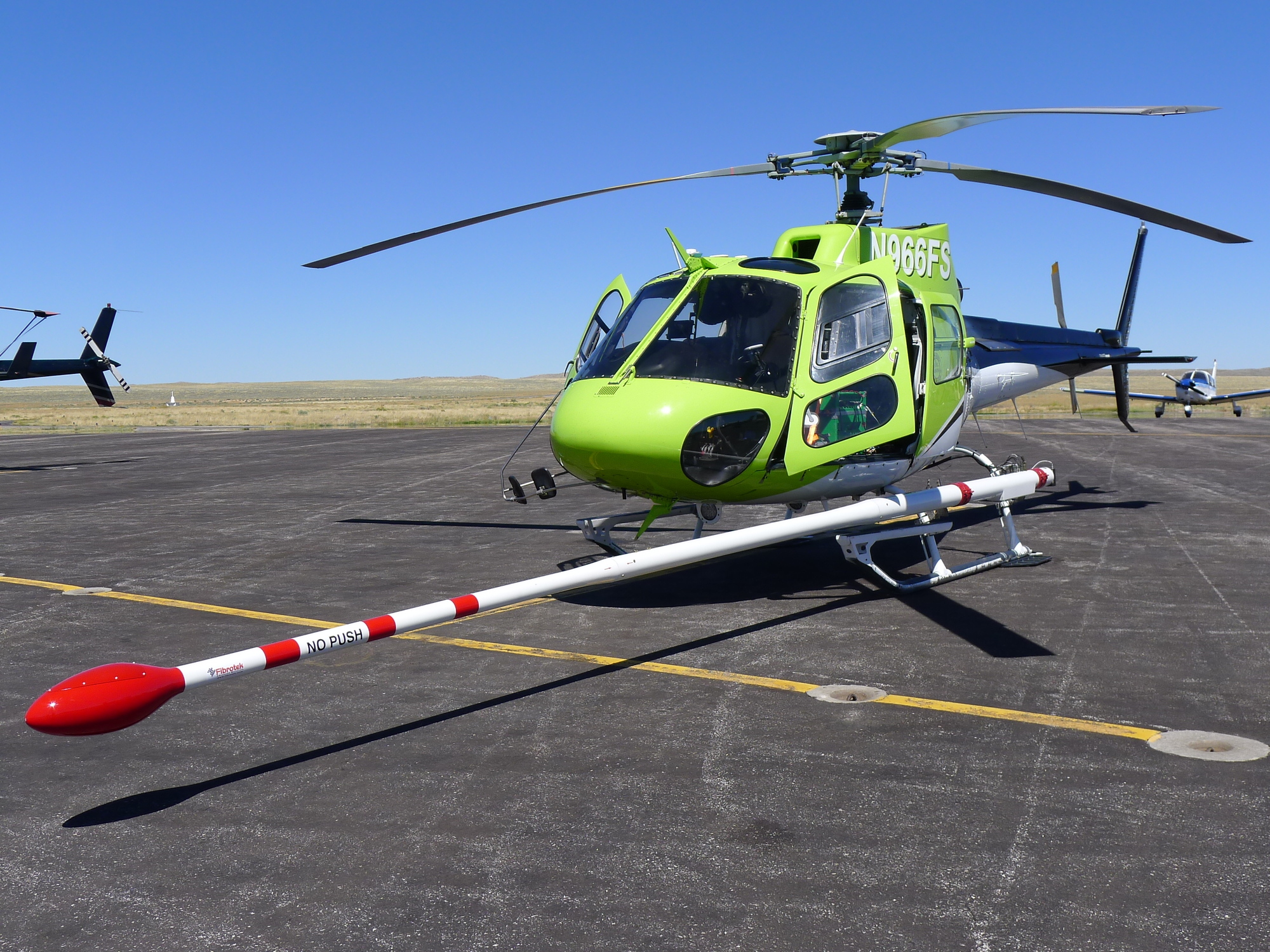
(Caption: A helicopter equipped with a stinger-mounted magnetometer and gamma-ray spectrometer conducted flights last summer to collect the survey data. WSGS photo)

|
Interpreting the past ~ providing for the future Email: wsgs-info@wyo.gov |
| STAY CONNECTED: | |||||||
|
|||||||
SUBSCRIBER SERVICES:
Manage Subscriptions | Unsubscribe All | Subscriber Help