
NEWS RELEASE: Wyoming Geological Survey Publishes Geologic Map of Phantom Lake Quadrangle
Wyoming State Geological Survey sent this bulletin at 01/26/2023 09:19 AM MST
January 26, 2023
******FOR IMMEDIATE RELEASE******
Media Contact:
Christina George
christina.george@wyo.gov
WSGS Publishes Geologic Map of Phantom Lake Quadrangle
The Wyoming State Geological Survey (WSGS) published a new 1:24,000-scale geologic map of the Phantom Lake quadrangle in the Medicine Bow Mountains of southeastern Wyoming. The map continues the WSGS’s broader focus on studying the rock units, depositional and intrusive processes, and structural history associated with mineralization trends in the region.
“The WSGS has led several research projects in the last few years that focus on critical and economic minerals, which are important to Wyoming and to the country. The Phantom Lake map contributes to this effort and aids in our understanding of the mineral potential in our state,” says WSGS Director and State Geologist, Dr. Erin Campbell.
The Phantom Lake quadrangle is in the Medicine Bow-Routt National Forest on the western flank of the Medicine Bow Mountains, about 17 miles southeast of Saratoga. The quadrangle includes formations that range in age from the oldest magmatic unit dated in the mountain range (a 2.685-billion-year-old granite), to thick sequences of Neoarchean to Paleoproterozoic metasediments and metavolcanics, to much younger glacial tills and other Quaternary deposits.
The map area also is adjacent to the Cheyenne belt, a 1.7-billion-year-old suture zone that influenced much of the mineralization within the Medicine Bow Mountains and many of the structural features on the Phantom Lake quadrangle. Historic gold mining occurred in the Gold Hill district in the northern portion of the map.
This project refines, standardizes, and modernizes earlier maps, while also contributing new geochemical and geochronological data for many of the Precambrian formations. These data are crucial to understanding of the area’s geologic history, assist with regional paleogeographic reconstructions, and contribute to evaluations of mineral potential within the map area.
"Nearly every unit in the Medicine Bow Mountains older than the Cheyenne belt occurs within the Phantom Lake quadrangle. This made it an ideal map to study the complex Precambrian geologic history of the northern Medicine Bows, and hopefully some of the geochemistry and geochronology results help unravel that history a bit," says WSGS geologist and lead author, Rachel Toner.
An accompanying report provides additional information on the mapped units in the quadrangle, including whole-rock geochemistry and analytical results from detrital and magmatic zircon geochronology. The analytical methods and raw data are detailed in the report appendices and supplemental data tables.
The Geologic Map of the Phantom Lake Quadrangle, Carbon County, Wyoming, Map Series 109, is available as a free download on the WSGS website or in hardcopy format for purchase. The report and data acquired for the project are also available for download on the WSGS website. The project was supported with funding through the U.S. National Cooperative Geologic Mapping Program (STATEMAP), which is managed by the U.S. Geological Survey.
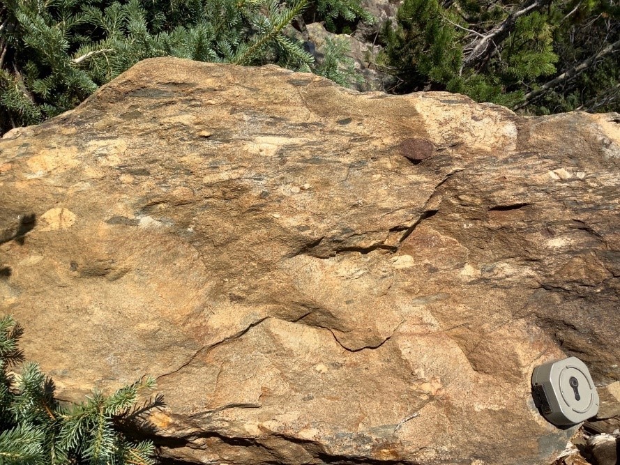
(Caption: Magnolia Formation basal conglomerate showing stretched and intact clasts. WSGS photo)

|
Interpreting the past ~ providing for the future Email: wsgs-info@wyo.gov |
| STAY CONNECTED: | |||||||
|
|||||||
SUBSCRIBER SERVICES:
Manage Subscriptions | Unsubscribe All | Subscriber Help