NEWS RELEASE: Wyoming Geological Survey Fall Newsletter

Wyoming State Geological Survey Geo Notes banner image

Interpreting the past, providing for the future - fall 2022 newsletter

Earth Science Week 2022 celebration

Earth Science Week event 1
Earth Science Week event 2

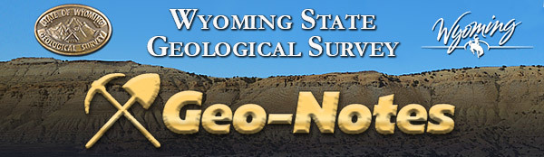
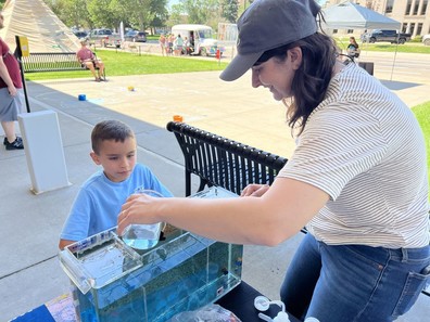
After a three-year hiatus, the WSGS and University of Wyoming (UW) Geological Museum looked forward to returning to hosting the annual Earth Science Week event in October. Nearly 300 attendees enjoyed this year's event, "Wyoming Rocks: Critical Resources for a Sustainable Future." Activities included planetarium shows, a scavenger hunt, rock identification kits, creative art activity, mineral matching game, and more. Partners this year were the UW School of Energy Resources, Planetarium, and Art Museum. 

Caption for top photo: Chelsea Kuhn and 7-year-old Jace picked out rock samples at the WSGS table. 

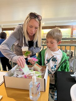
Caption for bottom photo: WSGS hydrologist Jim Stafford discussed minerals in some of our household items with attendees.


WSGS geologists take field trip to South Pass gold exploration

South Pass

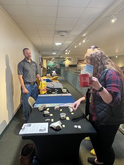
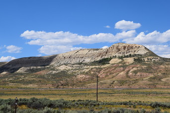
In August, WSGS geologists Patty Webber and Kelsey Kehoe spent two days in the South Pass area with Dr. Dean Peterson, chief geologist of Big Rock Exploration. The trip focused on the South Pass greenstone belt, which contains metamorphosed sedimentary and volcanic rocks more than 2.8 billion years old. Dr. Peterson shared his expertise with similar deposits in Canada and Minnesota, which provided a valuable backdrop upon which to understand the local geology.

The South Pass greenstone belt is dominated by metagreywacke and mafic metavolcanics, which have been heavily faulted and folded. Mineralization occurs in these zones of concentrated deformation, known as shear zones, where gold, quartz, and sulfides were deposited.

Historic gold and iron mining at South Pass dates back to the discovery of the Carissa Lode, which spurred Wyoming’s first gold rush in 1867. While large-scale mining hasn’t occurred in the region since the Atlantic City iron mine closed in 1983, Big Rock Exploration is one of a handful of companies actively exploring for gold deposits in this area.

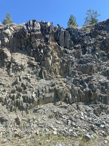
Caption for photo above: A shear zone cuts through greenstone and metagreywacke beds in a roadcut along Wyoming Highway 28.    


Geologists present at GSA conference

Derek LichtnerPatty Webber

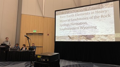
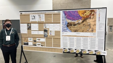
Several members of the WSGS team attended the October Geological Society of America conference in Denver. Geologist Derek Lichtner, in the top photo, presented his work on rare earth elements in heavy-mineral sandstones in southwest Wyoming. Lichtner authored a report last year about the heavy-mineral sandstone in the Upper Cretaceous Rock Springs Formation at Richards Gap in southwest Wyoming. He’s currently working on a related project that involves heavy-mineral sand deposits of all ages throughout the state.

Geologist Patty Webber presented her work on critical mineral potential of the Laramie Mountains in southeast Wyoming. The results of Webber’s two-year investigation will soon be released as a pair of maps and a report. This project is part of the U.S. Geological Survey’s Earth Mapping Resources Initiative (Earth MRI) program.

Map depicts WY’s Precambrian basement

The Precambrian basement structural configuration, both above and below the ground surface, is essential for understanding Wyoming’s geology. For many years, the original Wyoming Precambrian basement map, authored by D.L. Blackstone Jr. in 1993, guided geologic research in the state. Building upon the Blackstone map, and incorporating updated interpretations, the Wyoming State Geological Survey (WSGS) published a new map, Open File Report 2022-5, Precambrian Basement Map of Wyoming: Structural Configuration.

“Basement” refers to old crystalline rocks that are in the core of most mountain ranges and define the structure of nearby basins. In Wyoming, basement rocks are igneous and metamorphic, and are more than 541 million years old (Precambrian). These basement rocks are important to understand because they record the earth’s earliest geologic processes.

To revise the map, the WSGS used well logs, seismic lines, cross sections, and digital elevation models to refine and reinterpret the structure of the Precambrian rocks throughout the state. All data are compiled into a geodatabase; the dataset contains faults, contour lines, and controls used to guide the interpretations.


The basement map is part of the WSGS’s ongoing research into understanding the occurrence and distribution of critical minerals throughout Wyoming. Many critical minerals in the state are either found in, or originate from, Precambrian igneous and metamorphic rocks.

The 1:500,000-scale map is available for print, can be downloaded as a digital database, and can be viewed through the agency’s Interactive Oil and Gas Map of Wyoming. A report accompanies the map and details the study’s methods and results.


Three surficial maps of quads in central Wyoming underway

The WSGS is completing 1:100,000-scale surficial maps for the Riverton, Thermopolis, and Carter Mountain quadrangles in central Wyoming.

Carter Mountain, and portions of the Thermopolis and Riverton quadrangles, were mapped previously by James Case and Laura Hallberg. Staff geologists are working to fill in unmapped areas based on available photography and elevation models.

Publication of the maps will continue the WSGS initiative to complete 1:100,000-scale surficial mapping across Wyoming.


Earthquake preparedness kits delivered to schools in western Wyoming

In early October, WSGS geologist Seth Wittke joined the Wyoming Office of Homeland Security in delivering earthquake preparedness kits and educational materials to schools in Teton and Lincoln counties in western Wyoming. The schools are identified as being in a high seismic area.

Each school received 30 kits and a presentation on earthquakes, seismic risks, and preparedness steps to take during an earthquake or other disaster. Kits contained enough supplies for three days, and included food, water, a crank radio, and first aid supplies.

Kits were paid for with funds awarded from the National Earthquake Hazard Reduction Program Grant.