|
The Wyoming State Geological Survey (WSGS) published a report about groundwater salinity in the Wind River and Bighorn basins in northern Wyoming. Salinity is measured by the residue of dissolved salts, minerals, and metals that remains after laboratory evaporation of a water sample. It is one criteria used to determine if groundwater is suited for human consumption, agriculture uses, or industrial applications.
The study found:
- Groundwater salinity commonly exceeds 5,000 parts per million at depths greater than 5,000 feet in the Wind River Basin and at depths below 7,000 feet in the Bighorn Basin.
- Saline groundwaters occur most frequently at depths from 9,000–11,000 feet in both basins.
- Average salinity levels decline somewhat at depths below 11,000 feet because the Tensleep Sandstone and Madison Limestone, both important aquifers in Wyoming, contain fresher water than overlying geologic formations.
Salinity has been the focus of a WSGS series that examined water quality in many of the state’s energy-producing basins. Past reports focus on the Denver-Julesburg, Powder River, and Greater Green River basins. The WSGS also published a statewide salinity report.
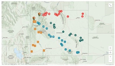
With summer around the corner, many are planning road trips, and some of those roads lead to Yellowstone National Park. This year marks Yellowstone’s 150th anniversary of its establishment as the world’s first national park. In celebration of the milestone, the WSGS launched a new geology web map. This unique map highlights the interesting geologic features to check out while on the way to Yellowstone.
More than 50 sites along four different routes throughout the state are featured on the interactive map. Sites range from classics like Devils Tower to lesser-known geologic features such as the fins along the Ferris Mountains near Muddy Gap.
The web-based application can be viewed on a mobile device or a computer desktop and is free to access.
For those wanting to learn more about the geology inside the park, the WSGS has a Geology of Yellowstone interactive web map with multiple geospatial datasets relating to the geology of Yellowstone. The map was developed in cooperation with the Yellowstone Volcano Observatory, of which the WSGS is a consortium member.
The WSGS launched an interactive Geologic and Topographic Map Index of Wyoming—a search tool for researchers and the general public.
- The index map compiles layers of bedrock, surficial, and topographic maps at varying scales published by the WSGS and U.S. Geological Survey.
- Popups offer direct links to order printed copies or download digital files.
- The interactive map also features 1:500,000-scale statewide layers of bedrock and surficial geology.
- Base layers provide assistance locating publications by township and range or county.
- Search for maps by geographical location, map title, quadrangle, author and more.
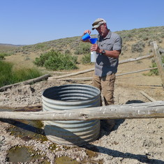
WSGS hydrogeologist Karl Taboga retired in April after nearly a decade with the Survey. Taboga has more than 19 years of total experience in surface and groundwater hydrology, environmental studies, and wetland and wildlife assessments. Prior to joining the WSGS, he worked in the environmental consulting industry in Wyoming, Colorado, and New Jersey.
During his tenure at the WSGS, Taboga worked with other scientists and staff to produce reports on Wyoming’s groundwater resources and groundwater salinity, an assessment of lithium deposits, a water atlas, and a state recharge map.
“The WSGS water resources team has been quite productive during my time here,” Taboga said. “We hope that our work products will provide economic benefits to the residents of Wyoming.”
Taboga obtained his M.S. in wildlife biology in 1979. He pursued graduate level studies and research part time in the Department of Geology and Geophysics and the College of Engineering at the University of Wyoming from 2002 to 2007. He obtained his Professional Geologist license in 2010.
|
A podcast hosted by the Meeteetse Museums interviewed two WSGS geologists for a pair of upcoming episodes related to the small town’s history. Kelsey Kehoe was interviewed by the Meeteetse Stories podcast in an episode about blacksmithing, and James Mauch was interviewed for an episode on the mystery of the Iron Creek brickworks. The episodes are scheduled for release May 4 and May 11, respectively.
According to the museums, it seemed fitting to kick off a new season of the podcast with an episode about blacksmithing because the blacksmith shop was the first building in Meeteetse. Kehoe will speak about the geology of coal in the area. The May 11 episode explores the Iron Creek Foundry and features an interview with Mauch on the geological deposits in Iron Creek that provide good material for brickmaking.
The Meeteetse Stories podcast can be found on Spotify, Apple Podcast, Google Podcast, iHeart Radio, Stitcher, and Podcasts.com.
|