|
Wyoming State Geological Survey (WSGS) geologists are preparing a report focused on an unmapped portion of the Greys River fault in northwestern Wyoming. Geologists had discovered the area while mapping the surficial geology in the Jackson 30' x 60' quadrangle in 2016.
The WSGS revisited the unmapped northern extent of the Greys River fault in 2019 to conduct an in-depth study as part of a larger mapping project. Additional aerial photography interpretation, field investigation, and high-resolution ground models were used to better define the extent and characteristics of the fault. This work resulted in WSGS Open File Report 2020-5, the Preliminary Surficial Geologic and Landslide Maps of the Blind Bull Creek and Pickle Pass Quadrangles, Lincoln County, Wyoming.
The WSGS is currently preparing a Report of Investigations related to the findings of the work completed in 2019. The publication will focus on the previously unmapped section of the fault, describing surface characteristics, geomorphic relationships, and general seismic history. The report will create new information that will be used to model the seismic hazards in the area.
Fault scarp in part of the newly-mapped section, Upper Blind Trail Creek.
The WSGS published a study in December about groundwater salinity in the Greater Green River Basin. The new report is part of an ongoing series led by WSGS hydrogeologist Karl Taboga that focuses on water quality in some of the state’s energy-producing basins.
Groundwater resources are more limited in the Greater Green River Basin than elsewhere in Wyoming, making it important to conserve fresher waters for domestic and agricultural use by using saline water for energy development and mining, whenever possible, says Taboga.
“Salinity” is the amount of dissolved material that remains as residue after the liquid portion of a water sample evaporates. Salinity is one way to determine whether groundwater resources are suited for human or agriculture use. In Wyoming, saline groundwater is encountered most frequently as a byproduct of oil and gas exploration in deep basin aquifers.
Other reports in the salinity series are about the Denver-Julesburg and Powder River basins. The WSGS also published a statewide report regarding saline waters. All reports are available as free downloads from the WSGS website.
The WSGS continues adding to the information pamphlets series about geology found in Wyoming’s state parks, the latest focusing on Boysen.
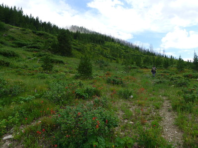
Boysen State Park sits in the middle of the state near Shoshoni and is the southern gateway to Wind River Canyon, which hosts its own unique geologic features. Boysen Reservoir covers most of the park’s grounds. Boysen State Park sits at the northern edge of the Wind River Basin and on the southern flank of the Owl Creek Mountains. Faults, 3-billion-year-old rocks, and the Great Unconformity can also be found in and around the park.
Other Wyoming state park pamphlets available are Buffalo Bill, Glendo, Edness K. Wilkins, Bear River, Keyhole, Guernsey, Seminoe, and Curt Gowdy. The series will conclude with a Hot Springs State Park pamphlet that is nearing publication.
State park pamphlets are free. In addition to the downloadable pamphlets available through the links mentioned above, hard copies can be picked up at the WSGS office on the University of Wyoming campus in Laramie and at park visitor centers.
|
A series recognizing staff and their contributions
Rachel Toner—senior oil and gas geologist, 8 years of service
What do you do at the WSGS: My tasks are pretty varied—they range from characterizing oil and gas reservoirs in the Powder River and Denver basins, to assisting with oil and gas production and price forecasts, to fieldwork and mapping of 1:24,000-scale quadrangles. As part of the WSGS’s participation in the federal EarthMRI initiative, I’ve also been researching Wyoming’s potential critical minerals resources. To support this research, I will be continuing to map and sample in the Medicine Bow Mountains, which has significant metal deposits. I use GIS extensively in all my projects to analyze and organize data and to create maps that spatially display the state’s bedrock and subsurface geology.
What makes your job interesting: I’m very lucky to have a job where I can work on a wide variety of challenging but fun projects, in a state with such diverse geology, and as part of a team of talented coworkers. I’m constantly learning and am never bored!
How does your job help Wyoming: All of my publications, maps, presentations, and direct inquiries have the explicit goal of benefiting the state of Wyoming. By publishing my projects’ geologic data and by creating tools for visualizing and analyzing that data, it hopefully helps spread the word on how important oil, gas, and mineral resources are to Wyoming’s economy.
What are some of your favorite geologic features in the state: There’s amazing geology everywhere in Wyoming, so it’s hard to choose favorites. If pressed, I would say Tongue River Canyon in the Bighorn Mountains, the Fremont Canyon/Alcova reservoir area, and the Leucite Hills volcanics and Flaming Gorge scenic byway in southwestern Wyoming. Closer to home, recent projects have given me an appreciation for the geologic complexity, diversity, and mineral resources of the Medicine Bow Mountains.
|
As we brave our way through a Wyoming winter, let's talk about things cold and icy—like glaciers.
Wyoming is home to the largest glacier in the Rocky Mountains and the second largest in the continental United States. Gannett Glacier lies in the Wind River Range in central Wyoming, northeast of Gannet Peak (the highest peak in the state). The glacier is currently about 3.3 square kilometers (1.27 square miles) in area; it was 4.6 square kilometers (1.78 square miles) in 1950, making it a retreating glacier. Glaciers are constantly accumulating ice at their head and melting at their terminus (foot). When the amount of melt is higher than the amount of ice formation, the glacier shrinks and retreats.
There are 38 named glaciers across Wyoming. Most of them are in the Wind River Range, with a few in the Teton and Absaroka ranges. Evidence of past glaciation does, however, exist in many mountainous areas across the state and can be found by looking for clues left by the long-gone glaciers.
Glaciers carve out characteristic U-shaped valleys (an example is Sinks Canyon, near Lander), as opposed to the V-shaped valleys created by rivers. Rocks left behind by glaciers can be distinctive in several ways as well. As glaciers retreat, they leave behind mounds of sediment in features called moraines. This sediment, known as glacial till, can vary widely in composition and size because glaciers pick up everything the ice passes over, including very large boulders. As rocks are carried along within a glacier, they bump and slide past each other. This action can create striations (long linear groves), chatter marks (impact marks), and other evidence of their movement. The rocks in the glacier also grind against one another, creating a fine powder called glacial flour. This glacial flour is very light and stays suspended when it enters glacial lakes and streams. The light reflecting off the particles gives glacial meltwater its characteristic light-blue and green color.
The most scenic features left behind by glaciers are glacial lakes. These lakes can be high in the mountains and are often deep and clear. As the glaciers receded, they left moraines surrounded by steep mountain terrain. In many cases the moraines trapped water, creating lakes in dramatic alpine settings. A trip to the high country usually involves a visit to a glacial lake, which we can all look forward to next summer.
--Dr. Erin Campbell, WSGS Director and State Geologist
|
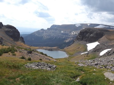 |
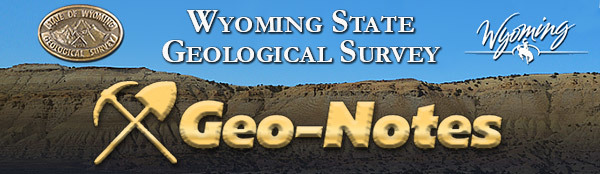
In the Absaroka Mountains near the Continental Divide.
|