
NEWS RELEASE: Wyoming Geological Survey Publishes Buffalo Bill State Park Pamphlet
Wyoming State Geological Survey sent this bulletin at 03/12/2020 10:31 AM MDT
March 12, 2020
******FOR IMMEDIATE RELEASE******
Media Contact:
Christina George
(307) 766-2286 x231
christina.george@wyo.gov
Learn about Buffalo Bill State Park Geology in new WSGS Pamphlet
Buffalo Bill State Park is the latest spotlighted in a series of information pamphlets about geology in Wyoming’s state parks. The Wyoming State Geological Survey’s (WSGS) goal with the series is to help park visitors learn about the geology around them.
“This series offers snapshots of the fascinating geologic features and processes unique to each state park,” says WSGS Director, Dr. Erin Campbell. “Buffalo Bill State Park is no exception. The landscape tells a story depicting billions of years of Earth’s history.”
Buffalo Bill State Park sits east of the Absaroka Range in the northwestern part of the state. Geologic features in the area include the Great Unconformity, a dormant volcanic field, and the world’s largest known ancient landslide.
Buffalo Bill Reservoir—situated in the center of the park—is fed by the North and South forks of the Shoshone River. Both forks flow from the Absaroka Range and provide nearly all of the water in the reservoir.
Other information pamphlets available in the series are Glendo, Edness K. Wilkins, Bear River, Keyhole, Guernsey, Seminoe, and Curt Gowdy. Pamphlets are free and are available at the WSGS office on the University of Wyoming campus in Laramie and at park visitor centers. Pamphlets can also be downloaded from the WSGS sales website.
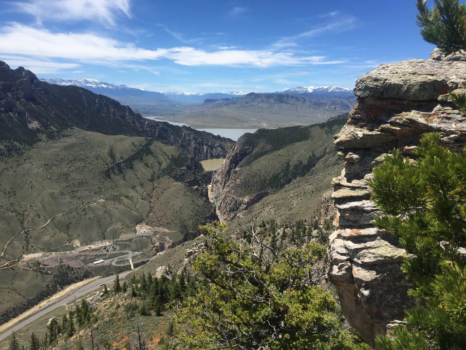
Buffalo Bill State Park. Photograph courtesy of Mark P. Fisher

|
Interpreting the past ~ providing for the future Email: wsgs-info@wyo.gov |
| STAY CONNECTED: | |||||||
|
|||||||
SUBSCRIBER SERVICES:
Manage Subscriptions | Unsubscribe All | Subscriber Help