|
The Wall Creek-Turner reservoir system in the southern Powder River Basin is one of the most prolific unconventional plays in Wyoming. Between January 2017 and July 2018, the Wall Creek and Turner reservoirs accounted for 33 percent of all oil and 23 percent of all natural gas produced from the basin.
The reservoir system is the focus of a new WSGS investigation, which found geology plays a larger role than well completion techniques in oil and natural gas production in the Upper Cretaceous Wall Creek Sandstone Member of the Frontier Formation and the Turner Sandy Member of the Carlile Shale.
Horizontal well attributes evaluated in this study include producing interval length, lateral orientation, hydraulic fracturing stage, slurry and proppant volume, and operator-specific trends over time. Production trends are spatially and statistically compared to reservoir geologic characteristics, including depth, thickness, pressure, temperature and regional structural features, as well as hydrocarbon composition such as crude oil gravity, gas-oil ratio, and natural gas carbon fraction.
“This study reinforces the complexity of the Wall Creek-Turner reservoir system,” says Wyoming State Geological Survey (WSGS) oil and gas geologist and author, Rachel Toner. “It appears that the location of a horizontal well in the Wall Creek-Turner, especially in regards to the reservoir depth and temperature, is a better predictor of production success than well design. Spatial interpolations between existing gas-oil ratio, oil gravity, and reservoir temperature datasets may also indicate where productive areas could be found in as-yet undeveloped portions of the reservoir.”
Read more about WSGS Report of Investigations 77 in the news release. The publication is available as a free download.
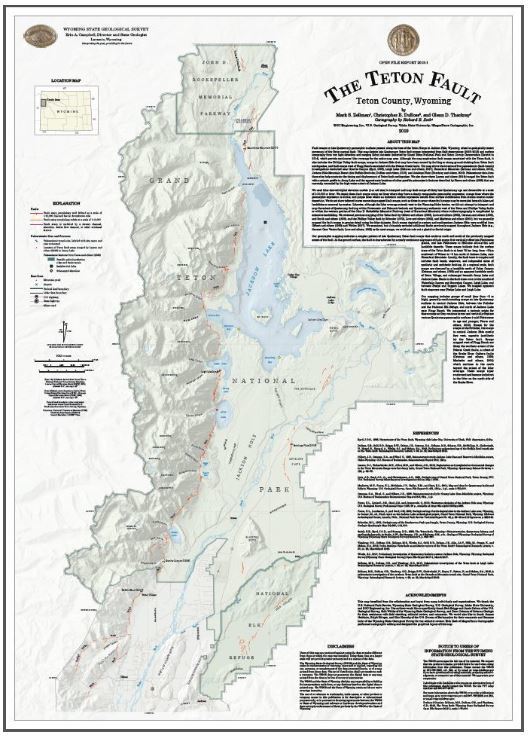
The Teton fault is a potential source of large earthquakes, and through a new mapping project, geologists have a better understanding of the potential geologic hazards associated with the fault in northwestern Wyoming.
The map is the result of a collaborative effort involving state, federal, academic, and consulting geologists. It is also the most detailed mapping ever completed across the length of the fault, which spans the eastern base of the Teton Range.
The Teton fault is one of the fastest moving faults in the interior United States. While it has not moved for thousands of years, prominent scarps and evidence from young faulting observed in trenches show the fault has moved during multiple large earthquakes since the glaciers retreated approximately 14,000 to 15,000 years ago.
Map authors Mark S. Zellman (BGC Engineering Inc.), Christopher B. DuRoss (U.S. Geological Survey), and Glenn D. Thackray (Idaho State University) used high-resolution remote sensing data called light detection and ranging (LiDAR) to create a detailed image of the ground surface and map the fault.
The map is available as a free download and for purchase as a printed version. For more information about the map, see the news release.
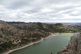
A new WSGS information pamphlet highlights the geology in Guernsey State Park along the North Platte River in eastern Wyoming. The pamphlet is the third in a series about geology in Wyoming’s state parks.
Guernsey State Park is just north of the town of Guernsey and home to Guernsey Reservoir. Bluffs of limestone and sandstone rise above the eastern half of the reservoir and along the North Platte River. These bluffs offer excellent exposure of interesting geologic features. For example, the geologic unconformity between the Hartville and Guernsey formations is a spectacular example of well-developed karst topography infilled with sediment.
The park is within the Hartville Uplift, where outcrops of rocks dating back to the Precambrian showcase more than 2.5 billion years of Earth’s history. This region has a rich mining history and is one of the oldest mining sites in North America.
Information pamphlets are also available for Curt Gowdy and Seminoe state parks, both in southern Wyoming. Pamphlets are currently in production for Keyhole, Bear River, Glendo, and Edness K. state parks.
Pamphlets are free and are available at the parks’ visitor centers, at the WSGS office on the University of Wyoming campus in Laramie, and as free downloads from the WSGS’ website.
|
Three new faces recently joined the staff at the WSGS, each bringing a diverse set of skills and wealth of knowledge that will contribute toward better understanding Wyoming’s geology.
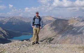
Geologist James Mauch has lived in the Rocky Mountains his entire life. He’s called Colorado, Montana, and Utah home, and says it is not surprising that he eventually found his way to Wyoming.
“I’m drawn to Wyoming by its wide open spaces, diverse landscapes, abundant public lands, and friendly people,” he says.
He holds two degrees—a bachelor’s in earth sciences-geology from Montana State University and a master’s in geology from Utah State University.
At the WSGS, Mauch is working in geologic hazards and surficial geology. His duties include creating and updating geologic hazard maps, mapping surficial geology for the StateMap program, and producing general geology reports for both a technical audience and the public. His current projects include information pamphlets in the state parks series. He’s also preparing for the summer field season, where he will be mapping two surficial geology quadrangles in the Little Greys River drainage for the StateMap program.
“I enjoy working with such a welcoming and professional group of people who are enthusiastic about geology and the state of Wyoming,” Mauch says. “I look forward to working on projects to better characterize and inform the public about the state’s geologic hazards, and I’m excited to contribute to the WSGS’ broader mission of working in the interest of the people of Wyoming.”
|
Geologist Patty Webber also grew up in the Rockies and has always wanted to know more about the mountains’ history, including how they formed. That curiosity led her to taking a high school geology class.
“I love that studying geology allows us to investigate the clues left behind to try to unravel a puzzle billions of years old,” Webber says.
Webber holds a bachelor’s degree in geology and geophysics from Purdue University and a master’s degree from the University of Iowa. She worked at the WSGS in summer 2018 as a contractor for the agency’s StateMap program. Afterward, she stayed in Wyoming because she wanted the opportunity to continue studying the state’s geology and landscapes.
“Wyoming has a lot to offer in terms of geology and recreation, so I’m happy to be able to call it home,” she adds.
Webber’s responsibilities at the WSGS include StateMap, thegeochronology map/database update, the Precambrian basement map project, and assisting in production of maps, among other duties. This summer, she will be in the field helping map the Firehole Canyon quadrangles in southwestern Wyoming.
“I’m looking forward to getting out and exploring more of Wyoming and continuing to learn as much as I can about its incredible geology,” Webber says. “I am really excited for the chance to work for the WSGS—it’s great working with people who are so passionate about geology and doing some really interesting work for the benefit of the state.”
|
Austin Heller is the newest member of the administration team. His duties include maintaining the office and making certain everyone has the tools and supplies they need to do the best science they can.
In addition to his stellar administrative skills, Heller is a geologist with a bachelor’s degree in geology and geophysics. His background allows him to assist staff in more ways than office support.
“For a long time I wanted to study linguistics, but once I found out I could pursue an education in how my favorite places formed, I was hooked,” he says. “Learning the story of how landscapes came to be is an enriching experience for me.”
Heller moved to Wyoming to attend the University of Wyoming. “I stayed because I love the lifestyle Wyoming allows me to live,” he explains. “The access to nearly every form of recreation makes it easy to stay.”
Since joining the WSGS, Heller says he has found that he especially appreciates being part of a “dedicated and driven team that does important work that I find interesting.”
|
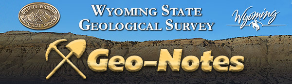
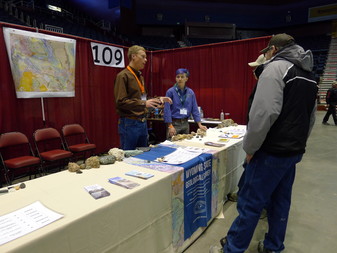
The WSGS attended the 2019 Wyoming Outdoor Expo May 9–11 in Casper. Staff led elementary students in activities about some of the state's minerals and rocks, demonstrated how geologists use microscopes to view thin sections, and shared information about some of the agency's work.
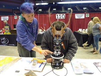
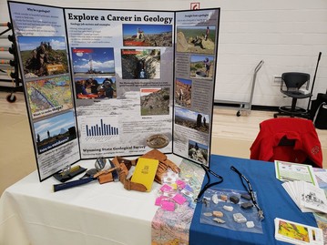
The WSGS led an aquifer workshop for high school students who attended the STEM (Science Technology Engineering and Mathematics) conference May 14 in Riverton. Students also explored a career in geology at the WSGS booth, which provided a snapshot of what it's like to be a geologist.
|