|
The Wyoming State Geological Survey (WSGS) recently investigated Codell Sandstone Oil Production trends in the northern portion of the Denver Basin in Laramie County, Wyoming, and found that proper application of drilling and completion technologies and practices appear to dictate the success of wells.
The Codell Sandstone has historically been considered uneconomical to produce because of its low porosity and permeability. With recent advances in horizontal drilling and hydraulic fracturing methods, however, the unconventional "tight" sand has proved to be an economically productive oil reservoir under the right conditions.
Nearly 120 horizontal wells operated by six companies have produced from the sandstone since 2012. The report examines characteristics associated with the highest producing of those wells.
The goal of this investigation is to provide a better understanding of operational best practices that in turn can help industry and regulators in optimizing oil production from the Codell Sandstone in the northern Denver Basin in Wyoming. The WSGS is performing similar analyses on additional unconventional plays in the Powder River and northern Denver basins to determine the influence that completion techniques and geology have on production.
The report, "Codell Sandstone Oil Production Trends, Northern Denver Basin, Laramie County, Wyoming," is available as a free download, and is accompanied by an Excel spreadsheet containing all well drilling, completion and production data used in the study. More information about the report can be found in the news release.
 Wyoming is peppered with state parks. Eleven in fact. They may be a traveler’s final destination or a stop along the way. A major draw to these parks is the geology.
To enhance your visit to these sites, the WSGS is publishing public information circulars about each park’s geology. The publications are part of a new WSGS Geology of State Parks program.
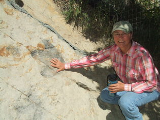
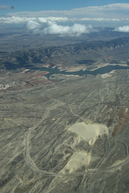
All state parks will be reviewed, but geologists will begin with Curt Gowdy in the southeastern corner, Boysen in the central part of the state and Seminoe in south-central Wyoming (seen in photo at top right). Other parks are Bear River, Buffalo Bill, Edness K. Wilkins, Glendo, Guernsey, Hot Springs, Keyhole and Sinks Canyon.
|
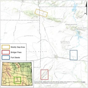
Work has started on several mapping projects in southeastern and south-central Wyoming. The maps will be published under the National Cooperative Geologic Mapping Program – State Geologic Survey Mapping Component, commonly referred to as StateMap.
The first set of mapping projects will be two bedrock geologic maps of the Fort Steele 7.5’ quadrangle and Bridger Pass 7.5’ quadrangle in Carbon County, and a preliminary surficial geology map of the Muddy Gap area in Fremont and Carbon counties.
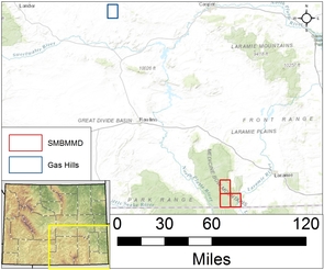
The second set involves preliminary geologic maps of the Albany, Foxpark and Woods Landing 7.5’ quadrangles in the Southern Medicine Bow Mountains Mining District in Albany County, and a preliminary geologic map of the Gas Hills 7.5’ quadrangle in Fremont and Natrona counties.
Devils Tower. Fossil Butte. Vedauwoo. These are just a few of the locations you can learn about the geology with the new digital 'Story Map' on the WSGS website. The online map is designed to provide a few facts and photos of eight sites. There's also information about the state's museums and other areas with interesting geology, including within the path of the Aug. 21 total solar eclipse.
|