|
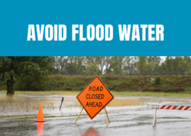
In Wisconsin, flooding is the most frequent and costly natural disaster. Flooding can be caused by periods of heavy rain in a short amount of time, large amounts of precipitation, rising levels in lakes and streams, concentrated overland flow, broken water mains, blocked drainage systems, rapid snow melt (particularly when the ground is still frozen) and ice jams. Flood insurance is the primary way to protect the investment made in your home or business from flooding, even if the property is located in a low-risk area adjacent to or outside of the federally mapped floodplain (also called special flood hazard areas, or SFHAs).
Here are some flood insurance facts:
-
Nationally, on average, 40% of NFIP flood insurance claims come from property owners outside of SFHAs. Based on data from the Southeastern Wisconsin storm event in August 2025, 98% of the federal individual assistance claims were from outside of the SFHAs.
-
Most homeowner insurance policies do not cover flood damage. Flood damage to a home or business can easily total $25,000 or more. Flood insurance is a separate and distinct policy from homeowner’s insurance.
-
Most renter insurance policies alone do not cover loss of contents due to flood damage, but a flood insurance contents policy will.
-
Federal flood insurance is available for properties located inside and outside designated SFHAs.
-
Flood insurance provides broader financial protection than FEMA Disaster assistance and a presidential disaster declaration is not required to file an insurance claim.
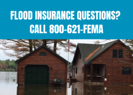
Homeowners and renters interested in purchasing flood insurance to help protect their homes and personal property are encouraged to contact their local insurance agent to ask whether flood insurance policies are available. If a local insurance agent does not offer federal or private flood insurance, additional information about how to obtain a federal policy is available at floodsmart.gov.
Most NFIP policies include a standard 30-day waiting period before coverage begins, so residents should factor this into their decision to purchase a policy and contact their agent well ahead of the spring and summer– when flooding most commonly occurs in Wisconsin. When flood insurance is acquired at the time of a home purchase, the policy is effective immediately.
Property owners in SFHAs who have mortgages from federally regulated lenders are required to carry flood insurance. Those who are not required to have coverage may still want to review their individual flood risk when considering whether or not to purchase a flood insurance policy. A home or business owner can ask their local zoning administrator if their structure is in or adjacent to an SFHA or they can go to FEMAs Flood Map Service Center, type in their address into the search box and see for themselves if the property of interest is in or adjacent to a SFHA. Flood risk can be evaluated by asking the following questions:
-
Is the structure in an SFHA?
-
Is the property adjacent to an SFHA?
-
What is the flooding history of the property?
What does flood insurance cover?
An NFIP flood insurance policy covers direct physical damage to your home from overland flooding (i.e., building coverage) and can cover your belongings (i.e., contents coverage) if this option has been selected. It is typical for property owners to only get building coverage, which is the minimum coverage required by lenders.
What does building coverage include?
Building coverage is also referred to as home and business coverage and includes the following items:
-
Electrical and plumbing systems
-
Furnaces and water heaters
-
Refrigerators, stoves and built-in appliances like dishwashers
-
Permanently installed carpeting
-
Permanently installed cabinets, paneling and bookcases
-
Foundation walls, anchorage systems and staircases
-
Fuel tanks, well water tanks and pumps and solar energy equipment
What does contents coverage include?
Contents coverage is also referred to as belongings coverage. This type of coverage is optional and needs to be added to a building coverage policy. Building coverage and contents coverage are typically purchased separately and have separate deductibles. Contents coverage includes items like:
-
Clothing, furniture and electronic equipment
-
Portable and window air conditioners
-
Carpet installed over wood floors
-
Valuable items such as original artwork and furs (up to $2,500)
-
Merchandise and raw materials held in storage or for sale (for business owners)
What are ways to reduce a flood insurance premium?
The cost of flood insurance can be pricy but consider these suggestions to reduce the flood insurance premium:
-
Get an elevation certificate – This certificate documents the elevation of the home and is used to compare the structure's elevation to the estimated base flood elevation. Proving the home is elevated above the current estimated base flood elevation can reduce insurance costs.
-
Elevate the structure – Raising the house above the base flood elevation can reduce the flood insurance premium.
-
Consider mitigation activities – Mitigation is the effort to reduce loss of life and property by lessening the impact of a flood. Flood mitigation reduces the overall risk of a structure experiencing flood damage and also reduces the severity of flood damage when it occurs. A mitigated structure will have lower flood insurance costs. Mitigation activities to consider include:
-
Elevate utilities – Move utilities like the air conditioner or water heater to a higher location (e.g., attic, extra closet, elevated platform) so they are less likely to be damaged in a flood. If utilities are above the base flood elevation insurance discounts may be available.
- Install flood openings – Add an opening or vent in a ground-floor crawlspace to let floodwaters flow through. This will reduce pressure on walls and may reduce insurance costs.
- Waterproof or fill in the basement – Homeowners with basements in high risk flood zones may pay 20% more for flood insurance, so filling in the basement could save money. Also, maintain a working sump pump and install a water alarm to protect the existing basement from damage.
- For information on flood mitigation options for your structure, contact your local zoning administrator or email DNRFloodplain@wisconsin.gov.
|
|
There are a few changes taking place at the Wisconsin Department of Natural Resources (DNR) related to viewing Geographic Information System (GIS) data layers that many communities, contractors and citizens use on a regular basis for floodplain, shoreland and other purposes. These updates are part of a project to utilize new data viewers, streamline existing data viewers and reduce financial costs. The DNR has scheduled changes to the Surface Water Data Viewer (SWDV) to be released in the coming weeks. Additionally, new layers have been added to a viewer called the Storm Water, Waterway and Wetland Permit Viewer (SW4P).
The most significant change for end users is that dams and floodplain layers will soon only be located on the SW4P viewer (commonly pronounced as “swap” viewer). It is also important to note that the Wisconsin Wetland Inventory (WWI) will remain on the SWDV as referenced in city and village Shoreland-Wetland Ordinances and county Shoreland Protection Ordinances.
How to Find Information within the SWDV and SW4P
The table below lists the information type and the corresponding layer and sublayer name, separated by >, for each viewer. Clicking the checkbox next to each layer and sublayer within the viewer, if present, will display the information. This is not an all-inclusive list, so please feel free to explore all the data available on these two viewers. As the viewers are updated, layer names and locations may change.
|
|
|
|
Wisconsin Wetland Inventory
|
Mapped Wetlands > Wisconsin Wetland Inventory (WWI)
|
Wisconsin Wetland Inventory (WWI)
|
Wetland Identifications and Confirmations
|
Mapped Wetlands > Wetland Identifications and Confirmations
|
Surface Water Permits > Wetland Identifications and Confirmations
|
Waterway and Wetland Permits and Alterations
|
Mapped Wetlands > Waterway and Wetland Alterations
|
Surface Water Permits > Waterway and Wetland Alterations
|
Ordinary High Water Mark and Navigability Determinations
|
Outfalls & Determinations > Ordinary High Water Mark Determinations and Navigability Determinations
|
Surface Water Permits > Ordinary High Water Mark Determinations and Navigability Determinations
|
|
|
|
|
Color LiDAR Elevations and Contours
|
|
LiDAR-based Elevation and Contours
|
Additionally, the SW4P now includes the option to add the FEMA National Flood Hazard Layer (NFHL). To add this layer within SW4P, select the “Dams and Floodplains” tab in the header row and then select “Add FEMA NFHL Layers.”
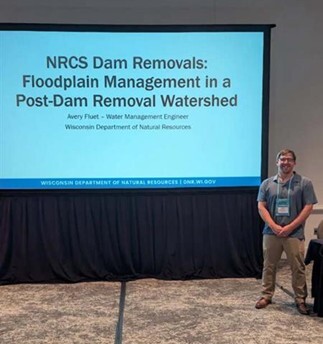
The Wisconsin Association of Floodplain, Stormwater, and Coastal Managers (WAFSCM) hosted the 2026 Association of State Floodplain Managers (ASFPM) National Conference at the Baird Center in Milwaukee from May 31 – June 4, 2026. Session topics included mitigation, modeling, mapping, National Flood Insurance Program, dams and levees, risk communication, extreme weather trends, natural and beneficial functions and a whole community approach to floodplain management. Wisconsin DNR staff gave presentations on the Greater Milwaukee Area Flooding of 2025, NRCS Dam Removals: Floodplain Management in a Post-Dam Removal Watershed, and When Higher Standards Become the Baseline: Floodplain Management in Wisconsin.
The ASFPM Welcome Fest featured a guest appearance by the Milwaukee Brewers Famous Racing Sausages.
Avery Fluet, Wisconsin DNR Water Management Engineer, presented on NRCS Dam Removals: Floodplain Management in a Post-Dam Removal Watershed.
Thank you to all the attendees and presenters and to ASFPM for hosting a successful conference. Next year's ASFPM conference will be held in Pittsburgh, Pennsylvania from May 23-27, 2027. There will be no WAFSCM conference in 2026, as they were the host chapter for the national conference.
Risk MAP is a FEMA-led process, facilitated by the Wisconsin DNR and used to update or create FIRMs. The FIRMs and other datasets created during this process are used to help move communities toward flood resilience. Flood risk datasets work alongside regulatory products (FIRMs and the FIS) to provide flood risk information and support the community's floodplain management and hazard mitigation strategies.
There are several key meetings and milestones that occur throughout the Risk MAP project lifecycle, which are listed below. To learn more about each of these steps please visit FEMA’s Lifecycle of a RiskMAP Project webpage.

-
Discovery: FEMA and the RiskMAP project team meet with representatives from the communities to gather information on local flood risk priorities and any available data.
-
Project Kickoff Meeting: The RiskMAP project team may hold this meeting to introduce communities to project specifics and scope of work prior to data development.
-
Data Development: If a study is funded, hydrologic and hydraulic modeling is completed and the latest LiDAR topographic data is acquired for mapping.
-
Flood Risk Review (FRR) and Resilience Meetings: When data development is finished, draft flood hazard data is presented to the communities for review and any non-regulatory products (e.g., flood depth and analysis girds, changes since last FIRM, and/or areas of mitigation interest) that were created are also made available.
-
Preliminary Flood Map Release: Once preliminary products (FIRMs and the FIS) have been released, they can be viewed at FEMAs Map Service Center by selecting the appropriate county and community from the jurisdiction menu.
-
Consultation Coordination Officer (CCO) Meeting and Public Open House: After preliminary release, the CCO meeting presents the new mapping to local officials, followed by an open house for the public to view the changes.
-
90-Day Comment and Appeal Period: Following two public notices in a local newspaper, this 90-day period allows the opportunity for comments and appeals to be submitted on the updated maps. Appeals must meet standard requirements, and any submissions should be routed through community zoning administrators prior to review.
-
The Letter of Final Determination (LFD) and Effective Date: FEMA sends the LFD letter to the community’s chief executive officer stating that the final notice of flood hazard determinations will be published in the Federal Register and the new or updated FIRMs and FIS will soon reach effective status. The receipt of this letter starts the 6-month adoption phase of the process. This is where communities need to update their floodplain ordinances to incorporate the updated FIRMs and FIS by the federal effective date to remain in good standing in the National Flood Insurance Program (NFIP). Currently, most communities also update their floodplain zoning ordinance language so that the current regulations meet state and federal minimum standards. DNR floodplain staff can set up a draft floodplain zoning ordinance for the community to review. This assistance is provided by the DNR, to communities, free of charge. If you are interested, please email DNRFloodplain@Wisconsin.gov .
RiskMAP Project Timeline Dates
The table below details the timing of the Risk Mapping Meetings and anticipated Letter of Final Determination start dates for upcoming projects.
|
|
|
|
Flood Risk Review & Resilience Meeting
|
|
|
|
|
|
|
|
|
|
|
|
|
|
Monroe County (Kickapoo Watershed)
|
|
|
|
|
|
|
|
Vernon County (Kickapoo Watershed)
|
|
|
|
|
|
|
|
Richland County (Kickapoo Watershed)
|
|
|
|
|
|
|
|
Crawford County (Kickapoo Watershed)
|
|
|
|
|
|
|
|
|
|
|
|
|
|
|
|
|
|
|
|
|
|
|
|
|
|
|
|
|
|
|
|
|
|
|
|
|
|
|
|
|
|
|
|
|
|
|
|
|
|
|
|
|
|
|
|
|
|
|
|
|
|
|
|
|
|
|
|
|
|
|
Wolf Watershed
(Outagamie & Waupaca County)
|
|
|
|
|
|
|
|
|
|
|
|
|
|
|
|
|
Trempealeau Watershed (Buffalo, Jackson, and Trempealeau Counties)
|
|
|
|
|
|
|
|
|
|
|
|
|
|
|
|
|
* – Dates are subject to change
N/A – projects with mapping needs previously identified or projects initiated by communities may follow a variation of the typical RiskMAP project timeline.
Projects with Discovery dates yet to be determined include Menominee County and Stockbridge Munsee (Shawano County). The remainder of the steps for these projects are not yet funded.
|
|
|
About The Wisconsin Floodplain Management Program
The Program's goals are to protect life, health and property; to minimize costs for flood control projects; to reduce tax dollars spent for rescue, relief and repair of flood damage; to shorten business interruptions caused by flooding; to prevent future flood blight areas; to discourage victimization of unwary land and home buyers; and to prevent increased flood levels caused by unwise floodplain development. Municipalities (counties, cities and villages) implement the statewide floodplain standards under Chapter NR 116, Wis. Adm. Code.
About The Wisconsin Shoreland Management Program
The goals of the Shoreland Zoning Program are to protect water quality, fish and wildlife habitat, recreation and natural beauty. Counties implement the statewide shoreland zoning standards under Chapter NR 115, Wis. Adm. Code. The standards apply only to unincorporated land that is within 1,000 feet of the ordinary high water mark of a lake, pond or flowage, within 300 feet of the ordinary high water mark of a river or stream or to the landward side of the floodplain, whichever distance is greater.
Contact Us
Floodplain: Sarah (Rafajko) Galster, Sarah.Galster@wisconsin.gov
Shoreland: Sue Vanden Langenberg, Susan.VandenLangenberg@wisconsin.gov
Dam Safety: Uriah Monday, Uriah.Monday@wisconsin.gov
|
|
|
Floodplain and Shoreland Management Notes is published by the Wisconsin Department of Natural Resources' Waterways Bureau. The purpose of the newsletter is to inform local zoning officials and others concerned about state and federal floodplain management, flood insurance, shoreland and wetland management, and dam safety issues. Comments or contributions are welcome. Please send comments to DNRFloodplain@wisconsin.gov.
This newsletter is supported by funding through the FEMA Cooperative Agreement as part of the Community Assistance Program-State Support Services Element of the National Flood Insurance Program. The contents do not necessarily reflect the views and policies of the federal government.
|
|
|
|
|