This content is based on DNR Publication WT-821 2012 updated in 2021, written by Lynn Markham and Kate Demorest, Center for Land Use Education.
The following list describes a range of practices that can be done to protect your property investment. Before beginning projects on your waterfront property or in the nearshore area, it is important to check local and state permitting requirements. Call your local county zoning office to inquire about projects at the ordinary high water mark and landward. For projects occurring in a waterbody, review the Wisconsin DNR’s frequently asked questions.
Practice 1: Build Far From The Shore
Locate all new buildings, additions, and septic systems far from the shore to ensure they will be on stable ground over the long term. Building, rebuilding, or expanding buildings close to the shore could become a poor investment due to changing water levels, collapsing banks, and rivers that move to new locations over time. Septic systems should also be located far from the water, so they do not leach into a nearby lake or stream. If you own a structure close to the water, consider purchasing flood insurance even if the structure is not located in a regulated floodplain.
Practice 2: Minimize The Hard Surfaces On Your Property
Runoff from hard (impervious) surfaces like rooftops and driveways can carry sediment, nutrients, and other pollutants into lakes and streams which can impact the populations of many fish species, including walleye, bass, northern pike, perch, and crappies.
- Nutrients promote growth of algae and aquatic plants. When the plants and algae die and decompose, they use up oxygen, which fish need to survive.
- Sediment and algae growth make it difficult for some predator species that hunt by sight to find food.
- Sediment can cover spawning beds of fish, such as smallmouth bass and walleye, and impact reproduction.
Practice 3: Minimize Erosion During Construction
During construction there are more opportunities for exposed soil to wash into nearby lakes or streams. When you’re planning a construction project, follow these steps to protect waterbodies nearby:
- Minimize hard surfaces and divert runoff around disturbed areas to minimize erosion.
- Develop a proper erosion control plan.
- Limit clearing and grading, especially on slopes that drain to the shoreline.
- Fence the area to be cleared to limit construction damage.
- After construction, establish vegetation right away.
Practice 4: Minimize Fertilizer Use
Only add fertilizer to your lawn if a soil test shows your soils are short on nutrients—most lawns aren’t. If your soil is short on nutrients, avoid fertilizers that contain phosphorus. Remember, it’s phosphorus that accelerates algae growth in lakes and streams.
Practice 5: Inspect And Maintain Your Septic System Regularly
Most waterfront homeowners in Wisconsin utilize a septic system, although some densely developed lakes have converted to public sanitary sewer systems. Owners of private septic systems have a responsibility to protect their family’s health as well as to protect the surface and groundwater from contamination. Properly functioning systems are designed to remove most disease-causing human pathogens but generally are NOT designed to remove or treat water-soluble nutrients or pollutants. The more water and material that goes into your septic system, more comes out into your drain field. Research on septic systems located in sandy soils in Wisconsin shows that both phosphorus and nitrates migrate underground over 150 feet from drain fields. If these seeping nutrients reach a nearby lake, they can contribute to aquatic plant growth and algae blooms. There are several activities you can implement in order to protect your septic system, such as inspecting your system every three years or avoiding driving and parking on the drain field to prevent compaction of the soil. Videos released by the EPA, "Don't Overload the Commode" and “Think at the Sink” explain how to be mindful in your home to protect your septic system.
Practice 6: Reduce Use Of Hazardous Chemicals And Safely Dispose
Reduce your use of hazardous chemicals; if you wouldn’t drink it, don’t dump it. If these chemicals are applied to the ground, they can end up in our drinking water, lakes, and streams. To dispose of these chemicals safely, search by product type or look up your county’s clean sweep schedule.
Practice 7: Protect Your Natural Areas
Natural shorelands contain a lush mixture of native grasses, flowers, shrubs, and trees that help to reduce and filter polluted runoff and provide important habitat for songbirds and other animals on the land and in the water. In contrast, lawns provide habitat for geese, which can become a nuisance and create runoff laden with sediments, pollutants, and nutrients. The trees, shrubs, and plants in natural shorelands not only create privacy for both the homeowner and the lake user but may also act as a noise buffer. If possible, larger natural areas provide more benefits; however, any amount of natural area is better than none.
Practice 8: Restore Your Shoreland Buffer And In-Water Habitat
If you have native vegetation along your shoreline, consider yourself fortunate. A mature native buffer represents many years of natural processes at work and discourages undesirable, non-native plants and animals while attracting songbirds, butterflies, turtles, and frogs.
If you have lawn to the water’s edge, a simple, no-cost way to get started in restoring your shoreland is to stop mowing next to the water. Seeds in the soil will germinate and valuable native plants will begin to reappear. If you would like to play a more active role in restoring your shoreline, visit Wisconsin Healthy Lakes & Rivers to learn more about different ways to take action.
Finally, leave fallen trees and branches in the water or intentionally add woody habitat (i.e., complete Fish Stick Projects. When trees and branches fall into the water, they form critical habitat for tiny aquatic organisms that feed bluegills, young game fish, turtles, crayfish, and other critters. Smallmouth and largemouth bass spawn near fallen trees. When game fish first hatch from their eggs, they are less than an inch long and use fallen trees and aquatic plants in the water as cover to survive.
Practice 9: Install An Infiltration Area
A rock infiltration area is an excavated pit or trench filled with rock that provides space for runoff to soak into the ground slowly. It is appropriate for sandy to loamy soils only, not clay! Rain gardens are a better option to infiltrate water in clay soils.
Practice 10: Build A Rain Garden
Rain Gardens: A Guide for Homeowners and Landscapers provides easy-to-follow instructions to create a rain garden, including guidance on size, location, and maintenance. Rain barrels can be helpful for watering plants but typically hold much less water than an infiltration area or a rain garden. Direct downspouts into your rain garden, natural areas, lawn, or rain barrels, not onto hard surfaces.
|
DNR will be offering a regional floodplain training to local officials for all Village, City and County floodplain managers in the West Central Region. The training will be held in Eau Claire and will include the following floodplain topics:
- Ordinances
- Mapping
- Permitting
- Violations & Enforcement
- CAV Overview
- Post Disaster Actions
- Mitigation Funding
- NFIP & Private Insurance
More information will be sent in the coming months through GovDelivery. Note, if you get this newsletter, then you will receive the training announcement. If you do not receive this newsletter directly, you can get it by subscribing to the “floodplains” GovDelivery list.
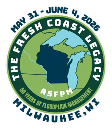
The Wisconsin Association of Floodplain, Stormwater, and Coastal Managers (WAFSCM) is hosting the 2026 Association of State Floodplain Managers (ASFPM) National Conference at the Baird Center in Milwaukee from May 31 – June 4, 2026. Floodplain Managers from the host state (Village/City/County Government & Tribal Officials) are eligible to apply for a scholarship to attend the 2026 ASFPM National Conference.
This scholarship will cover the registration fee for early conference registration. There will be 34 scholarships available for award to state community floodplain managers. These scholarships are funded by the Federal Emergency Management Agency (FEMA) through the Community Assistance Program - State Support Services Element (CAP-SSSE) grant received by the Wisconsin Department of Natural Resources.
Workshops and field tours, overnight accommodations, travel, and other expenses will not be covered by the scholarship and will be the responsibility of the recipient or their agency. Applications in excess of the available scholarships will be added to a waitlist and notified if a scholarship becomes available.
The scholarship application period is now open. Applications should be submitted no later than Jan. 16, 2026.
Scholarship criteria include:
- Be a Village/City/County Government or Tribal Official performing floodplain management duties within the state of Wisconsin.
- Attend the full conference (Tuesday, June 2 – Thursday, June 4, 2026).
- Volunteer at the conference for at least 4 hours. Volunteer positions range from room monitoring, checking badges, etc. No heavy lifting will be required.
- Complete and return the Scholarship Application by the specified deadline.
Membership in WAFSCM or ASFPM is not necessary to apply for and/or receive a scholarship and will not be a factor in choosing successful applicants. Twelve (12) Continuing Education Credits (CECs) toward Certified Floodplain Manager (CFM) accreditation are available for attendance at this conference.
Notification of scholarships will be provided by Feb. 2, 2026, and a special scholarship code will be provided for awardees prior to registration. Do not complete ASFPM’s online conference registration until you receive the scholarship code if you are awarded.
Those NOT receiving a scholarship will still have time to register at the early discount rate between February and April 2026.
2026 ASFPM National Conference information can be found online.
|
The previous newsletter article referenced record river crests, including the Milwaukee River at Estabrook Park. This statement was based on preliminary values that are still under review, see the USGS gauge website.
RiskMAP is a FEMA-led process, facilitated by the Wisconsin DNR and used to update or create flood insurance rate maps (FIRMs). The FIRMs and other datasets created during this process are used to help move communities toward flood resiliency. Flood risk datasets work alongside regulatory products to provide flood risk information and support the community's floodplain management and hazard mitigation strategies. DNR Floodplain engineers and GIS mapping staff often play a crucial role in the development of RiskMAP projects. To see a list of current RiskMAP Projects, visit the website.
 There are several key meetings and milestones that occur throughout the RiskMAP project lifecycle, which can take 3-5 years to complete.
-
Discovery Period – This is the first phase of the RiskMAP lifecycle with the goal of identifying risk. FEMA, state and local leaders will collect and review flood risk data and use this information to gather a complete picture of a community’s flood risk. Discovery helps determine whether a RiskMAP project is needed and what the scope of the project will be. Community officials within the project area play a critical role, as they provide feedback and details on specific flood risk challenges and concerns. This phase happens in the first year of the project.
-
Project Kickoff Meeting – This meeting introduces communities to project specifics and scope of work prior to data development. Desired input from community officials is discussed.
-
Flood Risk Review (FRR) And Resilience Meetings – These meetings are part of the analysis and mapping phase after data development has been completed. The purpose of the FRR meeting is to provide an overview of the engineering analyses, present draft work maps and datas, and collect feedback from community officials. During the Resilience meeting, the project team presents additional non-regulatory products, which can be used to aid in developing mitigation strategies and contribute to a better overall understanding of flood risk. This can help communities plan for the future by discussing factors that contribute to flooding in project areas, as well as identifying ways to reduce the risk. Following the completion of draft mapping, it can take approximately 6-12 months to reach the preliminary map status.
-
Preliminary Flood Map Release – Once preliminary products have been released, they can be viewed at FEMAs Map Service Center by selecting the appropriate county and community from the jurisdiction menu. After preliminary release, there’s typically another 12-18 months before the maps will reach effective status.
-
Consultation Coordination Officer (CCO) Meeting And Public Open House – The CCO meeting is sponsored by FEMA with presentations by the state of Wisconsin floodplain mapping staff. The purpose is to present the preliminary FIRMs and FIS report and gather feedback on the products from local officials. Following the CCO meeting, a Public Open House provides citizens the opportunity to view maps, ask questions, learn about local flood risks and resources available to reduce risk. Local communities are urged to promote the Public Open House so citizens are aware of the proposed map changes. The CCO meeting and Open House are typically scheduled a month or two after the preliminary map release.
-
90-Day Comment And Appeal Period – Following two public notices in a local newspaper, this 90-day period allows the opportunity for comments and appeals to be submitted on the updated maps. Appeals must meet standard requirements, and any submissions should be routed through community zoning administrators prior to review.
Additional details on the steps throughout the RiskMap process are available on FEMA’s website.
Letter of Final Determination (LFD) and effective date are milestones in a flood risk project. The Letter of Final Determination is sent to the community executive stating that the final notice of flood hazard determinations will be published in the Federal Register and new or updated flood insurance rate maps will soon reach effective status. The receipt of this letter starts the 6-month adoption phase of the process. This is where communities need to update their floodplain ordinances to incorporate the updated maps and FIS, by the federal effective date to remain in good standing in the National Flood Insurance Program (NFIP). Currently, most communities also update their floodplain zoning ordinance language so that the current regulations meet state and federal minimum standards. DNR floodplain staff can set up a draft floodplain zoning ordinance for the community to review. Our assistance is provided to communities free of charge. If you are interested, please get in touch with DNR at DNRFloodplain@Wisconsin.gov.
The table below details the timing of the Risk Mapping Meetings and anticipated Letter of Final Determination start dates for upcoming projects.
|
Project
|
Discovery
|
Project Kickoff Meeting
|
Flood Risk Review And Resilience Meeting
|
Preliminary Maps
|
CCO Meeting/ Open House
|
90-Day Appeal Period
|
LFD Start
|
|
Washington County
(Milwaukee Watershed)
|
May 16, 2013
|
N/A
|
Aug. 28, 2019
|
March 20, 2024
|
May 2, 2024
|
Sept. 27-Dec. 26, 2024
|
Aug. 20, 2025
|
|
Langlade County
|
N/A
|
April 29, 2020
|
April 14, 2023
|
April 30, 2024
|
May 29, 2024
|
Sept. 13-Dec. 12, 2024
|
Sept. 17, 2025
|
|
Douglas County
|
N/A
|
March 20, 2020
|
Jan. 25, 2023
|
Dec. 2, 2024
|
Jan. 23, 2025
|
Aug. 1 – Oct. 30, 2025
|
TBD
|
|
Monroe County (Kickapoo Watershed)
|
March 26, 2018
|
Oct. 5, 2021
|
June 5, 2024
|
Oct. 7, 2025
|
TBD
|
TBD
|
TBD
|
|
Vernon County
(Kickapoo Watershed)
|
March 26, 2018
|
Jan. 13, 2022
|
Jan. 11, 2024
|
April 30, 2025
|
July 31, 2025
|
TBD
|
TBD
|
|
Richland County (Kickapoo Watershed)
|
March 26, 2018
|
Jan. 13, 2022
|
Jan. 11, 2024
|
Jan. 31, 2025
|
March 18, 2025
|
Sept. 18 – Dec. 17, 2025
|
TBD
|
|
Crawford County (Kickapoo Watershed)
|
March 26, 2018
|
Jan. 13, 2022
|
Jan. 11, 2024
|
May 15, 2025
|
Aug. 5, 2025
|
TBD
|
TBD
|
|
Bayfield County
|
N/A
|
March 19, 2020
|
Aug. 22, 2024
|
July 31, 2025
|
TBD
|
TBD
|
TBD
|
|
Chippewa County
|
N/A
|
Dec. 7 2022
|
May 1, 2025
|
April 15, 2026
|
TBD
|
TBD
|
TBD
|
|
St. Croix County
|
N/A
|
Sept. 29, 2025
|
TBD
|
TBD
|
TBD
|
TBD
|
TBD
|
|
Outagamie County (Wolf Watershed)
|
N/A
|
Oct. 10, 2023
|
TBD
|
TBD
|
TBD
|
TBD
|
TBD
|
|
Waupaca County (Wolf Watershed)
|
N/A
|
Oct. 10, 2023
|
TBD
|
TBD
|
TBD
|
TBD
|
TBD
|
|
Polk County
|
N/A
|
Dec. 7, 2022
|
TBD
|
TBD
|
TBD
|
TBD
|
TBD
|
|
Trempealeau Watershed (Buffalo, Jackson, Trempealeau Counties)
|
TBD
|
N/A
|
N/A
|
N/A
|
N/A
|
N/A
|
N/A
|
|
Menominee County
|
TBD
|
N/A
|
N/A
|
N/A
|
N/A
|
N/A
|
N/A
|
|
Stockbridge Munsee (Shawano County)
|
TBD
|
N/A
|
N/A
|
N/A
|
N/A
|
N/A
|
N/A
|
* – Dates are subject to change
Bolded dates highlight what is happening next.
N/A – projects with mapping needs previously identified or projects initiated by communities may follow a variation of the typical RiskMAP project timeline
|