The Wisconsin Dept. of Natural Resources Surface Water Grants Story Map brings grants to life across the state.
WDNR is pleased to announce the Water Quality Program's Lakes and Rivers Section, recently finished an online story map to provide detailed information to the public on the state's Rivers and Lakes Grant Program. This story map tool is an interactive tool created with ArcGIS Online that displays projects funded by the department's Surface Water Grant program in 2018. This story map is a great way to learn about projects funded statewide that protect and/or improve their favorite lake or river.
There are 211 projects located in 62 Wisconsin counties depicted on the map, representing $6.2 million dollars in local or regional funding to improve water quality, reduce runoff, create aquatic habitat, and target aquatic invasive species. This new interactive map, provides a visual representation of the work funded by the program's grant dollars. You can filter the map by grant type, county, and legislative area and find information about the department's grant funding programs and supported projects. Grant types include;
- Lake Planning
- Lake Protection
- River Planning
- River Management
- Healthy Lakes
- Aquatic Invasive Species Education, Prevention, and Planning
- Aquatic Invasive Species Control
- Aquatic Invasive Species Research and Demonstration
- Clean Boats, Clean Waters
- More information
Explore the story map and learn more about the Surface Water Grants Program.
Watershed Planning
Ozaukee and Washington Counties, MMSD, Sweet Water, SEWRPC and WDNR staff are collaborating to develop EPA compliant Nine-Key Element Watershed Plans for numerous HUC12 watersheds in the greater Milwaukee River watershed. The areas have been specifically targeted because they include numerous MS4 communities, WPDES permitted point sources, active county conservation initiatives, and farmer-led watershed groups that are actively working there. The watershed planning effort is funded by nonpoint source and GLRI grants using a combination of WDNR and EPA funding. The finished plans will address all of the nine-key elements and include information on the types and sources of NPS pollution, as well as possible areas where conservation measures and BMPs could most effectively be used to reduce NPS pollutant loading to receiving waters. Anticipated completion dates of the plans ranges from 2019 – 2020. The final plans will contain valuable information for communities that may be interested in pursuing watershed-based alternative permit compliance options such as Adaptive Management or Water Quality Trading. The specific HUC12 watersheds include;
- 040400030107 - North Branch Milwaukee River
- 040400030209 - Village of Newburg-Milwaukee River
- 040400030602 - Town of Freedonia-Milwaukee River
- 040400030603 - Village of Grafton-Milwaukee River
- 040400030604 - Milwaukee River-Frontal Lake Michigan
- 040400030301 - Town of Richfield – Cedar Creek
- 040400030302 - Cedar Lake - Cedar Creek
- 040400030303 - Jackson Marsh State Wildlife Area - Cedar Creek
- 040400030304 – Cedar Creek
For more information, contact Mark Riedel, WDNR TMDL Project Manager.

The University of Wisconsin-Extension in conjunction with UW-Madison Department of Soil Science will conduct Soil, Water and Nutrient Management Meetings to provide research updates in the field of soil management, fertility, and nutrient management. Presentations include:
- Cover crops and nutrient management
- Can we use soil health tests for fertilizer recommendations?
- Evaluating fall manure BMPs
- Sampling soils and plants in Wisconsin
- Soil compaction issues after a wet fall
- Wisconsin nutrient management update
Speakers include UW-Extension Soil Specialists Carrie Laboski, Matt Ruark and Francisco Arriaga; Andrew Stammer, Director of the Soil & Forage Analysis Laboratory; and Sue Porter, Wisconsin Department of Agriculture, Trade and Consumer Protection. The schedule for local meetings is:
- Monday, December 3: Juneau at Dodge County Admin Bldg., 127 Oak St. Contact: Laure Dei, UW-Extension Dodge County, Admin Bldg. 127 Oak St., Juneau, WI 53039; 920-386-3790.
- Tuesday, December 4: Kiel at Millhome Super Club, 3 miles East on Hwy. 57/31. Contact: Mike Ballweg, UW-Extension Sheboygan County, 5 University Dr., Sheboygan, WI 53081; 920-459-5904
Fore more information...
The National Cooperative Soil Survey Program is an endeavor of the USDA’s Natural Resources Conservation Service (NRCS) and other federal agencies, state and local governments, and other cooperators. It provides a systematic study of the soils in a given area, including the classification, mapping, and interpretation of the soils.
The entire Official Web Soil Survey Database (WSS) will be refreshed to ensure that updated official data is available in October of each year for use in implementing national programs affecting landowners and managers.
There is one new Wisconsin Interpretation:
-
Soil Suitability for Wild Lupine and Karner Blue Butterfly (WI) —The Karner blue butterfly (KBB) is a federally listed endangered species present in small patches across the North Central and North Eastern U.S. The KBB usually occupies open barrens, savannas, and prairies that contain wild lupine. This plant is widespread in Wisconsin’s central and northwest sands. The pale green caterpillar of the KBB feeds exclusively on the leaves of wild lupine.
|
Conservation groups, private landowners and government organizations are encouraged to apply for a share of $5.7 million from the Wisconsin Wetland Conservation Trust available to complete wetland mitigation projects. Proposals for the current round of funding are due Dec. 14, 2018 and can be used to cover all aspects of restoration including land purchases, site construction and long-term maintenance and monitoring.
With winter fast approaching, many pond owners are clearing out ornamental aquatic plants and animals before their ponds freeze over. But some plants, like water hyacinth, water lettuce and parrot feather, that can make a pond beautiful and healthy in the summer are non-native and highly invasive species and should not be thrown away into lakes, rivers or wetlands. The Wisconsin Department of Natural Resources urges pond owners to properly dispose of these aquatic invaders.
|
The Commission has prepared a draft regional transportation improvement program (TIP) listing all arterial highway, public transit, and other transportation improvement projects proposed to be carried out by State and local governments over the next four years (2019-2022) in the seven-county Southeastern Wisconsin Region. The TIP indicates the transportation system improvement priorities of State and local governments in Southeastern Wisconsin by their programming of projects to be undertaken in each of the next four years. The draft 2019-2022 TIP is available for review and comment through November 29, 2018.
The “Rain Gardens: A Guide for Homeowners and Landscapers” manual is being updated and will be replacing “Rain Gardens”. Stay tuned for updates and to obtain a copy as soon as it is completed.
Rain gardens, small, shallow areas filled with beautiful native plants, reduce polluted runoff from entering Wisconsin’s waters. Creating a rain garden is a great way for homeowners, schools, businesses, churches, and other organizations to help protect our lakes and streams. Rain garden plants capture 30% more water than a regular lawn and filter that water into the ground. This reduces the amount of water containing household fertilizers, pesticides, oils, and other contaminants coming from our roofs, lawns, driveways, or parking lots running into storm sewers. Rain gardens are also a delight to view and are a nice place for birds and butterflies to live.
The Wisconsin Department of Natural Resources invites you to help clean up our waters by building your own rain garden!
|
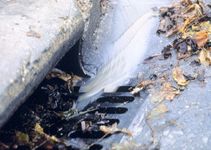
A copy of the 2018 Municipal Separate Storm Sewer (MS4) Annual Report PDF form has been added to the DNR Municipal storm water eReporting web page. Municipalities may use this PDF form to begin routing for information collection for calendar year 2018.
However, the online 2018 form is not yet available in the eReporting system. It is expected to be available December 2018. Please watch for more GovDelivery notifications for when the 2018 online form is available. If a municipality starts an online form before the 2018 form goes live, it is likely that they will have to start over with their report.
The annual report is due March 31, 2019. Data will be required to be entered into the online eReporting system. We will not accept an uploaded or emailed PDF. The PDF form is available only for information collection.
Please join CSWEA-Wisconsin Watershed and Stormwater Committee and Marquette University for a FREE Webinar offering examples of WEF, regulatory agencies, wastewater utilities, and counties leading efforts to address the water quality challenges our communities face. Advanced registration required. Register online by November 13 .
If you wish to participate in-person please meet at the Global Water Center, sixth floor (no advanced registration required, however space at the Global Water Center is limited to 30). Lunch is not provided; please bring your own. Info| Register
Mayor Barrett announced the City’s Green Infrastructure Plan Framework to add functional greenspace to Milwaukee streets, schools, and parking lots on September 26.
Development of the Green Infrastructure Plan Framework was a collaborative effort between the City’s Environmental Collaboration Office, Department of Public Works, Department of City Development, Milwaukee Metropolitan Sewerage District, UWM School of Freshwater Sciences, Milwaukee Public Schools, Green Schools Consortium of Milwaukee, Marquette University Water Law and Policy Initiative, Fund for Lake Michigan, Brico Fund, and other business and environmental stakeholders.
The Wisconsin Association for Floodplain, Stormwater, and Coastal Management (WAFSCM) is holding its 16th Annual Conference on November 7‐9 at the Ingleside Hotel in Pewaukee. We’re excited about this year’s lineup of workshops, speakers, and field tour. Professional Development Hours (PDHs) and Continuing Education Credits (CECs) can be earned at the workshops, main conference, and tour. Scholarship opportunities are available again this year.
NASECA-WI, a leader in erosion control and stormwater education, established a training program in 2010 to set baseline knowledge criteria for site workers who install and inspect erosion control practices on construction sites. Unlike most national training programs which provide just the basic principles of erosion control, this training program is Wisconsin-based and covers the principles of erosion and sediment control, as well as WisDNR, WisDOT, and DSPS rules, regulations, and standards.
Nov. 28-29, 2018, 8:00 am-4:30 pm
Location:
Metropolitan Builders Association
N16w23321 Stone Ridge Dr.
|
Introduced only a few years ago, Adaptive Management and Water Quality Trading continue to gain popularity among WPDES permit holders as a preferred alternative permit compliance option. While there are a number of reasons a facility or community may opt for one of these options, two of the leading reasons are;
- It is typically far more cost effective to reduce NPS pollutant sources compared to costly facility upgrades – often by two to three orders of magnitude (e.g. $50/lb of P in agriculture compared to $500 - $5,000 (or even more) for a plant upgrade), and
- Watershed-based permit compliance options provide water quality benefits UPSTREAM, so rate-payers will benefit from improved water quality. Conversely, a treatment plant upgrade only improves water quality downstream of the discharge point and the community.
If you are interested in learning more about these options, please contact your local WDNR Wastewater Staff or Mark Riedel (608-275-3471) the area AM and WQT Coordinator.
|
 This map depicts WPDES permit holders that have formally selected adaptive management or water quality trading as their preferred phosphorus compliance option. Click the map to visit the map to view more information about the permit holder, including the Notice of Intent (NOI) submitted to the DNR. Permittees identify themselves by submitting either a Notice of Intent to Trade or an Adaptive Management (AM) Request form to DNR. If you would like to be identified on this map in advance of form submittals contact Matt Claucherty.
|

Dec 10: Surface Water Planning Grants Deadline
- Lake Management Planning
- Lake Classification & Ordinance Development
- Aquatic Invasive Species (AIS)
- Education, Prevention & Planning
- Clean Boats Clean Waters
- River Planning
Feb 1: Surface Water Management Grants
- Lake Protection
- Land/Easement Acquisition
- Wetland & Shoreline Habitat Restoration
- Lake Management Plan Implementation
- Healthy Lakes Project
- AIS Established Population Control
- River Protection
- River Management
- Land/Easement Acquisition
|
|