Seattle Municipal Archives Gazette July 2026

Seattle Municipal Archives logo blue-white

Archives Gazette July 2026 

color photo of Libby Hopfauf

Congratulations, Libby!

We are thrilled to announce that Libby Hopfauf, SMA’s Audiovisual and Digital Archivist, has been named the 2026 recipient of the Spotlight Award from the Society of American Archivists (SAA). Established in 2005, SAA’s Spotlight Award recognizes the contributions of individuals who work for the good of the archives profession and of archival collections, and whose work would not typically receive public recognition.  

Libby has been with SMA since 2015, and until recently was also the Executive Director of Moving Image Preservation of Puget Sound (MIPOPS). She is recognized nationally as a leader in audiovisual preservation and an authority on fighting the ongoing magnetic media preservation crisis. As a collaborative partner in the NEA-funded initiative DVRescue, Libby has worked to support the development of open-source tools, research and testing protocols, comprehensive documentation, and preservation training. She also co-founded the Magnetic Media Crisis Committee and the Northwest Archivists’ Audio and Moving Image Roundtable, and has served on advisory and emergency response committees across the region.

Libby is also a committed teacher and mentor and has volunteered as an instructor and guest lecturer at the University of Washington Information School, Seattle University, UCLA, New York University, and the King County Library System. As her colleagues have noted, “Libby represents the archival professional who does the essential work that makes everyone else’s work possible—with generosity, technical excellence, and unwavering commitment to collective success.”

We are so proud and lucky to have Libby working with us here at SMA!

What's Happening

New Freeway Park Online Exhibit

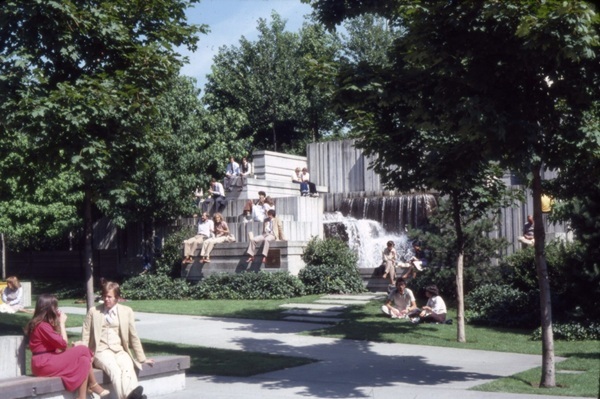
Seattle’s Freeway Park officially opened to the public 50 years ago this month on July 4, 1976. To celebrate this milestone anniversary, we’ve created a new online exhibit tracing the history of the park from conception to opening. The exhibit was researched using records in the archives and is illustrated with photos, moving images, and documents from SMA’s holdings. 

color photo of people standing and sitting around a fountain in Freeway Park

Freeway Park, circa 1970s. Image 205364, SMA.

Freeway Park was the first ever park to be built above a freeway, using as its base a “lid” covering a section of I-5 in central Seattle between downtown and First Hill. The idea for the park grew from efforts to create an innovative and much-needed green space in the city’s downtown core that would also reconnect neighborhoods separated by the construction of I-5 in the 1960s. Planning and building the park was a massive, complex project that required the close cooperation of city, state, federal, and private agencies over several years. Construction was done in phases and the entire project was completed in 1976, just in time for Seattle’s U.S. Bicentennial celebrations on July 4th of that year. 

Read much more at the exhibit, and be sure to check out the Freeway Park Association website for information about events celebrating this year’s anniversary!


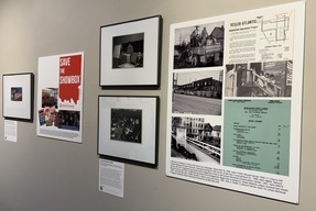
color photo of exhibit panels on a gallery wall

We the People of Seattle Exhibition

Our new exhibition We the People of Seattle: America at 250 is now open!

The free display is located in the Seattle Municipal Tower Gallery on the 3rd floor and is open to everyone. You’ll find records highlighting instances of civic action in Seattle’s history – including letters, maps, moving images, audio recordings, and ephemera – and stories illustrating how everyday Seattleites have helped to shape city policy through participation.

The exhibition will be up in the gallery through the end of September - we hope you'll stop by and check it out!

Collection Highlights

Newly Processed: Street Vending Records

Our volunteer Ilias Bowen-Sicalides recently finished processing a set of Engineering Department records that gives us a fascinating look at street vending carts in the 1970s and 1980s.
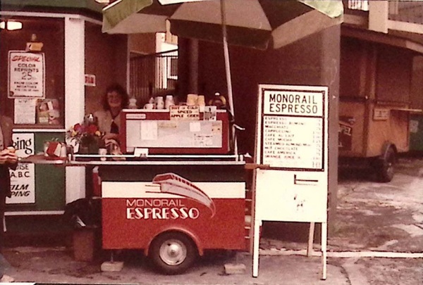
color photo of Monorail Espresso street cart circa 1979

Monorail Espresso cart, circa 1979. Photo from Street Cart Scrapbook, box 2, folder 1 (Series 2618-07).
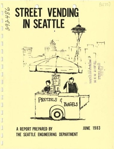
Street Vending Report Cover

The Board of Public Works authorized street vending carts in 1972, with a one-page document providing all of the regulations for cart owners. As the number of vendors increased over the next decade, the city saw a need to update those regulations and commissioned a report from the Engineering Department to clarify existing regulations and recommend improvements.

This collection includes that report, its drafts and appendices, records of public forums, and correspondence about the new regulations. It also includes research done into other cities’ regulations, news clippings about response to the updates, and a collection of street vendor permits and invoices from before and after the new regulations took effect.

See our blog post about the collection to learn more!


Find of the Month: Determinants of City Form

An unusual Department of Community Development report from 1971 was meant to incorporate ecological and urban design factors into Seattle’s city planning efforts. Titled "Determinants of City Form," the document is more or less an atlas of stylized maps with accompanying narratives. A transmittal letter to the mayor declared the study "a major milestone in laying the groundwork for the evolution of a city which can match the excitement and beauty of its natural setting."

The report emphasized Seattle’s uniqueness, and the language got a little flowery at times. For example: "Some cities are more memorable than others. A city's milieu frequently borders on a mystique which is difficult to define. It is not only the parts of the city but also the composite of the various phenomena that gives a city character."
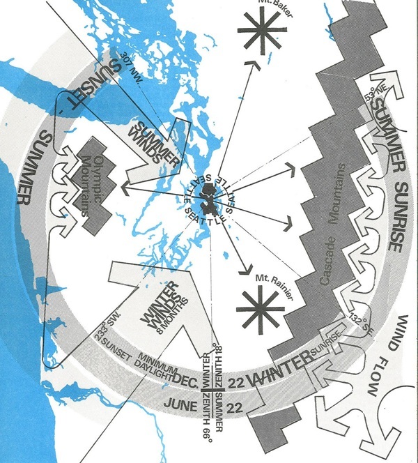
color climate map of Seattle

Climate map of Seattle, Document 1295 (Series 1801-92), SMA

The maps are the real stars of the document. Some are fairly typical, illustrating topography, population density, or neighborhoods. Others are more unusual, like a "word map" or maps showing view orientation or peak shadows. More esoteric maps depict concepts like activity clusters, time envelopes, and massing of building bulk.

The section of transportation maps includes some interesting visualizations. A movement systems map shows arrows of varying widths illustrating roads, transit, and ferry routes. A time-distance map shades the city based on travel times from a central point at 4th and Madison. Other maps show traffic volume and public transportation systems.

The report declared itself to be "an inventory of the existing forces that have shaped and are shaping the quality of the environment." However, it pointed out that social issues and human needs were also important factors that should be taken into account in the city planning process, and urged that these be incorporated into decision making to meet "the changing needs of the human user of the city."

Explore other Find of the Months on our website!