February 15, 2022
Dear Friends and Neighbors,
As you may have heard, the Washington State Redistricting Commission approved maps to rebalance our 49 statewide legislative districts and 10 federal congressional districts in November. This is a process conducted every 10 years in our state based on the federal Census data for population. The process was challenging in 2021, in part because the commission received data later than usual and because of the significant population growth shown in western Washington. Despite approving the plans late, the Washington State Supreme Court ruled that the commission substantially complied with its constitutional redistricting obligations. These maps needed to be officially adopted by the Washington State Legislature during our 2022 legislative session. For official adoption, the Legislature is authorized to make minor modifications, if needed, to the boundaries so long as they do not change any district’s population by 3,000 people. The Legislature took action to finalize the maps on February 8th. The maps are now “final” – subject to pending lawsuits – but the new boundaries do not go into effect until after the November 2022 elections.
 The Washington State Legislature has approved new state and federal district maps.
How Washington’s redistricting process works
The redistricting process occurs after the completion of the national census, which is taken every 10 years, most recently in 2020. Congressional district lines have been drawn by the Redistricting Commission since 1983 and legislative district boundaries since 1991. This commission comprises five members. Four are appointed by the leaders of each of the four major caucuses. The four appointed commissioners then appoint a fifth, nonvoting chairperson. Enactment of new redistricting maps for Washington requires bipartisan approval by at least three of the four Redistricting Commission members.
Voters created state’s Redistricting Commission
For many years, the Legislature was in charge of redistricting, but many had grown angry and frustrated with how partisan and time-consuming this approach had become. By the 1980s, Washingtonians sought change. In 1983, Washington voters passed Senate Joint Resolution 103, an amendment to our state constitution that created our state’s independent Redistricting Commission. Over the past decade, several other states have revamped their redistricting process to reduce the chance of partisan politics and “gerrymandering,” a term describing districts with bizarrely drawn boundaries. Other states have followed our state’s lead in creating independent commissions to draw up legislative and congressional district maps, with just minimal political manipulation involved. Although with the recent issues with Washington state’s Redistricting Commission, I anticipate the state could seek to modify our process for the next 10-year changes in 2030.
New Washington state legislative districts
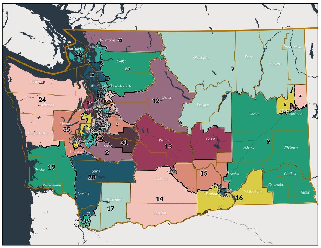 The new legislative districts map shows the new boundaries for our district, moving Okanogan County and much of Douglas County into the 7th District. The new 12th District now includes East Wenatchee, Chelan County, Snohomish County (Index to Monroe) and King County (North Bend to Duvall).
Changes for Douglas and Okanogan counties
Unfortunately, the map drawn significantly changes the 12th District, splitting up Chelan and Douglas counties and shifting Okanogan County fully into the 7th District. Chelan, Douglas, and Okanogan counties share many natural resource and economic interests. Also, Chelan and Douglas counties have a long and proud history of cooperation across city and county lines and essentially function as one community. One of the fundamental tenants in the redistricting process is to keep “communities of interest” together. RCW 44.05.090 states, “District lines should be drawn so as to coincide with the boundaries of local political subdivisions and areas recognized as communities of interest.” The map does not meet this standard, in my opinion. Chelan and Douglas counties – in their entirety – should have been preserved together in the approved, final redistricting plan.
History of 12th District borders
While I was very surprised by the drastic changes for District 12, this isn’t the first time our district has been adjusted. In the early 1930s, the 12th District was moved from southeastern Washington to its present location in North Central Washington. All of Chelan County has been within the 12th District since then. In 1965, the 12th District included all of Chelan and Douglas counties. By 1972, the western half of Okanogan County, including Winthrop and Brewster, was added to the 12th District, as was the northern part of Grant County. The northern portion of Kittitas County was part of the 12th for 30 years until the present boundaries were redrawn in 2012 – a shift that also picked up more of the southeastern portion of Okanogan County and part of Grant County.
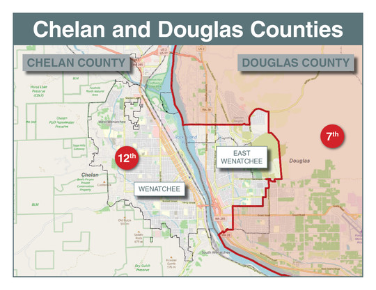 This map shows the significant split between Chelan and Douglas counties. A portion of East Wenatchee and the remainder of Douglas County will reside in the 7th Legislative District.
New 12th District borders
The new 12th District boundaries will continue to include much of East Wenatchee, all of Chelan County, and portions of Snohomish County (Index to Monroe) and King County (North Bend to Duvall). Approximately half of the population of the new area includes the cities of North Bend, Carnation, Sultan, and Monroe with the other half of the new area located in unincorporated King and Snohomish counties. A new feature of the 12th District is a greater portion of the amazing Cascade Mountains, including Snoqualmie Pass and Stevens Pass. The new area of the district includes new school districts, utilities, and businesses. While the western Washington portion of the district may not experience the wildfire threat well-known to North Central Washington, it can experience other natural disasters, such as flooding. The region also has a variety of transportation issues unique to its area of the state as population growth and travel west-to-east for tourism and outdoor recreation has created traffic flow and safety challenges. As I do with all constituents, I will be working hard to outreach to these communities over the coming months and years.
Photos from new areas of 12th District
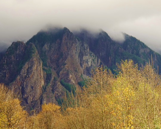
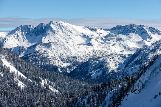 The new district crosses the Cascade Mountain Range.
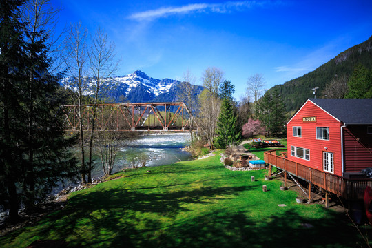 Kayaking is popular along the North Fork of the Skykomish River at Index.
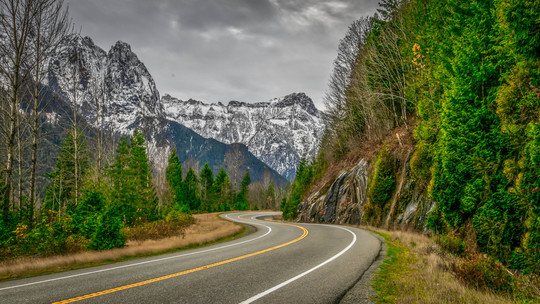 U.S. Highway 2, often referred to as the “Stevens Pass highway," is a beautiful drive.
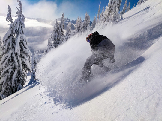 Snowboarders enjoy Stevens Pass Ski Resort, much like Mission Ridge.
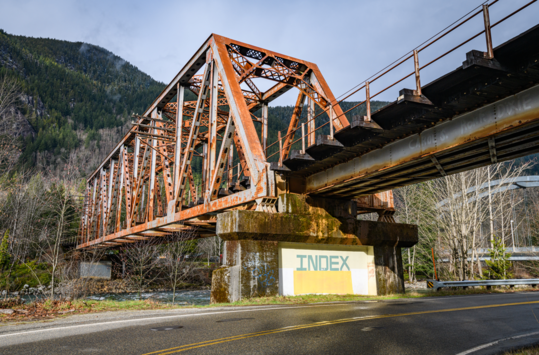 The community of Index is located along Highway 2 past Stevens Pass.
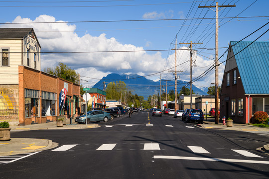 The city of Sultan is located on Highway 2 in Snohomish County.
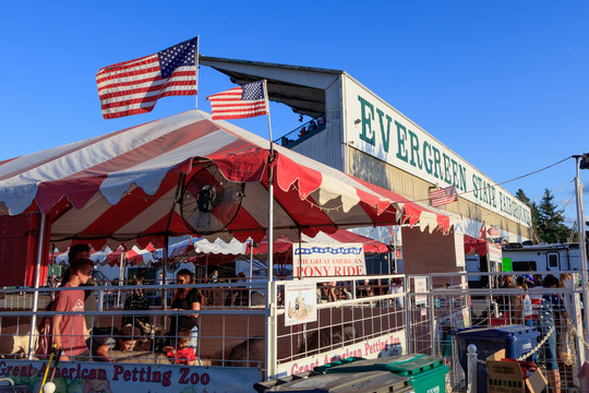 The city of Monroe is the site of the Evergreen State Fairgrounds.
 The new district will stretch along I-90 to North Bend, home to Mount Si.
 Carnation is located in King County between North Bend and Duvall.
Listen to my recent local radio interviews
Each week during session, I will be calling our local radio stations to participate in live interviews about the latest topics in the legislative session. If you'd like to hear my most recent interviews, click on these links for KOHO, KOZI, and KPQ. If you have any questions, please contact me anytime.
Thank you for the opportunity to serve as your state senator.
Sincerely,

Brad Hawkins
State Senator Brad Hawkins
12th Legislative District
Website: senatorbradhawkins.org
107 Newhouse Building - P.O. Box 40412 | Olympia, WA 98504-0412
(360) 786-7622 or Toll-free: (800) 562-6000
|