November 16, 2021
Dear Friends and Neighbors,
In accordance with state laws, the independent and bipartisan Washington State Redistricting Commission redraws state legislative and congressional district maps every 10 years. Today, after months of consideration and public comments, the commission announced it was unable to reach agreement on its final plan for state legislative districts and federal congressional districts. You can read more about the Redistricting Commission's news here.
Today’s news about our Redistricting Commission being unable to come to an agreement on rebalanced state legislative and federal congressional districts is very disappointing as I know the commissioners worked very hard and collected substantial public comment. Washington state has a proud history of bipartisan success with our redistricting process.
The inability of the commission to reach an agreement is a huge setback and it’s discouraging. The later-than-usual Census data was a big factor, but politics is always at play. Hopefully, the commission’s inability to reach agreement is not a sign that the growing political divide in our country is beginning to threaten our redistricting process. The process going forward is uncertain. By law (RCW 44.05.100), jurisdiction over redistricting is now transferred to our State Supreme Court. This has never occurred before, so predicting the process beyond today is anybody’s guess. This is a result none of us wanted. I suspect the State Supreme Court feels the same way.
How Washington’s redistricting process works
The redistricting process occurs after the completion of the national census, which is taken every 10 years, most recently in 2020. Congressional district lines have been drawn by the Redistricting Commission since 1983 and legislative district boundaries since 1991. This commission comprises five members. Four are appointed by the leaders of each of the four major caucuses. The four appointed commissioners then appoint a fifth, nonvoting chairperson. Enactment of new redistricting maps for Washington requires bipartisan approval by at least three of the four Redistricting Commission members. Our state’s bipartisan redistricting system requires cooperation. It isn’t surprising that Washington’s redistricting process is admired by other states seeking to move away from an approach in which one party controls the final result.
Voters created state’s Redistricting Commission
For many years, the Legislature was in charge of redistricting, but many had grown angry and frustrated with how partisan and time-consuming this approach had become. By the 1980s, Washingtonians sought change. In 1983, Washington voters passed Senate Joint Resolution 103, an amendment to our state constitution that created our state’s independent Redistricting Commission. Over the past decade, several other states have revamped their redistricting process to reduce the chance of partisan politics and “gerrymandering,” a term describing districts with bizarrely drawn boundaries. I’m encouraged to know other states have followed our state’s lead in creating independent commissions to draw up legislative and congressional district maps, with just minimal political manipulation involved.
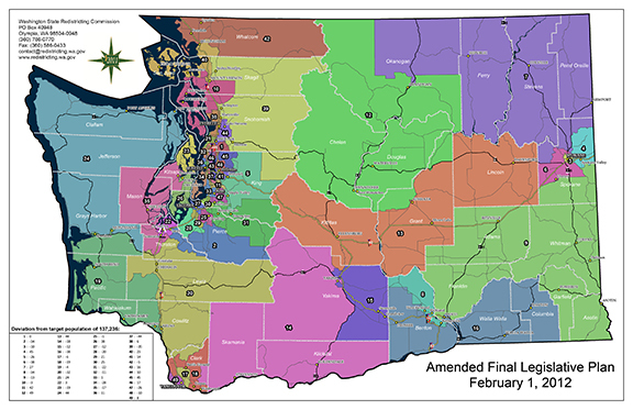 The state's legislative districts need to be redrawn so that each district represents approximately the same population. Our current 12th District is one of the largest districts in our state (based on geography) and includes Chelan and Douglas counties and portions of Grant and Okanogan counties.
 The congressional district boundaries for our federal representatives will be adjusted once the redistricting process is finalized. Our current 12th Legislative District boundaries include portions of the 8th Congressional District (Rep. Kim Schrier) and 4th Congressional District (Rep. Dan Newhouse).
Redistricting’s likely impact on eastern WA
The final redistricting plan, once it is implemented, will have an impact on eastern Washington. Throughout the history of our state and certainly throughout the Redistricting Commission’s history, there have been changes to the legislative and congressional districts. For this particular plan, commissioners had challenges balancing the districts due to the population growth in western Washington compared to central and eastern Washington. This likely will result in some noticeable shifts for some legislative districts.
History of 12th District borders
This isn’t the first time our district could see adjustments. In the early 1930s, the 12th District was moved from southeastern Washington to its present location in North Central Washington. All of Chelan County has been within the 12th District since then. In 1965, the 12th District included all of Chelan and Douglas counties. By 1972, the western half of Okanogan County, including Winthrop and Brewster, was added to the 12th District, as was the northern part of Grant County. The northern portion of Kittitas County was part of the 12th for 30 years until the present boundaries were redrawn in 2012 – a shift that also picked up more of the southeastern portion of Okanogan County and part of Grant County.
Listen to my recent local radio interviews
Leading up to the legislative session and each week during session, I will be calling our local radio stations to participate in live interviews about the latest topics in the legislative session. If you'd like to hear my most recent interviews, click on these links for KOHO and KOZI. If you have any questions, please contact me anytime.
Thank you for the opportunity to serve as your state senator.
Sincerely,
 Brad Hawkins
State Senator
Brad Hawkins
12th Legislative District
E-mail:
brad.hawkins@leg.wa.gov
Website: senatorbradhawkins.org
107 Newhouse Building
- P.O. Box 40412 | Olympia, WA 98504-0412
(360) 786-7622 or Toll-free: (800) 562-6000
|