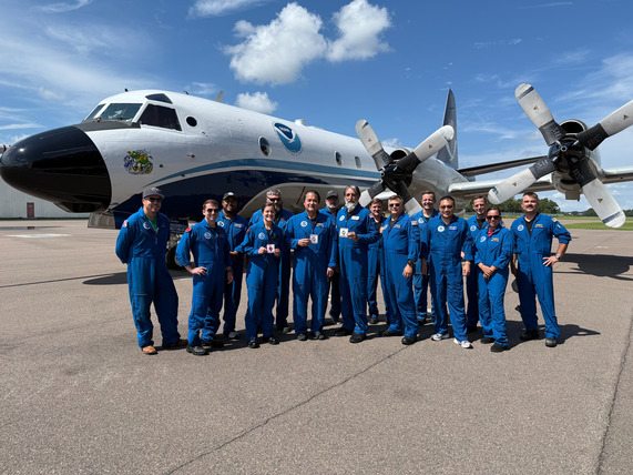
NOAA aircraft collect vital data in Hurricanes Erin and Gabrielle

From Erin to Gabrielle, NOAA hurricane hunters have been hard at work this season. Crews flew 16 missions into Hurricane Erin aboard the WP-3D Orions and Gulfstream IV-SP, logging over 105 flight hours and releasing more than 350 dropsondes and other expendables to improve forecasts and expand our understanding of tropical systems. They followed with 9 missions into Hurricane Gabrielle, adding another 44 hours in the air and deploying more than 130 expendables. Want to see what it’s like to fly into a hurricane? Check out this video.
|
NOAA aircraft supports Texas flooding emergency response

A NOAA Twin Otter and King Air recently supported the National Geodetic Survey by collecting aerial damage assessment images in areas affected by flooding in Texas in July. Together, the aircraft flew over 60 hours, captured more than 11,000 images, and covered over 90 square kilometers to assist with the mission. These vital images help determine the extent of the damage and support FEMA’s recovery efforts.
|
NOAA Twin Otter surveys air pollution and greenhouse gases over Baltimore, D.C., and Marcellus Shale

This summer, a NOAA Twin Otter conducted flights over Baltimore, Washington, D.C., and the Marcellus Shale region to measure air pollution and greenhouse gas emissions. Equipped with advanced LiDAR technology and other state-of-the-art instruments, the aircraft collected detailed chemical and meteorological data in support of NOAA Research. These measurements play a vital role in improving understanding of how air pollution forms and contribute to the development of more effective strategies for mitigating greenhouse gas emissions.
|
NOAA Twin Otter supports bowhead whale surveys

In Alaska, survey teams aboard a NOAA Twin Otter conducted flights to support a NOAA Fisheries marine mammals study focused on bowhead and beluga whales. These aerial surveys allow crews to record numbers, behavior, distribution, and photo-identification data to support recovery efforts for endangered bowheads. In collaboration with Alaska’s North Slope Borough and Canada’s Fisheries Joint Management Committee, the project will update population estimates for bowhead and beluga whales, providing critical insight into whether these populations are increasing, declining, or stable and guiding future conservation and management.
|
Heritage: Remembering Hurricane Katrina
Twenty years ago, Hurricane Katrina tore through the southeastern U.S., causing much destruction as NOAA flew missions into the storm to improve forecasting. These hurricane flying operations played a critical role in collecting data that advanced prediction and response efforts.
In this video, NOAA staff reflect on their experiences and how forecasting has improved since then.
Photo: Eyewall of Hurricane Katrina south of Louisiana landfall.
Credit: Rear Adm. Mike Silah
|
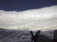
Featured Photo
 Following a mission into Hurricane Erin, ENS Larissa Sperk achieved her first eyewall pass, and Damon Sans Souci celebrated his 500th. Congratulations!
Photo Credit: Nikki Hathaway, NOAA
On the Radar
Looking ahead, our aircraft teams will stay busy with a wide range of missions. Hurricane season operations will continue, with crews and aircraft ready to support as new storms develop.
Twin Otters will conduct marine mammal surveys, including work focused on the North Atlantic right whale and other protected species in the Gulf of America.
The NOAA King Air will continue flights for the National Geodetic Survey’s GRAV-D project, which collects high-resolution gravity data across the country to improve mapping accuracy. The aircraft also remains ready for emergency response missions should storms make landfall.
We look forward to sharing accomplishments from the fall with you in the next issue of Flightlines. Subscribe to the newsletter by signing up here, and be sure to follow us on social media!
facebook.com/NOAAHurricaneHunters
twitter.com/NOAA_HurrHunter
Find us on Instagram @FlyNOAA
|