|
For the Week of September 19, 2021

Weekly Hydro Ship Activity Report
Welcome to NOAA's Weekly Hydrographic Ship Activity Report! We hope you enjoy this reader-friendly layout for our weekly report as we update you on the progress of our NOAA-ship and contractor-run surveys. Please continue to direct your correspondences to progress.sketches@noaa.gov.
Highlights of this edition
- NOAA Ship Ferdiand R. Hassler, having completed mainscheme for priority sheets in Approaches to New York, is now focusing on investigations and infills.
- TerraSond saildrone takes advantage of favorable wind in the Bering Sea for the Bering Sea Reconnaissance Survey.
- See the up-to-date survey coverage for all vessels in the Hydrographic Survey Projects Story Maps
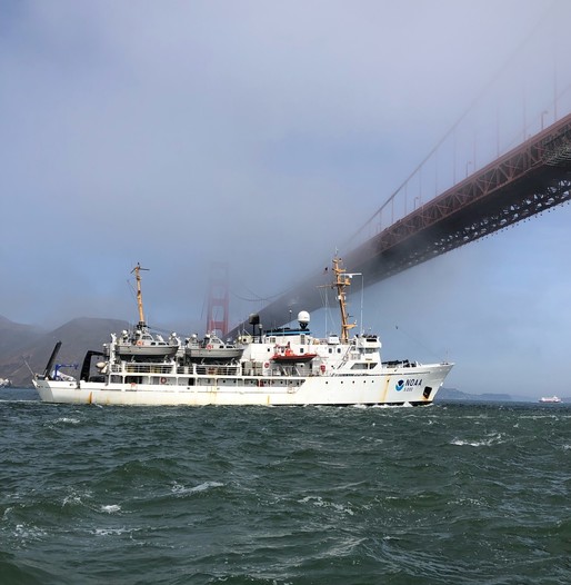
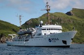
NOAA Ship Fairweather arrived in San Francisco, CA last week to begin surveying within the Bay Area. This photo is courtesy of Greg Swart, a Bay Area Resident and father of a current Fairweather crew member.
NOAA Ships
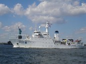
FERDINAND R. HASSLER
OPR-C319-FH-21 Approaches to New York
Recap
- NOAA Ship Ferdinand R. Hassler completed mainscheme acquisition on sheet H13479, and continued acquisition on H13480. Small boat operations took place on H13475 to survey the entrance to Shark River Inlet.
|
|
|
 |
-
Hassler will focus on collecting all holidays and investigating contacts on H13476, H13477, H13479, H13480, and H13475.
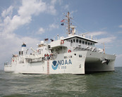
THOMAS JEFFERSON
Recap
- NOAA Ship Thomas Jefferson is alongside Norfolk. The ship moved the ship's servers and processing ability into MOC-A for winter work while the ship is in dry dock.
|
|
|
 |
Looking Forward
- The ship will transit into Colonna's Dry dock on Thursday, September 30, 2021. Ship's force will continue the effort to set up servers and processing ability at MOC-A.
FAIRWEATHER
OPR-L361-FA-21 San Francisco Bay, CA
Recap
- NOAA Ship Fairweather transited south through Inside Passage and Pacific Coast, anchored in San Francisco bay on September 22, 2021.
-
FA opened project OPR-L361-FA-21 starting survey acquisition on F00834 and H13541
|
|
|
 |
-
FA will continue acquisition on OPR-L361-FA-21 next week.
- Following a mini-inport in Alameda to take on stores an augmenters, FA will transit to Channel Islands Marine Sanctuary project.
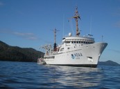
RAINIER
Recap
- NOAA Ship Rainier is alongside the Marine Center Operations Center - Pacific in in Newport, OR.
|
|
|
 |
Looking Forward
-
Rainier completed their survey season and will begin dock side repairs the end of September.
Contracted Vessels

OPR-J315-KR-21 Pascagoula, MS
Recap
-
RV Broughton moved to Dauphin Island, AL.
-
RV Broughton acquired acquisition in survey area H13489.
Looking Forward
-
RV Broughton will continue acquisition in survey area H13489.
- SV Blake will acquire fill and investigation data in survey areas H13487, H13488, and H13489.
- There will be bottom samples next week.
|

OPR-K380-KR-21 Port Freeport & Approaches, TX
Recap
- Survey operations continued on the MV Atlantic Surveyor on H13505 (Sheet 4) until 9/21/2021 when the vessel moved to H13506 (Sheet 5).
- Weather delay was incurred on 9/22 and part of 9/23/2021.
- Survey resumed on H13506 (Sheet 5) om 9/23/2021.
Looking Forward
-
MV Atlantic Surveyor survey operations will continue on H13506 (Sheet 5) and H13505 (Sheet 4) as weather conditions allow.
|

OPR-R340-KR-21 Approaches to Egegik Bay, AK
Recap
Vessel Activities:
-
Q105 transited from Dillingham to Homer, departing Dillingham late on 9/18, arriving Homer afternoon of 9/22 (local time).
-
Q105 was met in Homer by TerraSond demobilization crew, who completed demobilization of all equipment and transported back to Palmer by end of day 9/23.
- Office-based equipment check-in began 9/24.
- LNM collected to date: 5,922 (of 5,726 planned).
Tide Work:
- JOA was unable to travel to Egegik for planned staff shots due to COVID restrictions in place there. Available telemetry from Egegik indicates normal operating conditions for the gauges.
- JOA personnel travelled to Pilot Point (Dago Creek Mouth) tide station 9/23 through 9/24 for staff shots and to investigate possible instability in Gauge 1 data observed in gauge telemetry. The orifice for gauge 1 was found to be unstable due to soft bottom there, and showed a downward shift of about 27 cm. The crew installed a new orifice for Gauge 1 several meters upstream in what appeared to be more solid bottom, at a depth of about 0.7 m shallower, and also performed staff shots for the new orifice before departing Pilot Point.
Looking Forward
Vessel Activities:
- No vessel activities planned. The vessels have been demobilized.
- Within the office, TerraSond will complete integration of vessel data server onto office network and finish equipment check-in.
- Work will begin on near-term deliverables.
Tide Work:
- Egegik staff shot trip as soon as possible; may or may not occur this week. Waiting on permission from Egegik for JOA staff to travel there due to community COVID restrictions.
S-R364-KR-21 Bering Sea Reconnaissance Survey
Recap
- SD1030 and SD1034 completed route “2b” on 9/23 and began transit towards area “3”
- SD1033 and SD1067 reached area “3” on 9/21 and began survey along route “3a”
- SD1033 and SD1067 left their planned route temporarily on 9/22 and 9/24 to take advantage of wind conditions to charge with their hydro-generators.
- DTONs were identified in southern Norton Sound and submitted to OCS on 9/23.
- As described in more detail on the Mission Portal, it was noted this week that the daily NC files, expected to contain data at 1-minute intervals, was found to have gaps in depth and/or positions, starting approximately 9/8 and corresponding to power saving measures on the saildrones. However, the depth data on the Mission Portal appears to be continuous. Saildrone reports the data can’t be re-exported to NC file until power conditions are normal on the vehicles. Full resolution data logged on the vehicles, which will be available once they are retrieved, should be unaffected. Meanwhile, in addition to the NC files, Mission Portal depths will be checked periodically for DTONs, as was done this week to identify the DTONs in Norton Sound.
- The closest approach to a whaling buffer zone this week was on 9/23 when SD1030 and SD1034 were within about 2 NM of the Golovin whaling buffer zone. Saildrones were on their pre-planned route and did not enter any buffer zones.
- Mission Days completed as of end of day 9/25/21 (UTC): 49 (of 65 planned)
Looking Forward
- SD1033 and SD1067 will continue survey along route “3a”
- SD1030 and SD1034 will reach area “3” and begin survey along route “3b”
- The vehicles are not expected to be in the vicinity of any whaling buffer zones this week.
|
|