|
Over the past few months, the world has changed in significant ways. People have been following stay-at-home orders and social distancing protocols and are traveling much less than they used to. The impact to visiting public lands this year is uncertain and will vary across the country, but some trends have been identified and are being examined closely:
- International travel to the public lands, and to the United States in general, will be significantly down this year
- Domestic travel to public lands will likely be done more locally, i.e., with fewer cross-country road trips and more visits within home and adjacent states; the demand for camping and RVs appears to be growing in some parts of the country
- Many public lands are opening or are reopening, but with less capacity for visitors
- Some of these public lands have already experienced overcrowding, due to a combination of less capacity and more demand from people eager to get out of their homes and into the outdoors
Volpe’s Public Lands Team will work closely with its sponsors to monitor these—and identify new—trends as the summer progresses, and we will develop recommendations and solutions to address emerging issues as appropriate. Though it is unclear how long the impacts of the pandemic will affect travel and visitation to our public lands, the Public Lands Team will continue to help its sponsors chart these new waters.
Project contact: Ben Rasmussen
The Columbia River Gorge National Scenic Area (CRGNSA) protects the beautiful canyon where the Columbia River runs through the Cascade Mountains along the border between Oregon and Washington. The 292,500-acre Congressionally Designated area includes portions of two states, six counties, and numerous towns with varying authorities and degrees of partnerships. More than 50,000 people live within the CRGNSA boundary. The CRGNSA includes a total of 93,000 acres of federal lands within these boundaries; the U.S. Forest Service (FS) oversees 83,000 of those acres, and has other responsibilities related to overall management of the region.
The major transportation infrastructure within the CRGNSA includes the Columbia River; two rail lines; five ports; Interstate 84; state highways; and a multitude of local roads, multiuse trails, and transit lines. Over the years, the mix of jurisdictions overseeing these assets led to many different efforts to understand and influence transportation issues impacting the Gorge’s stakeholders.
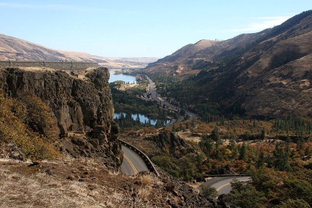 Fig 1. View of the Columbia River Gorge. Credit: Volpe.
In late 2019, FS staff asked the Volpe Center for assistance reviewing the variety of reports yielded by these efforts, with the goal of developing a prioritized set of actions to mitigate congestion and transportation impacts and improve access within the CRGNSA. Volpe staff reviewed sixteen different documents, totaling more than 1,600 pages, ranging from site-specific pedestrian studies, to local economic development plans, to regional transportation plans. Fourteen common topic areas emerged; Volpe and FS staff narrowed the list to eight priority topics: congestion management/parking, public transportation, safety, recreation, economic/financial aspects, bicycling, pedestrians, and resource protection. The key findings or recommendations from each document related to the eight topic areas were compared against the Management Plan for the Columbia River Gorge National Scenic Area (Management Plan), which is the guiding document for FS management of the Gorge. The majority of findings and recommendations aligned with the Management Plan, although there were some conflicts and potential conflicts, most commonly related to economics and financial aspects. The next step in the process is to conduct a gap analysis to determine if FS staff need additional information in order to move forward on developing action plans for mitigating congestion and improving access within the Gorge.
Project Contact: Heather Richardson
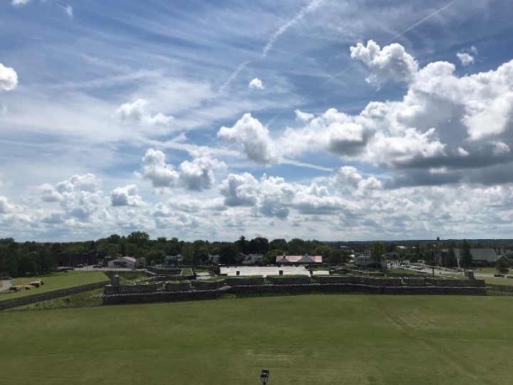 Fig 2. Fort Stanwix. Credit: Volpe.
The Volpe Center is in the process of finalizing a Transportation Study for Fort Stanwix National Monument (FOST) in Rome, New York. This site, managed by the National Park Service, includes the archaeological remains of Fort Stanwix, the reinforced fort reconstruction, the Marinus Willett Collections Management and Education Center, and a half mile of recreational trails. The original fort was built during the French and Indian War, and used again during the American Revolutionary War. Located under a mile from the Erie Canal, FOST sits along the main east-west state transportation corridor and is located within a day’s drive of a number of major U.S. and Canadian cities. The park is close to a number of area attractions including city and state parks, state historic sites, state scenic byways, and a national heritage corridor.
Due to its location in the center of downtown Rome, FOST experiences transportation challenges related to wayfinding, safety, connectivity, alternative modes, and parking. Building off of the Transportation Summary Report completed in 2006, Volpe evaluated current transportation conditions at the park and the surrounding area in order to determine the feasibility of potential infrastructure or operational changes such as enhanced wayfinding, better parking management, and improved regional connectivity. The project team conducted a site visit to FOST in June 2019 for in-person stakeholder meetings and held a number of additional remote meetings with representatives from the park, city, metropolitan planning organization, state department of transportation, and economic development agency.
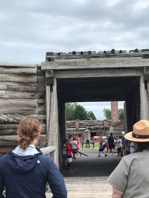 Fig 3. Volpe staff touring the fort with an NPS ranger. Credit: Volpe.
The Volpe team is currently finalizing the project report, and will publish it later this month. Recommended strategies from the transportation study include consistent signage and tourist information throughout the region; increased off-street parking utilization; enhanced pedestrian and cyclist wayfinding; and updated visitor information on train, bus, and bicycling options. The majority of these recommendations involve partnerships with local stakeholders in order to identify opportunities to work together for mutual benefit.
Project contact: Emma Vinella-Brusher
The White River National Forest (WRNF) in Colorado offers a popular hike to scenic Hanging Lake and Spouting Rock. The trailhead for the hike starts at a rest area off Interstate 70 near Glenwood Springs. The trailhead and scenic locations are very popular and until last year were only accessible by personal vehicles, which routinely crowded the parking area and at times backed up traffic on the interstate. In order to manage congestion and improve access to the area, the Volpe Center worked with stakeholders to develop a shuttle system to transport visitors to the trailhead from nearby Glenwood Springs, approximately nine miles away. The shuttle debuted in summer 2019 and has exceeded its ridership goals. This service allows visitors to park their personal vehicles and avoid the frustration of an overflowing parking lot.
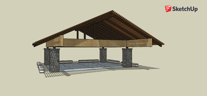 Fig 4. 3D model of the Hanging Lake shelter. Credit: Volpe.
The shuttle drops off and picks up visitors at a plaza on the far end of the rest-area parking lot. The only structure at the plaza is a restroom facility along with some benches and a paved pathway leading to the start of the hike. WRNF requested Volpe’s assistance in designing a shelter for visitors awaiting return shuttles to provide them with a way to keep out of the sun and rain. Volpe created a 3D model of several shelter concepts, ultimately producing a series of renderings and an animated fly-through of the preferred design.
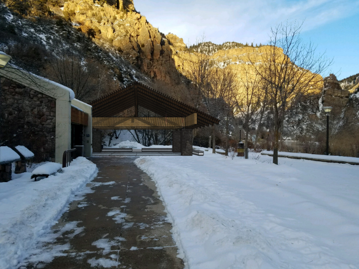 Fig 5. Rendering of the Hanging Lake Shelter. Credit: Volpe.
Volpe is currently assisting WRNF in developing cost estimates for shelter construction. This project completes the shuttle system, providing not only access, but comfort and a place to relax out of the elements, both before and after completing the scenic three-hour trek to see Hanging Lake and Spouting Rock.
Project Contact: Jonah Chiarenza
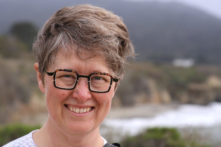 Fig 6. Erica at Año Nuevo State Park. Credit: Volpe.
What public lands projects are you working on now? What has been your favorite?
I have been lucky to work on a variety of public lands projects with a lot of different agencies since I started at Volpe. Currently I manage our portfolios with FHWA’s Western Federal Lands Division Office (WFL) and the National Park Service regional office in Alaska, and I co-manage our portfolio with the Bureau of Land Management (BLM). Some of my favorite projects recently have been developing the BLM’s first National Long-Range Transportation Plan, updating the Alaska Federal Lands Long-Range Transportation Plan, and conducting site-level transportation studies at Klondike Gold Rush National Historical Park and Kenai Fjords National Park in Alaska. What I love about all of these projects is that they require a different mindset about what public lands transportation is and how to make smart management decisions. For example, the BLM’s transportation network has unique challenges because it is so large, remote, and dispersed. And in Alaska, the LRTP doesn’t just consider road and trail infrastructure, but also over-snow travel, remote air strips, and even a hand tram!
What types of projects outside of public lands do you work on?
My non-public lands work typically falls into a few categories: performance-based planning and programming, multimodal transportation, and resilience. In 2017, I contributed to the Report to Congress on Performance-Based Planning and Programming, and now I am conducting follow-up research on how state DOTs and MPOs are implementing their performance-based plans. Recently, I have also supported transportation-related due diligence analysis for the Millennium Challenge Corporation (MCC) in Lesotho and Malawi, and I had the opportunity to travel to Lesotho with MCC last summer. Although it is crucial to be sensitive to each country’s unique context, it has also been fascinating and rewarding to realize how some of the skills and insights I have learned working on transportation planning and policy issues for remote public lands have been relevant to other low-volume road settings around the world!
What are your fondest memories of public lands?
I grew up in northeast Maine and spent a lot of time outdoors – exploring the wetlands of Moosehorn National Wildlife Refuge (my favorite bog), the tidal flats at Cobscook Bay State Park, and our annual excursion to climb Mount Katahdin in Baxter State Park. We climbed Katahdin for the first time when I was seven or eight, and my parents kept telling me the summit was just another quarter mile – for several miles! This was when I learned not to trust adults, but also to manage expectations for endurance activities! For me it’s always better to assume the end is quite far away, and be pleasantly surprised when you reach it.
What new public land have you discovered since working at Volpe?
I would have to say all of the public lands in Alaska I have had the opportunity to visit. I love Alaska – in a lot of ways it reminds me of what I love about Maine, but bigger and colder and with more spectacular mountains. It’s hard to choose just one location, but I’ll choose the first public land I visited in Alaska: the BLM’s White Mountains National Recreation Area, which has a system of cabins connected by winter trails over tundra. I went there for a recreational bikepacking trip with a few friends, and although our trip was cut short due to inclement weather, it was such a beautiful landscape that I felt so lucky to experience.
What’s the most unique, interesting, or strangest job you had before working at Volpe?
I was a geology major in college, and after I graduated I got to do an internship through the National Association of Geoscience Teachers at the U.S. Geological Survey’s Cascades Volcanoes Observatory in Vancouver, WA. This was in 2006, when Mount Saint Helens was erupting in a non-catastrophic manner, extruding approximately one cubic meter of solidified lava per day. My job was in the photogrammetry group, where I helped them build weather-proofed remote sensing cameras, fly in a helicopter to the crater rim of the volcano, and install them. The cameras then radioed back images every 10 minutes, which I helped to analyze to come up with volumetric measurements of eruption rates. I also got to learn GIS on the job, and I made a 3D animation of the eruption’s progression with LiDAR data, which was actually being shown at the Coldwater Visitor Center when I visited in 2015. I joke that this was actually the coolest job I’ll ever have!
If you were to have a job that wasn’t transportation or public lands related, what would it be?
In an alternate universe I probably would have stuck with geology – in which case I might be in a sub-basement crushing rocks and analyzing isotopes right now. More seriously, though, there are a lot of really exciting tie-ins between geology and public lands transportation, such as hydrological analysis and resilience work, so there’s a possibility I would have ended up working on similar problems, just from a different frame of reference.
Contact: Erica Simmons
|