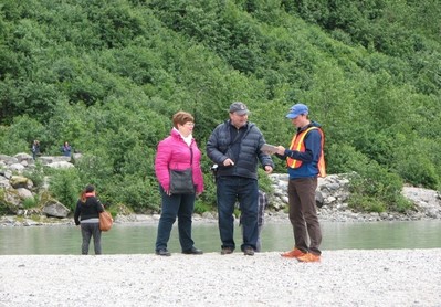
 Staff from the University of Alaska-Fairbanks administering the Alaska user survey.

Federal public lands host nearly one billion
visitors each year. Those visitors arrive by planes, trains, buses, ferries, bicycles,
automobiles, and even on foot seeking beauty, adventure, recreation, and more.
But what do public land agencies really know about their visitors’
transportation experiences? And what can they do to improve those experiences? The Collaborative
Visitor Transportation Survey Project, or CVTS, is an effort among the Federal Land Management Agencies
(FLMAs) to develop a common set of tools and measures for collecting visitor
experience data on Federal public lands.
The idea for the CVTS grew out of discussions within the Alaska
Collaborative Long Range Transportation Plan (CLRTP) team, which includes staff
from the FLMAs, Alaska Department of Transportation and Public Facilities,
Federal Highway Administration Western Federal Lands, and Volpe’s Public Lands
Team, who provide technical support. This team, similar to CLRTP teams in other
regions of the country, was tasked with preparing a long range transportation
plan, which is a vision document that facilitates the strategic identification
and prioritization of transportation infrastructure and systems needed to meet
the agencies’ mission. The Alaska team was developing performance measures for
a range of topic areas (e.g., safety, resource protection, etc.), and for
visitor experience, the team lacked data to specifically address transportation
needs. While some agencies collect generic transportation data as a part of
broader surveys, the measures and methods were not consistent across agencies
and were not comparable. Given this data gap, the team decided to conduct a
common, shared visitor survey (which was administered by staff at the University
of Alaska-Fairbanks), and to meet the requirements of the Paperwork Reduction
Act, it was necessary to obtain approval from the Office of Management and
Budget (OMB) to administer the survey. The Paperwork Reduction Act states that
any information collection (e.g., surveys, focus groups, etc.) sponsored or
administered by a Federal agency that asks the same set of questions to 10 or
more people (excluding Federal employees) must be reviewed and approved by
OMB.
The Alaska LRTP team realized that its counterparts in other
areas of the country were likely to have a similar need for visitor experience
data to inform their LRTPs, so instead of only submitting the Alaska survey to
OMB, the team asked Volpe’s Public Lands Team to develop a generic clearance
that streamlines the review process for all FLMAs. A generic clearance is an
OMB-approved plan for a series of information collections utilizing similar
methods and questions. Agencies submitting individual collection requests under
a generic clearance receive expedited OMB review if they utilize the
pre-approved set of survey questions.
The generic clearance makes the collection of visitor
experience data a quicker and more feasible part of transportation planning and
enables agencies to more easily collaborate on survey efforts. This data can
help identify transportation–related issues and can inform future planning
efforts focused on delivering more effective and efficient transportation
services and facilities. As is the case with the Alaska survey, the data can
also serve as a tool to measure performance over time.
Under the CVTS Generic Clearance, 13 surveys, sponsored by a
range of FLMAs, have been approved since the CVTS’s inception in November 2014.
The Generic Clearance, which is set to expire in November 2017, was recently
updated and has been submitted to OMB for renewal.
Project Contact: Margaret
Petrella
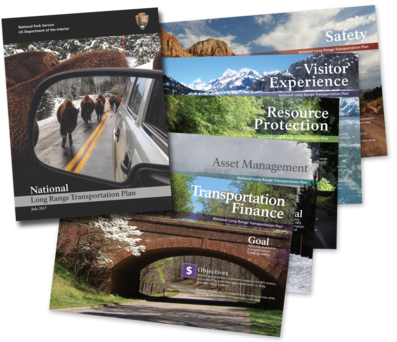 The cover of the NLRTP, along with the title pages for the five NLRTP goal areas.
On July 28, 2017, the National Park Service (NPS) released its first
ever National
Long Range Transportation Plan (NLRTP). The
NLRTP establishes a performance-based framework for managing transportation
investments across the NPS, using data-driven analyses. The Volpe Center Public
Lands Team provided project management, research, analysis, writing, and design
support in partnership with the NPS Denver Service Center and others to produce
this seminal plan. Volpe assisted the NPS in developing performance measures
and targets in five goal areas: Asset Management, Transportation Finance,
Resource Protection, Visitor Experience, and Safety. Volpe also led a
first-of-its-kind financial analysis, which included all funding sources used
for transportation and provided a comprehensive record of how transportation
investments have historically been made. This analysis formed the foundation
for a National Transportation Investment Strategy and performance measures that
are both aspirational and realistic.
Project Contact: Jonah Chiarenza and Kevin
McCoy
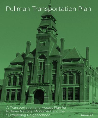 The cover of the Pullman Transportation Plan, showing the Factory Building at the Monument.
On September 18, 2017,
the Chicago Metropolitan Agency for Planning (CMAP) and the National Parks
Conservation Association released a transportation plan for the Pullman
National Monument, a
new National Park Service unit designated in 2015 on the South Side of Chicago,
Illinois. The Volpe Center Public Lands Team provided assistance to CMAP and
its consultant team, led by Sam Schwartz Consulting, in understanding the
unique planning considerations of National Parks and other Federal public
lands. Volpe assisted with background research, strategy development, and
information about possible funding sources for implementation. The plan
provides Pullman with a comprehensive vision and specific recommendations for
improving transportation and access for both visitors and the surrounding
community. “The Pullman Transportation Plan is a critical step in realizing the
full potential of Pullman as a livable, walkable community that tells one of
America’s most important stories,” said Joseph C. Szabo, executive director of
CMAP.
Project Contacts: Kevin McCoy and Jessica Baas
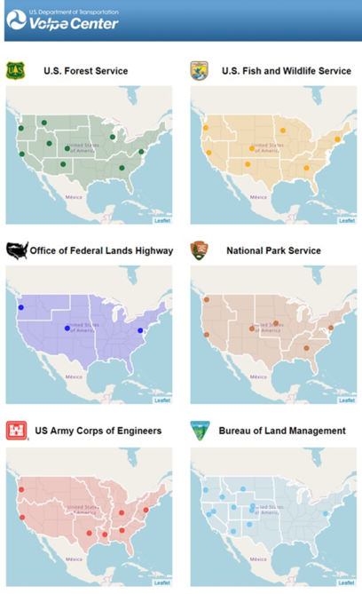 Maps showing regional FLMA boundaries.
A “region” is defined as an
area or division, especially part of a country or the world, having definable
characteristics but not always fixed boundaries. For the Federal Land
Management Agencies (FLMAs) with which the Public Lands Team works, this
definition holds very true. For a
variety of reasons, the regions by which FLMAs divide up the country to
administer and support all of their units differ, in some cases significantly,
from one another. And that keeps us on our toes as we work collaboratively with
FLMAs at all geographic scales.
Accordingly, we challenged Matt Goodwin, one of Volpe’s 2017
summer interns, to develop an interactive webpage that makes it easy to identify,
view, and compare FLMA regional boundaries as well as the main offices for each
region (https://volpeusdot.github.io/PLT-Web-Map/). Initially, we were going to layer each FLMA’s
regions on top of each other on one map, but that became too complex given so
many different boundaries. Instead, we laid out each FLMA map side-by-side and
made them interactive so users can mouse over each region for its name and
regional office location.
This webpage has already proven helpful for our team, and we
are now sharing it with you in the hopes that it can be helpful to you, too!
Project Contact: Benjamin
Rasmussen and Logan
Nash
 Campers on the Boston Harbor Islands on their way to catch the ferry back to Boston.
As fall winds down in to winter, many of us are starting to
plan adventures for the warmer days of 2018. Next year, consider taking
advantage of public transportation options for accessing public lands that
provide unique opportunities for car-free camping.
Traveling to public lands by foot, bicycle, bus, ferry, or
train helps reduce congestion at these sites and reduces air pollution and
noise from personal vehicles. Plus, public transportation access provides
people who don’t own a car with camping options and gives city-dwellers a
chance to get out and experience nature in ways that might not otherwise be
possible.
Many camp sites are accessible by bicycle, which may require campers
to have a base-level of gear (e.g., bike racks, panniers). However, not
everyone is a bicycle-touring enthusiast. The following list of Federal public
lands’ camp sites are great examples of places that visitors can use public
transportation to camp car-free:
The Volpe Public Lands Team helps Federal Land Management
Agencies solve their unique transportation challenges, which includes
increasing car-free access to public land sites and expanding opportunities for
traveling within sites via transit or active modes of transportation.
Increasingly, public lands are experiencing impacts of higher visitation
demand, which in addition to impacts to natural resources also comes with
roadway and parking congestion. Encouraging visitors and staff to use
alternatives to driving, and making these options fun, convenient, and
affordable, improves the visitor experience while also enhancing resource
protection.
One initiative the Public Lands Team is currently supporting
in this area is the development of the National Park Service (NPS) Active
Transportation Guidebook. This Guide will be a resource for NPS units and
partners interested in expanding opportunities for walking and bicycling within
National Parks and their gateway communities.
Contact: Jessica Baas
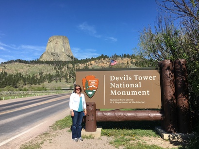 Heather on a site visit to Devils Tower National Monument in Wyoming to help staff conduct a feasibility analysis for implementing a shuttle service.
What public lands projects are you
working on now?
I manage Volpe portfolios with the
National Park Service (NPS) Northeast, Intermountain, and Pacific West Regions.
I also manage Volpe support of the NPS Congestion Management Program, which has
established a framework for addressing congestion issues at park units across
the country. My work also includes major initiatives across the NPS regional
offices to determine the best option for replacement of transit vehicles (e.g.,
electric, hybrid, or propane options), transit feasibility studies, and
alternative transportation planning. Additionally, I was on detail as the
Acting Alternative Transportation Program Coordinator for the NPS Northeast
Region from November 2015 through September 2017.
What types of projects outside of
public lands do you work on?
Currently, I’m working on a Federal
Transit Administration (FTA) project to develop a research plan for transit
automation in the United States. The project scope includes literature review,
stakeholder engagement, and benefit cost analyses to inform ways that FTA can
approach preparing transit agencies for bus automation.
What are your fondest memories of
public lands?
I did not grow up visiting public lands
and began to discover them in college. I went to school in Syracuse, New York,
and discovered the beauty of Green Lakes State Park in Fayetteville, New York. I would run or
walk the trails around the emerald green lakes as a reprieve from university studies.
Since coming to Volpe in 2013, I have had the opportunity to visit many
national parks. My first work trip was to Glacier National Park while working
on the Going-to-the-Sun Road corridor management study. The majesty of the park left a great
impression on me and I felt privileged to be working on a project with the
purpose of ensuring visitors in the future will be able to enjoy the park as I
did.
What new public land have you
discovered since working at Volpe?
I had not previously heard of Mammoth
Cave National Park in Kentucky until 2015 when I worked
on a ferry replacement study there. I was surprised to learn ferry service is
integral to park operations when it is not on a lake or near a coast. In
addition to being a natural wonder, Mammoth Cave is steeped in history and
biological significance. Many of the cave ceilings are imprinted with
nineteenth-century signatures written by candle smoke and other monuments left
by visitors long ago.
What’s the most unique, interesting, or
strangest job you had before working at Volpe?
In early 2003, I was living in Houston,
Texas, with my family while waiting to start grad school in the fall. I was
employed at a temp agency near the Johnson Space Center when the Columbia
shuttle tragedy occurred. The temp agency was asked to provide staff to assist
in responding to the outpouring of sympathy for the crews’ family and National
Aeronautics and Space Administration employees. I reported to the Astronaut
Office for six months, tracking and sending NASA’s reply to thousands of people
from around the world who were compelled to reach out in the face of the
heartbreak. It was a difficult time to be at NASA, but the warmth of the
compassion from everyone writing in provided a sense of support I have never
before experienced.
If you were to have a job that wasn’t
transportation or public lands related, what would it be?
I find joy in helping other people. I
believe I would work as a nurse or for a non-profit helping people in need.
Contact: Heather
Richardson
|