Innovation of the Month:
Weather Responsive Management Strategies
Over the last few weeks, we have shown you how States use weather-responsive management strategies (WRMS) to manage flooding and predict and respond to dust storms. WRMS is also effective in managing burn scars after wildfires are contained. This is when rainfall creates erosion, debris flows, or mudslides, resulting in extremely dangerous conditions for motorists.
The Utah Department of Transportation (UDOT) and the California Department of Transportation (Caltrans) have both used WRMS to successfully manage burn scars. Using a geographic information system map to indicate the location of burn scar boundaries, UDOT works with the Forest Service and National Weather Service (NWS) to determine rainfall rates for each burn scar area that would cause flooding and debris flows. NWS and UDOT use a dozen mobile weather stations to help monitor conditions in these areas.
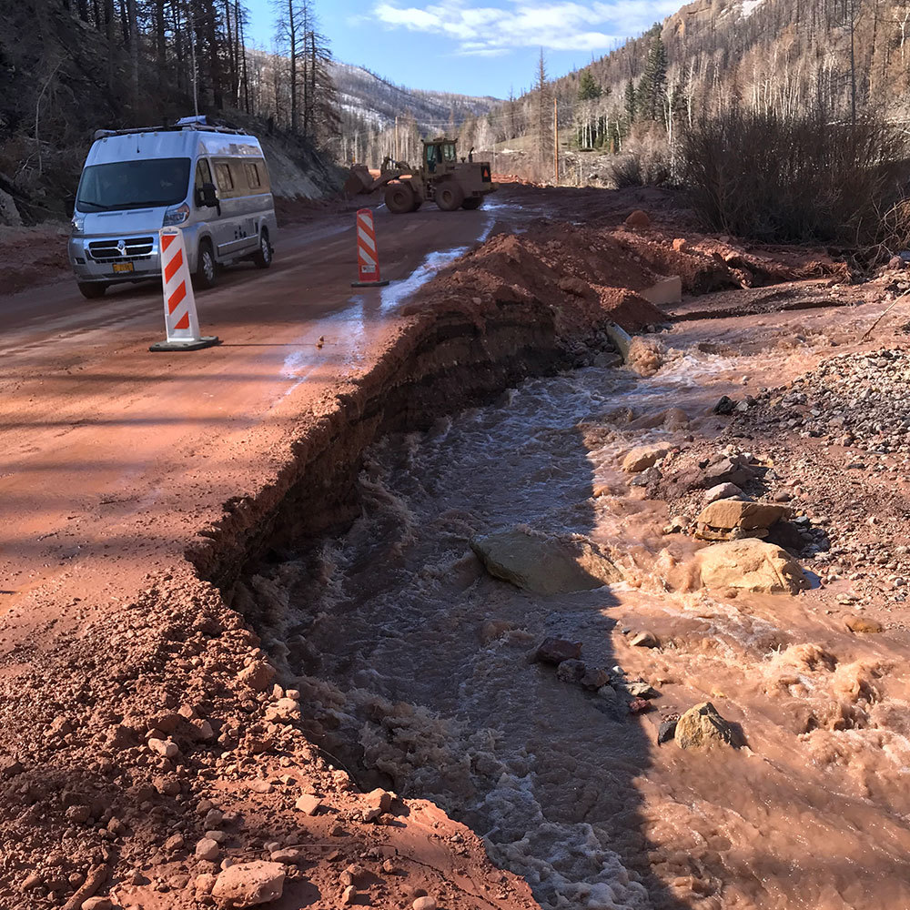 After wildfires, roadways in burn scars are susceptible to damage from mudslides and debris flows. (Credit: UDOT)
Since 2018, Caltrans, in collaboration with the California Department of Forestry & Fire Protection (who puts together burn scar plans with maps showing expected erosion and debris areas), uses rainfall rate briefings from the NWS to make better decisions for managing facilities in high risk areas such as shutting down highways prior to events occurring. This enhanced coordination and information allowed Caltrans to take a proactive approach, resulting in an estimated $22 million in savings within the first year based on regional economic indicators for the cost of a closure on this route due to a debris flow. The enhanced information also reduced the risk to travelers of any crashes or injury resulting from a debris flow.
Caltrans is now working to enhance and expand these efforts to use new road weather information systems (RWIS). Caltrans uses these systems to collaborate with the NWS to assemble forecast information for local agencies and law enforcement, to proactively close highways when they predict mudslides and debris flows. The goal is to use predictability to close roadways ahead of time, clean roads faster, or even save the roadway. Utilities are also considering WRMS approaches pre-emptively to shut down power grids in some areas to prevent fires.
To learn more about how WRMS can help your agency respond to dangerous conditions created after wildfires or other unique weather events, contact David Johnson with the FHWA Office of Operations.
Ohio DOT Crowdsourcing Workshop Builds Partnerships Across Agencies
Crowdsourced data, available region- and State-wide, help to break down data and operational silos between agencies and builds partnerships as they share data to collaboratively manage transportation assets across agency boundaries. While the Ohio Department of Transportation (ODOT) regularly uses crowdsourced vehicle data, many regional and local transportation agencies within the state are just beginning to explore its potential.
FHWA conducted a workshop with the Ohio DOT, six cities, and other public and private agencies on the building blocks for making the most of crowdsourced data such as its real-time and archived uses. As a result of the workshop, local public agency participants became aware of ODOT’s ability to share crowdsourced vehicle data and are now working together to access this source for a range of operations planning activities.
To bring a similar workshop to your state, contact the EDC-5 Crowdsourcing for Operations team leads James Colyar or Paul Jodoin.
Innovative Funding Supports Improvements in the Nation’s Capital
Through joint development agreements, State and local agencies can offset the costs of transportation improvements by partnering with private developers—benefitting transportation users and communities while saving public dollars.
In Washington, DC, the 2.2 million-square-foot Capitol Crossing development project is expected to create 8,000 permanent jobs and generate an estimated $40 million in annual property taxes. The city partnered with a private developer to construct a platform over a recessed section of I-395. The development will reconnect the surrounding neighborhoods and provide new retail, commercial, residential, and public spaces.
The agreement includes the complementary 3rd Street Tunnel Project, a collection of improvements sponsored by the District Department of Transportation. The private partner committed to paying for necessary utility relocations, reconfiguring access ramps between I-395 and surface streets, and restoring the street grid above I-395.
The joint development deal could generate as much as $120 million in payments to the District of Columbia.
Value capture methods can benefit your community and your bottom line. Find out how by contacting Stefan Natzke, FHWA Office of Planning, Environment, and Realty, or Thay Bishop, FHWA Center for Innovative Finance Support.
In Case You Missed It – New Issue of Innovator Available
The January/February issue of Innovator is available on its new web platform, accessible from any device! This new and improved format will give an optimized experience, whether you access it from your mobile phone, tablet, or computer.
|