From Geophones with Love: Seismic Geophysical Methods
Watch this five-minute episode highlighting Seismic Geophysical Methods
Click here to follow along as Agent Gamma learns how to get the most out of his subsurface exploration program with seismic geophysical methods.
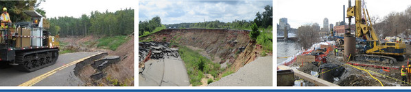
MaineDOT Uses Seismic Refraction to Determine Bedrock Depth
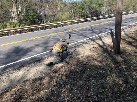
Using a hammer energy source for a seismic refraction survey.
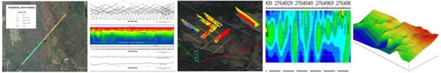
MaineDOT completed a seismic refraction survey at the Route 26 Highway Rehabilitation Site located in Woodstock, Maine. The objective of this survey was to determine the bedrock and overburden depths and variation prior to the construction of a soil nail wall on a slope located uphill of the existing highway.
Subsurface conditions at the site generally consisted of loose, rocky soil. Two lines were surveyed, both traversing a steep slope, which made walking and planting the geophones very difficult. Test borings were not possible on the slope due to steep terrain.
Each survey line was 445 feet long and consisted of four, 115-foot-long segments with each segment containing 24 geophones that were spaced 5 feet apart. Each segment was tested with six to seven shots (seismic impacts). The general shot configuration consisted of one shot at either end of the segment, one off each end about 50 feet, and two or more within the segment. The energy source consisted of a 16-lb hammer or a small explosive charge buried about 3 feet deep.
The survey identified three soil layers based on the shear wave velocity measured. The Layer 1 velocity for the survey was about 1,100 feet per second (fps) and is interpreted to represent dry, loose soil. The Layer 2 velocity was about 2,900 to 3,300 fps and is interpreted to represent dense soil – possibly glacial till. The Layer 3 velocity was about 16,500 fps and is interpreted to represent bedrock.
The seismic results show the seismically interpreted depths to bedrock and configurations. The interpreted bedrock depths range from approximately 10 feet to 30 feet deep over the survey area. Estimating bedrock depth at the site in a noninvasive manner was extremely valuable due to the access challenges and stratigraphy variation and was critical to design of the soil nail wall.
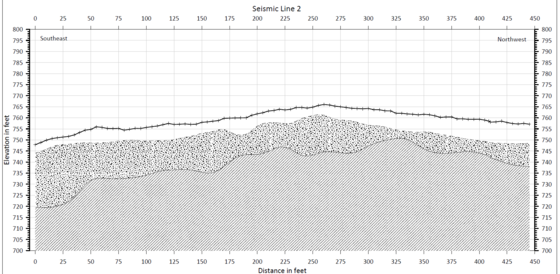 Profile of seismic refraction results on Line 2
Using Seismic Geophysics Early as Part of Project Planning
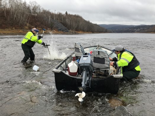 Underwater seismic refraction survey in the challenging St. John River
MaineDOT also conducted a geophysical seismic refraction survey along the proposed alignment of the new Madawaska-Edmundston International Bridge Crossing in Madawaska, Maine. The objective of the underwater seismic refraction survey was to obtain top of bedrock information to assist with the preliminary foundation design effort and assess the feasibility of piers on constructed on shallow foundations on bedrock. The survey supplemented the preliminary borings conducted at the proposed bridge landings.
The seismic refraction survey was conducted along the 1,100-foot diagonal alignment across the St. John River. Seismic Refraction data were acquired with 5- and 10-foot geophone spacing on a 200-foot geophone spread. The bedrock surface appeared to be relatively flat along the entire bridge alignment in the river. Data showed 0 to 6 feet of riverbed overburden, 15 to 25 feet of dense glacial till, and competent bedrock below.
The geophysical investigation was instrumental during the preliminary phase and complemented the final design subsurface investigation.
Webinar #5: 'Double-Header' Geophysics: Electrical and Seismic Methods
 Reduce project risks, improve quality and accelerate project delivery using effective geotechnical site characterization. Learn how to make the most of your site characterization program efforts. Watch webinar #5 in the series on the A-GaME (Advanced Geotechnical Methods in Exploration) — ‘Double-Header’ Geophysics: Electrical and Seismic Methods.
Highlights:
- Overview of electrical and seismic methods, and fundamental considerations
- Applications for geotechnical site characterization in transportation
- Case-histories
- Advantages of using multiple methods and techniques for site characterization objectives
- Q&A panel with all speakers/panelists at the end of each session
Double-Header Panelists:
Moderator: Ben Rivers, FHWA Resource Center
Speaker: Mike Howley, Hager-Richter
Speaker: Clint Wood, University of Arkansas
Speaker: Phil Sirles, Collier Geophysics
Speaker: Bill Owens, Caltrans
Speaker: William Dalrymple, Caltrans
Speaker: Nolan Leue, Caltrans
Panelist: Jeff Reid, Hager-Richter
FHWA has partnered with Deep Foundations Institute (DFI) to host and distribute recordings of the 2020-2021 winter webinar series, featuring the FHWA A-GaME on its YouTube Channel.
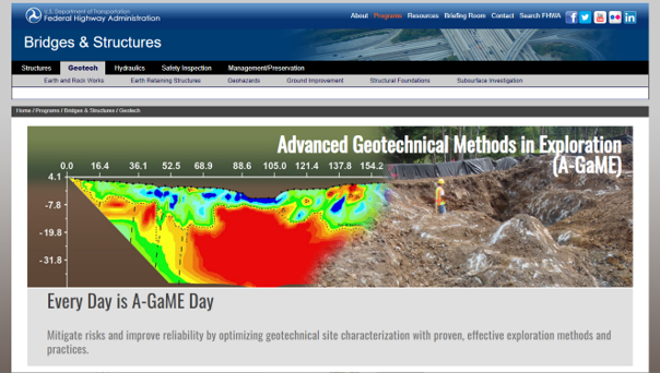
Every Day Is A-GaME Day
Be sure to visit the new A-GaME webpage for the latest information and resources on A-GaME technologies for enhanced, effective site characterization that can help to save time, money and resources in transportation projects. There are A-GaME videos; links to bulletins with success stories and updates on news and events; and resources from the FHWA and our industry partners.

Geo-Industry Geophysics Users Group
The joint industry Geophysics Users Group was created in cooperation with FHWA, Geo-Institute, DOTs, DFI and TRB Committees AKG20 and AKG60 to address geophysics users’ needs. The group is undertaking a launch project, DIGGS for Geophysics, that will expand the ASCE/DIGGS XML schema to handle geophysical data. The ambitious goal of the project is to develop fully functional geophysical data structure in DIGGS in about one year.
If you are interested in geophysics, join the monthly virtual meetings on the second Tuesday of the month at 3:00 p.m. (ET). The meetings are held via Microsoft Teams, which will also be used to house information generated by the group. For more information visit the Geophysics Users Group Committee web page or contact Derrick Dasenbrock, FHWA Resource Center, at derrick.dasenbrock@dot.gov.
|
Stay Connected |
|
 |
If you are not already a subscriber, the Center for Accelerating Innovation invites you to subscribe to EDC News and Innovator. These newsletters showcase successful deployments of EDC initiatives and other innovative topics in the highway industry.
|