A-GaME Televiewer Technology Aids in Design of Slope Repair
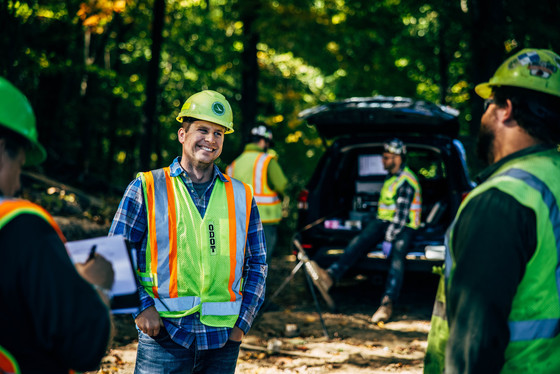
ODOT’s Cody Notz onsite during televiewer logging
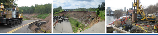
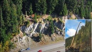
In March, a rock slope failure along State Route 7 in Mingo Junction prompted the Ohio Department of Transportation (ODOT) to initiate a rock slope repair project. As the planning and design for a major excavation got underway, ODOT combined the use of televiewers — an advanced geotechnical methods in exploration (A-GaME) technology — with conventional boring data to reduce uncertainties and boost confidence in the design.
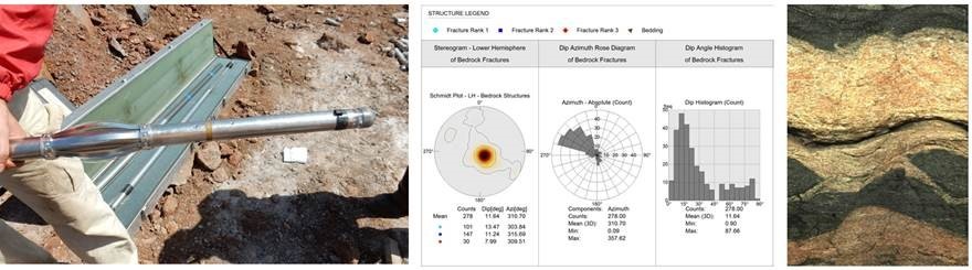
According to Christopher (Cody) Notz, P.E., district geotechnical engineer for ODOT-District 11, ODOT crews took five soil borings on the slope above the rock slide. The soil borings showed that the rock was very poor quality, with high angle fractures and significant water. “We knew that the information we got from the soil borings and from the rock cores wasn’t enough for us to confidently design this slope,” Notz points out. “Once you pull the rock cores from the borehole, you can view the joints and the discontinuities, but there is core loss so you don’t have a full picture of what’s actually in the hole.”
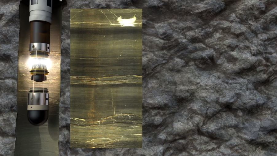
Initially, the ODOT crew sent a video camera down the boreholes, but they were unable to get detailed visual information or determine the orientation of the fractures within in the slopes relative to the roadway. At that point, ODOT chose to use acoustic and optical televiewers to obtain high-resolution 3D images of each borehole. The Optical Televiewer (OTV) uses a camera while the Acoustic Televiewer (ATV) uses an ultrasonic pulse to take 360 degree, continuous oriented images of the borehole wall.
“We chose the televiewer because this technology gives us a 3D image of what is actually in the ground in situ,” explains Notz. “It gives us the planes of these joints relative to the roadway and relative to the slope. We can use this data along with the other holes up and down the slope to better map the joints along the slope and aid in our design.”
Notz says that the data ODOT received from this technology will allow them to refine the design and be more confident in the final slope design for this project. “The data will allow us to be more efficient in the elevations that we choose for our benches and the locations that we decide to place our cuts,” he adds. “And to create a much more efficient design overall and hopefully produce a better product.”
Televiewer in Motion
Click here to watch this short animation to get a better understanding of optical and acoustic televiewers.
A-GaME Webinar #8: A Look Down the Hole - Optical and Acoustic Televiewers
FHWA A-GaME webinars feature proven, effective exploration methods and practices for enhanced, effective site characterization that reduce project risks, improve quality and accelerate project delivery.
Highlights:
- The what, why and how of televiewers – A 360°, high-resolution view of the underground!
- The difference between optical and acoustic methods
- The types of rock formations where televiewers really shine
- Bonus features: digital caliper logs, strike and dip plots
- Case history of the value of televiewers from Mosul, Iraq
- State DOT applications
Panelists:
Moderator: Benjamin Rivers, FHWA Resource Center
Speaker: Rob Garfield, Hager Richter Geosciences
Speaker: Georgette Hlepas, U.S. Army Corps of Engineers
Speaker: Gabriel Taylor, Washington State DOT
Speaker: Nicholas Farny, FHWA - Western Federal Lands Highway Division
Watch now
WSDOT Uses Televiewers for Rock Cut Design
One of the presentations in Webinar #8 — A Look Down the Hole: Optical and Acoustic Televiewers — focuses on Washington State DOT’s (WSDOT’s) use of televiewers for rock cut design on a multiphase project at the Snoqualmie Pass East on I-90. The pass is the main corridor across the Cascades, which divide the east and west sides of the state. In order to widen the road and straighten a specific curve, WSDOT needs to cut rock on very steep slope with poor rock quality and difficult access. Gabriel Taylor, L.E.G, of WSDOT, discusses the use of televiewers to identify discontinuities that were critical to the rock cut design, and the importance of using multiple methods to correlate data.
|

A-Game Webinars
Deep Foundations Institute (DFI) is hosting and distributing recordings of the 2020-2021 winter webinar series, featuring the FHWA A-GaME on its YouTube Channel.
The webinars feature a variety of topics related to proven, effective exploration methods and practices for enhanced, effective site characterization that reduce project risks, improve quality and accelerate project delivery.
|
Stay Connected |
|
 |
If you are not already a subscriber, the Center for Accelerating Innovation invites you to subscribe to EDC News and Innovator. These newsletters showcase successful deployments of EDC initiatives and other innovative topics in the highway industry.
|