|
|
Multistate Critical Minerals Study Results in Wyoming Phosphoria Formation Data Release
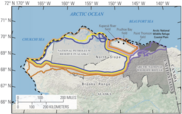
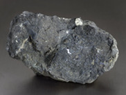
Data collected as part of the Western Phosphate Field Geochemical Reconnaissance Project, a collaboration among the geological surveys of Idaho, Wyoming, Utah, and Montana with USGS Earth Mapping Resources Initiative (Earth MRI) funding, is now available online. The project evaluated critical mineral occurrences within the Permian Phosphoria Formation, particularly in the phosphate-rich Meade Peak and Retort members. |
|
 |
|
|
|
Utah and Navajo Nation Partnership Leads to Geologic Map of Oljeto Quadrangle
 |
|
With USGS support, Utah state geologists worked with the Navajo Nation on geologic mapping work in the Oljeto quadrangle on the Navajo Nation to directly support Navajo Nation science needs to better understand the relation between regional geology and groundwater supply. This collaboration demonstrates a proven model for state partners conducting geologic mapping work in areas of Tribal Nation interest. |
|
|
|
Lithium in Carolinas Could Replace Imports for a Century or More
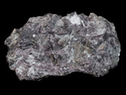
Through a combination of geologic maps, tectonic history, geochemical sampling, geophysical surveys, and records of mineral occurrences, a team of USGS geologists assessed lithium in northern and southern Appalachia. Their estimates revealed that southern Appalachians hold an estimated 1.43 million metric tons of lithium oxide, concentrated in the Carolinas, and the northern Appalachians hold an estimated 900,000 metric tons, concentrated in Maine and New Hampshire. The combined estimated 2.3 million metric tons of undiscovered, economically recoverable lithium, is enough to replace 328 years of U.S. imports at last year’s level! |
|
 |
|
|
|
USGS News:
Publications:
Data releases:
|
|
|
Interior Department Estimates 600 Years Worth of Coal Beneath Federal Lands
 |
|
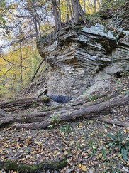
A USGS report on coal resources beneath federally managed public lands in the United States, estimates that there are 4.2 billion short tons of reported coal reserves associated with active mines and an additional 356 billion short tons of available coal resources. If produced, that would be enough coal to supply all the nation’s needs for at least 600 years at the current rate of consumption. |
|
|
|
USGS Updates U.S. Critical Mineral Deposits
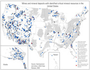
The U.S. Geological Survey has released an updated database showing known U.S. deposits of 59 critical minerals needed to strengthen the American economy and protect national security. USGS staff compiled the 1,271 known deposits in 41 states and Puerto Rico. The deposits contained in the database help to delineate critical mineral focus areas that, in turn, help to prioritize new Earth MRI data collection which is currently re-mapping the entire United States. Of those, 412 or nearly one-third have recognized, documented critical mineral resources and no production — representing untapped potential for critical mineral production. |
|
 |
|
|
|
Cooperative National Geologic Map Version 2: Now Covers All 50 States and Some US Territories
 |
|
|
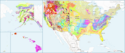
The Cooperative National Geologic Map, which showcases the nation’s geology at a regional scale in one consistent and standardized format, now includes Alaska, Hawaii, and most U.S. territories including all of Puerto Rico, the U.S. Virgin Islands, and Guam, as well as parts of the Commonwealth of the Northern Mariana Islands, and part of American Samoa. The first version of this map, which was released in 2025, portrayed only the geology of the Lower 48 States.
|
|
|
|
|
First-of-Its Kind National Mine Waste Inventory
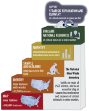
Developed by the USGS in coordination with states and other partners, the National Mine Waste Inventory is a first-of-its-kind public repository, containing information about the nation’s mine waste sites and their potential resources, including critical minerals. The Inventory is an essential foundation for evaluating the nation's supply of minerals in mine wastes, identifying mine wastes with opportunities for mineral recovery, and guiding policy and investment decisions. |
|
 |
|
|
|
National Index of Borehole Information (NIBI)
|
The National Index of Borehole Information (NIBI) is a centralized index of public subsurface resources created to advance search, discovery, access, and re-use of these assets. NIBI indexes public borehole information providing the connection back to the holding repositories for full access. This access facilitates multidisciplinary research in areas such as geology, climate, carbon sequestration, hydrogeology, and energy and minerals resources leading to improved understanding of the subsurface.
|
|
|
 |
|
|
|
Who We Are
The USGS Geology, Energy, and Minerals Mission Area is composed of the:
Through impartial science, mapping, supply chain analysis, and decision support, GEMMA informs:
- Resource management decisions by both Federal and State land managers
- Billions of dollars in investments by the private sector and Federal government
- National security, tomorrow’s infrastructure, and public safety
Learn more about our work at . Explore our data at . Have questions? Contact us at .
|
|
|
|
|