 Fall Newsletter
October 2026
Featured Headlines
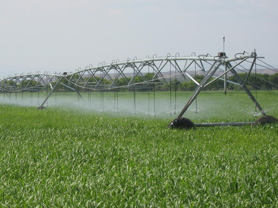
Landsat Product Supports Water Management Worldwide
How much water is required? How much water is "too much"?
Those are questions that are often asked when trying to understand how much water crops and vegetation actually use.
A USGS Landsat science product helps provide information at the scale of individual fields from around the world using remote sensing observations.
A study, "On-demand global Landsat evapotranspiration product: Development, evaluation, and dissemination," explores the methods, performance evaluation and operational maturity of the on-demand field-scale, Landsat-based actual evapotranspiration product distributed through the EROS Science Processing Architecture (ESPA) platform.
World Space Week
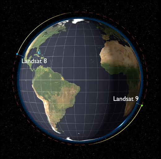
A social media post for World Space Week reached more than 38,000 viewers across all platforms, highlighting interest in the 54-year long Landsat program.
The post detailed Landsat 8 and Landsat 9, which travel about 438 miles above Earth in sun-synchronous, near polar orbits. Each satellite completes one orbit around Earth in about 99 minutes. As Earth rotates beneath them, the satellites observe a different strip or "path" of Earth's surface with each pass. The satellites return to the same "start" or ground path every 16 days, providing complete coverage of Earth's land surfaces every eight days between them.
See the World Space Week post on EROS' Facebook account.
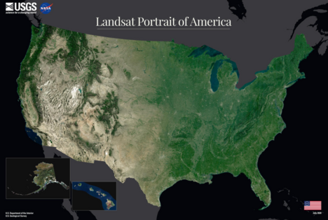
Landsat Portrait of America
In honor of the 250th anniversary of the United States, a new mosaic captures the full geographic range in a single image.
Read more about the mosaic and download the image by clicking below.
Publications, Reports & Data Releases
Evapotranspiration
LANDFIRE
Land Cover/Rangelands
Science
Topobathymetry
Important Dates
October 26-30, 2026: Committee on Earth Observation Satellites (CEOS) Working Group on Information Systems and Services, Boulder, Colorado
October 28-29, 2026: Landsat Science Team Meeting, Reston, Virginia
November 11, 2026: Veterans Day-EROS Closed
November 18, 2026: EROS Center Fall Poster Session, 11 am-2:30 pm CT.
November 26, 2026: Thanksgiving Day-EROS Closed
Recent Videos
RCMAP Long-term and Near real-time Rangeland Vegetation and Monitoring - A recorded webinar from the USGS EROS User Experience Webinar Series.
How to Use USGS Earth Explorer to Download Imagery - Whether you're a beginner, novice or expert, this guide can help you get started or refresh your memory when it comes to accessing imagery through EarthExplorer.
Guess the Landsat Location - Can you guess the locations of these mystery Landsat images? Challenge a colleague and keep score!
 EarthShots locations recently updated:
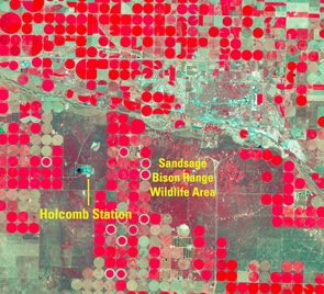
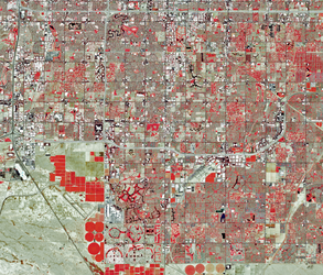
Landsat images display the significance of center-pivot irrigation systems in southwest Kansas between 1972-2026. The systems, which use water from the High Plains Aquifer, have multiplied over the years.
Red areas in these images indicate health vegetation, while light-colored cultivated fields in the images are fallow or recently harvested wheat fields. Visit the Garden City, Kansas Earth Shots feature.
Phoenix, Arizona, was established in 1881 as a small agricultural community and has since turned into one of the nation's fastest-expanding metros.
In its first 60 years, the Maricopa County area was a modest desert community with about 186,000 residents. Today, the Phoenix area has reached 4.845 million people, and projections show that the population growth is expected to expand. Visit the Phoenix, Arizona feature on Earth Shots.
Eyes on Earth Podcast
With Landsat's eyes on the Earth 24/7 and a vast archive of remotely sensed data, we have more than a few stories to tell!
You'll find more than 100 podcast episodes by visiting our Eyes on Earth web library.
Check us out online!
Subscribe to our Newsletter!
What you'll discover:
- Articles, podcast episodes, videos and more that explain how the view from space benefits all of us.
- New developments in EROS' remote sensing science and technology.
- Resources to learn more about Landsat and have fun with remote sensing data.
The U.S. Geological Survey’s EROS Center uses remotely sensed data to track how the Earth is changing. In addition to world class science, EROS houses the national archive of Earth observation data and operates the satellites of the U.S. Landsat Program.
If you have any comments or questions about EROS Center Headlines, please contact us at eroscommunications@usgs.gov.
|