 4th Quarter Newsletter
October to December 2024
 2024 in Review
As 2024 came to a close, we reflected on some key achievements and experiences at the USGS EROS Center. From science advancements to Landsat satellite development, we celebrated some big news.
In 2024, the Landsat program proved its worth once again with a new land cover product suite, numerous scientific contributions, and an economic valuation study that reported its value at $25.6 billion USD.
Featured News Headlines

Dec. 10, 2024
The USGS and NASA presented the 51st annual William T. Pecora Awards at the American Geophysical Union (AGU) 2024 Annual Meeting.
|
Oct. 31, 2024
For two decades now, and counting, the LANDFIRE program continues to assemble a complete clearinghouse of data products for wildland fire managers.
|
Oct. 29, 2024
Scientists from EROS are working with other USGS researchers to find more ways to use Landsat data to identify harmful algal blooms.
|

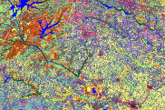
Oct. 24, 2024
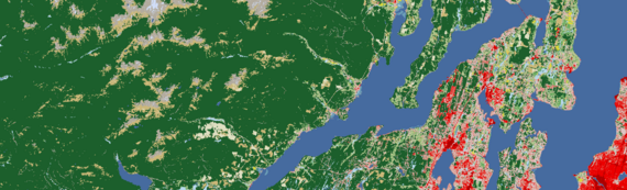
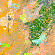
Annual NLCD arrived with a new ability to look at land cover and land change for the United States, year by year, from 1985 to 2023.
|
Oct. 7, 2024
Landsat 7, launched in 1999, completed its mission in 2024. We look back at its 25 years of service and the role it played in expanding EROS and its workforce.
|
Read all EROS News here.
Eyes on Earth Podcast Episodes
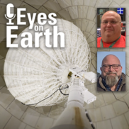
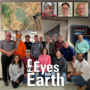
Dec. 9, 2024
EROS ground station technicians provide a play-by-play account of what happens in the Landsat operations room during a live Landsat pass.
|
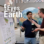
Nov. 25, 2024
Posters at the 2024 EROS Fall Poster Session covered a wide range of topics as local graduate students and EROS scientists shared their work in the EROS atrium.
|
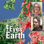
Nov. 12, 2024
Key members of the Landsat 7 team from USGS and NASA share their experiences, heart-pumping moments, and fond memories from this incredible 25-year mission.
|
Oct. 28, 2024
The next generation of USGS land cover mapping arrived on October 24, 2024. Annual NLCD provides land cover data of the United States for every year back to 1985.
|

Oct. 15, 2024
LANDFIRE is a diverse product suite with countless uses that go beyond fire management. The program has now been providing data for 20 years.
|
Listen to other Eyes on Earth podcast episodes here.
Videos
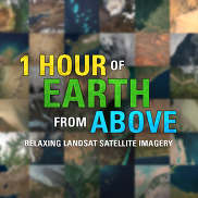
Dec. 16, 2024
This virtual tour showcases our planet’s diverse landscapes, from the icy expanses of Antarctica, Greenland, and Russia to the arid deserts of Namibia, Pakistan, and Australia. This unique blend of science and serenity offers a calming, immersive experience!
|
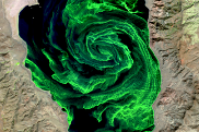
Nov. 7, 2024
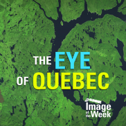
Manicouagan Reservoir, which lies within the remnant of an ancient impact crater, was created after the construction of the Daniel-Johnson Dam in 1968. A declassified satellite image from 1964 reveals the pre-reservoir landscape.
|
Explore the Image of the Week gallery here.
 Select Publications and Data Releases
A full list of Publications can be found here.
Important Dates
Other Resources
Quote of the Quarter

"These [EROS poster] sessions are a very effective way to connect with the next generation of scientists and engineers. It's gratifying to see our commitment to cultivating a talent pipeline for the Earth observation sciences.”
Pete Doucette
Director of the USGS EROS Center
November 13, 2024
|
Connect With Us Online!
Learn more about EROS here.
Social Media Highlights
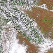
Wind River Range, Wyoming
Dec. 24, 2024
The Wind River Range, located in west-central Wyoming, is a unique wilderness area that rises from the high plains of the South Pass of the Continental Divide and runs northwest to the Yellowstone Plateau.
|

Seven Summits - Mount Everest
Dec. 4, 2024
In honor of International Mountain Day, the Seven Summits of the world were celebrated and explored—from the towering snow-capped Mount Everest in Asia to the pyramid-shaped Puncak Jaya in Oceania.
|
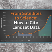
How to Cite Landsat Data
November 21, 2024
By properly citing Landsat data, you acknowledge the data author and/or steward; you ensure scientific transparency and reproducibility; and you aid in tracking the impact of the data.
|
Connect With Us on Social Media!
|