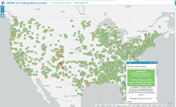
App of the Week: COVID-19 Testing Sites Locator
Federal Emergency Management Agency (FEMA) sent this bulletin at 04/24/2020 12:20 PM EDT
|


|
Update Your E-mail Address | Change Delivery Preference | Update State and Zip Code | Unsubscribe Subscribe to receive alerts during disasters in your state. If you have questions or problems with the subscription service, please contact subscriberhelp.govdelivery.com. This service is provided to you at no charge by FEMA. Privacy Policy | GovDelivery is providing this information on behalf of U.S. Department of Homeland Security, and may not use the information for any other purposes. |